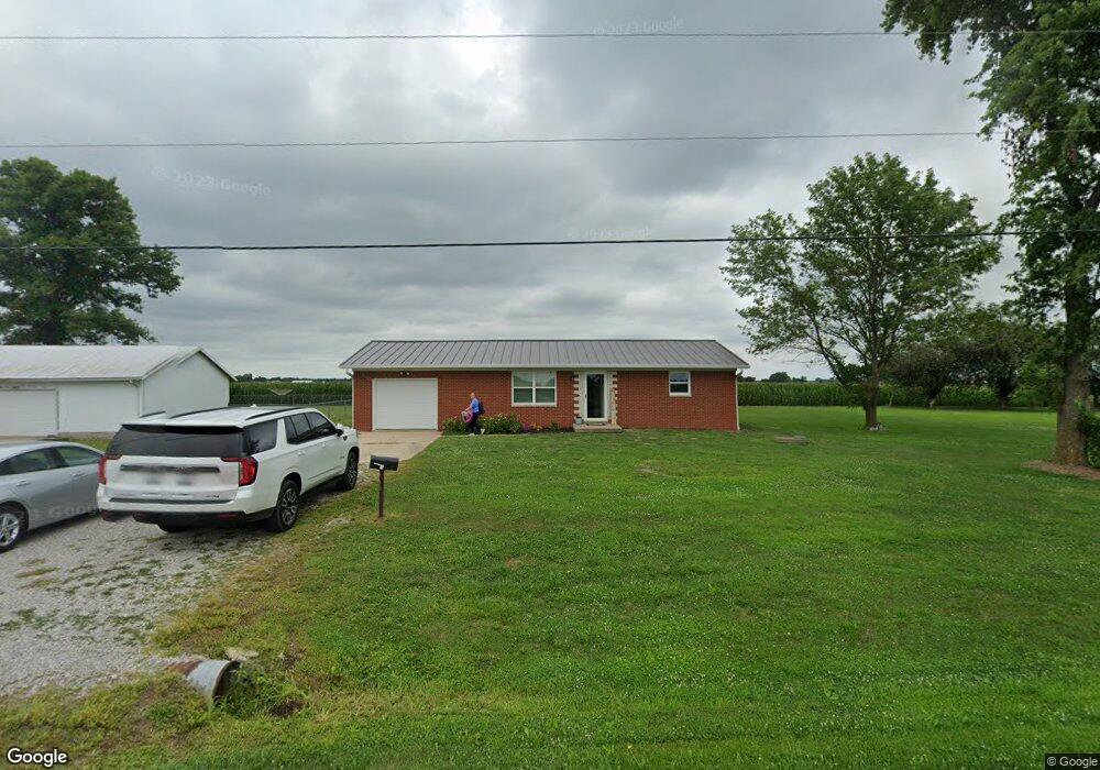
1801 Airport Rd New Baden, IL 62265
Estimated Value: $133,000 - $197,564
--
Bed
--
Bath
950
Sq Ft
$179/Sq Ft
Est. Value
About This Home
This home is located at 1801 Airport Rd, New Baden, IL 62265 and is currently estimated at $169,891, approximately $178 per square foot. 1801 Airport Rd is a home located in Clinton County with nearby schools including Wesclin Middle School and Wesclin Sr High School.
Ownership History
Date
Name
Owned For
Owner Type
Purchase Details
Closed on
Oct 14, 2022
Sold by
Matthews Nicholas J
Bought by
Santel Elayna N and Santel Allen R
Current Estimated Value
Home Financials for this Owner
Home Financials are based on the most recent Mortgage that was taken out on this home.
Original Mortgage
$139,521
Outstanding Balance
$134,242
Interest Rate
6.02%
Mortgage Type
New Conventional
Estimated Equity
$35,649
Purchase Details
Closed on
Dec 10, 2021
Sold by
Schwan Hans W
Bought by
Santel Elayna N and Matthews Nicholas J
Home Financials for this Owner
Home Financials are based on the most recent Mortgage that was taken out on this home.
Original Mortgage
$140,000
Interest Rate
3.14%
Mortgage Type
New Conventional
Create a Home Valuation Report for This Property
The Home Valuation Report is an in-depth analysis detailing your home's value as well as a comparison with similar homes in the area
Home Values in the Area
Average Home Value in this Area
Purchase History
| Date | Buyer | Sale Price | Title Company |
|---|---|---|---|
| Santel Elayna N | -- | Town & Country Title | |
| Santel Elayna N | $120,000 | Town & Country Title |
Source: Public Records
Mortgage History
| Date | Status | Borrower | Loan Amount |
|---|---|---|---|
| Open | Santel Elayna N | $139,521 | |
| Previous Owner | Santel Elayna N | $140,000 |
Source: Public Records
Tax History Compared to Growth
Tax History
| Year | Tax Paid | Tax Assessment Tax Assessment Total Assessment is a certain percentage of the fair market value that is determined by local assessors to be the total taxable value of land and additions on the property. | Land | Improvement |
|---|---|---|---|---|
| 2024 | $2,391 | $45,420 | $7,880 | $37,540 |
| 2023 | $2,315 | $43,250 | $7,500 | $35,750 |
| 2022 | $2,315 | $40,810 | $7,080 | $33,730 |
| 2021 | $2,513 | $39,620 | $6,870 | $32,750 |
| 2020 | $2,441 | $37,380 | $6,480 | $30,900 |
| 2019 | $2,435 | $37,380 | $6,480 | $30,900 |
| 2018 | $2,449 | $35,463 | $6,335 | $29,128 |
| 2017 | $2,440 | $34,430 | $6,150 | $28,280 |
| 2016 | $0 | $34,430 | $6,150 | $28,280 |
| 2015 | $2,069 | $34,430 | $6,150 | $28,280 |
| 2013 | $2,069 | $34,960 | $6,150 | $28,810 |
Source: Public Records
Map
Nearby Homes
- 228 Walnut
- 244 Walnut
- 4810 Airport Rd
- 308 W Indiana St
- 111 E Poos Dr
- 204 W Poos Dr
- 91 Weatherholt Dr
- 10971 Platinum Ln
- 5929 Highbanks Rd
- 414 Turquoise Ct
- 847 Topaz Ct
- 841 Topaz Ct
- 633 Moorland Cir
- 108 E Main St
- 3 W Patterson St
- 25 W Oak St
- 57 W Patterson St
- 51 S Brockschmidt Rd
- 38 Cheryl Dr
- 1117 Gulfstream Way
- 1727 Airport Rd
- 1515 Airport Rd
- 2111 Airport Rd
- 1521 Airport Rd
- 4760 Summer Rd
- 1440 Airport Rd
- 2020 Airport Rd
- 2121 Airport Rd
- 4505 Summer Rd
- 4333 Summer Rd
- 4818 State Route 160
- 4929 State Route 160
- 4929 State Route 160
- 2639 Airport Rd
- 144 N 4th St
- 2727 Airport Rd
- 835 Airport Rd
- 2500 Damiansville Rd
- 2122 Damiansville Rd
- 1730 Damiansville Rd