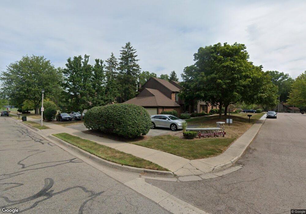
1801 Burrwood Cir Unit 1 East Lansing, MI 48823
Estimated Value: $184,000 - $204,000
3
Beds
1
Bath
1,316
Sq Ft
$149/Sq Ft
Est. Value
About This Home
This home is located at 1801 Burrwood Cir Unit 1, East Lansing, MI 48823 and is currently estimated at $195,875, approximately $148 per square foot. 1801 Burrwood Cir Unit 1 is a home located in Ingham County with nearby schools including Marble Elementary School, MacDonald Middle School, and East Lansing High School.
Ownership History
Date
Name
Owned For
Owner Type
Purchase Details
Closed on
Dec 3, 2018
Sold by
Jmbjar Llc
Bought by
Great Swell Llc Llc
Current Estimated Value
Purchase Details
Closed on
Feb 26, 2018
Sold by
Matter Lorraine B
Bought by
Jmbjar Llc
Purchase Details
Closed on
Aug 2, 1999
Sold by
Moore Larry W and Moore Lisa M
Bought by
Matter Lorraine B
Home Financials for this Owner
Home Financials are based on the most recent Mortgage that was taken out on this home.
Original Mortgage
$87,600
Interest Rate
7.25%
Purchase Details
Closed on
Jun 28, 1999
Sold by
Wabeke Gregory A and Wabeke Jerry L
Bought by
Moore Larry W
Home Financials for this Owner
Home Financials are based on the most recent Mortgage that was taken out on this home.
Original Mortgage
$87,600
Interest Rate
7.25%
Purchase Details
Closed on
Apr 8, 1998
Sold by
Wabeke E W
Bought by
Moore Larry W
Create a Home Valuation Report for This Property
The Home Valuation Report is an in-depth analysis detailing your home's value as well as a comparison with similar homes in the area
Home Values in the Area
Average Home Value in this Area
Purchase History
| Date | Buyer | Sale Price | Title Company |
|---|---|---|---|
| Great Swell Llc Llc | -- | None Available | |
| Jmbjar Llc | $69,805 | None Available | |
| Matter Lorraine B | $109,500 | -- | |
| Moore Larry W | $98,000 | -- | |
| Moore Larry W | $98,000 | -- |
Source: Public Records
Mortgage History
| Date | Status | Borrower | Loan Amount |
|---|---|---|---|
| Previous Owner | Matter Lorraine B | $87,600 |
Source: Public Records
Tax History Compared to Growth
Tax History
| Year | Tax Paid | Tax Assessment Tax Assessment Total Assessment is a certain percentage of the fair market value that is determined by local assessors to be the total taxable value of land and additions on the property. | Land | Improvement |
|---|---|---|---|---|
| 2025 | $5,145 | $88,000 | $0 | $88,000 |
| 2024 | $45 | $82,700 | $0 | $82,700 |
| 2023 | $4,828 | $65,800 | $0 | $65,800 |
| 2022 | $4,887 | $68,100 | $0 | $68,100 |
| 2021 | $4,785 | $68,400 | $0 | $68,400 |
| 2020 | $4,729 | $63,300 | $0 | $63,300 |
| 2019 | $3,416 | $60,700 | $0 | $60,700 |
| 2018 | $2,914 | $55,800 | $0 | $55,800 |
| 2017 | $2,698 | $55,700 | $0 | $55,700 |
| 2016 | -- | $56,000 | $0 | $56,000 |
| 2015 | -- | $58,400 | $0 | $0 |
| 2014 | -- | $46,700 | $0 | $0 |
Source: Public Records
Map
Nearby Homes
- 692 Moorland Dr Unit 10
- 5435 Blue Haven Dr
- 1653 Ann St
- 586 Lexington Ave
- 5420 Park Lake Rd
- 1105 Robb St
- 1542 Ann St
- 1613 Parkvale Ave
- 1608 Haslett Rd
- 562 Virginia Ave
- 5604 Deville Ct
- 657 Spartan Ave
- 5680 Deville Ct Unit 61
- 5189 E Brookfield Dr
- 2545 Koala Dr
- 5724 Lebaron Ct
- 1124 Burcham Dr
- 5403 Wild Oak Dr
- 509 Cornell Ave
- 919 Collingwood Dr
- 1805 Burrwood Cir
- 1809 Burrwood Cir
- 1809 Burrwood Cir Unit 3
- 1813 Burrwood Cir Unit 4
- 680 Moorland Dr
- 1817 Burrwood Cir Unit 5
- 684 Moorland Dr Unit 8
- 1821 Burrwood Cir
- 688 Moorland Dr Unit 9
- 687 Jaywood Dr Unit 13
- 696 Moorland Dr
- 691 Jaywood Dr Unit 14
- 1800 Burrwood Cir
- 1804 Burrwood Cir
- 700 Moorland Dr Unit Bldg-Unit
- 700 Moorland Dr Unit 12
- 1808 Burrwood Cir Unit 54
- 1812 Burrwood Cir
- 695 Jaywood Dr
- 699 Jaywood Dr