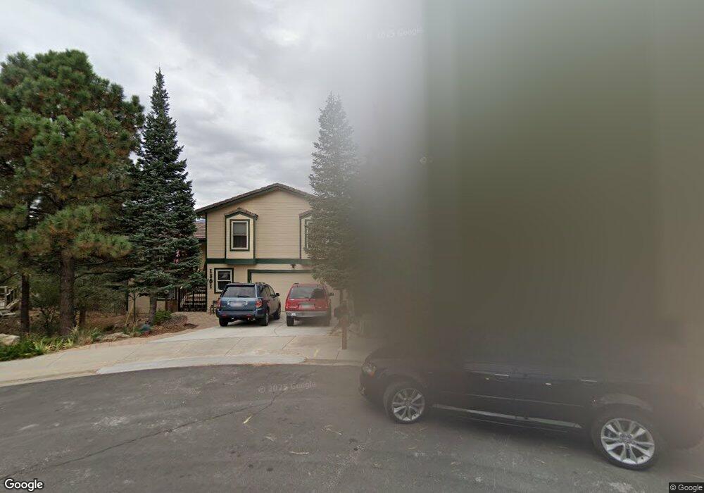
1801 Forest Ridge Dr Colorado Springs, CO 80918
Pulpit Rock NeighborhoodEstimated Value: $581,490 - $680,000
4
Beds
4
Baths
2,914
Sq Ft
$224/Sq Ft
Est. Value
About This Home
This home is located at 1801 Forest Ridge Dr, Colorado Springs, CO 80918 and is currently estimated at $651,373, approximately $223 per square foot. 1801 Forest Ridge Dr is a home located in El Paso County with nearby schools including King Elementary School, Russell Middle School, and Coronado High School.
Ownership History
Date
Name
Owned For
Owner Type
Purchase Details
Closed on
Mar 3, 2016
Sold by
Brown William R and Brown Jean K
Bought by
Rudy Michael P and Rudy Midori T
Current Estimated Value
Home Financials for this Owner
Home Financials are based on the most recent Mortgage that was taken out on this home.
Original Mortgage
$320,000
Outstanding Balance
$253,279
Interest Rate
3.65%
Mortgage Type
VA
Estimated Equity
$398,094
Purchase Details
Closed on
Dec 16, 1987
Bought by
Rudy Midori T
Purchase Details
Closed on
Mar 1, 1984
Bought by
Rudy Midori T
Create a Home Valuation Report for This Property
The Home Valuation Report is an in-depth analysis detailing your home's value as well as a comparison with similar homes in the area
Home Values in the Area
Average Home Value in this Area
Purchase History
| Date | Buyer | Sale Price | Title Company |
|---|---|---|---|
| Rudy Michael P | $320,000 | Unified Title Co | |
| Rudy Midori T | -- | -- | |
| Rudy Midori T | -- | -- |
Source: Public Records
Mortgage History
| Date | Status | Borrower | Loan Amount |
|---|---|---|---|
| Open | Rudy Michael P | $320,000 |
Source: Public Records
Tax History Compared to Growth
Tax History
| Year | Tax Paid | Tax Assessment Tax Assessment Total Assessment is a certain percentage of the fair market value that is determined by local assessors to be the total taxable value of land and additions on the property. | Land | Improvement |
|---|---|---|---|---|
| 2025 | $1,863 | $45,780 | -- | -- |
| 2024 | $1,745 | $37,980 | $8,760 | $29,220 |
| 2023 | $1,745 | $37,980 | $8,760 | $29,220 |
| 2022 | $1,595 | $28,510 | $6,440 | $22,070 |
| 2021 | $1,731 | $29,330 | $6,620 | $22,710 |
| 2020 | $1,886 | $27,790 | $5,110 | $22,680 |
| 2019 | $1,876 | $27,790 | $5,110 | $22,680 |
| 2018 | $1,738 | $23,680 | $4,680 | $19,000 |
| 2017 | $1,646 | $23,680 | $4,680 | $19,000 |
| 2016 | $929 | $23,980 | $4,920 | $19,060 |
| 2015 | $925 | $23,980 | $4,920 | $19,060 |
| 2014 | $922 | $23,280 | $4,920 | $18,360 |
Source: Public Records
Map
Nearby Homes
- 5950 Ridge Brook Ln
- 5811 Spurwood Ct
- 5810 Spurwood Ct
- 1850 Brookdale Dr
- 2061 - 2091 Furman Point
- 6075 Castlewood Ln
- 1892 Brookdale Dr
- 1725 Applewood Ridge Ct
- 5925 - 5943 University Village View
- 6145 Pine Hill Dr
- 6119 Pine Hill Dr
- 1858 Erin Loop
- 1860 Erin Loop
- 6107 Pine Hill Dr
- 5555 Denmark Ct
- 6170 Castlewood Ln
- 5514 Saxon Ln
- 5520 Dunbar Ct
- 5502 Mansfield Ct
- 1920 Erin Loop
- 1823 Forest Ridge Dr
- 5935 Castlewood Ln
- 1802 Forest Ridge Dr
- 1843 Forest Ridge Dr
- 1820 Forest Ridge Dr
- 5905 Castlewood Ln
- 5925 Castlewood Ln
- 1840 Forest Ridge Dr
- 5965 Castlewood Ln
- 1809 Vickers Dr
- 1863 Forest Ridge Dr
- 5903 Rim Ridge Ct
- 1860 Forest Ridge Dr
- 5913 Rim Ridge Ct
- 5985 Castlewood Ln
- 1801 Vickers Dr
- 5950 Castlewood Ln
- 5910 Ridge Brook Ln
- 1805 Vickers Dr
- 5930 Castlewood Ln