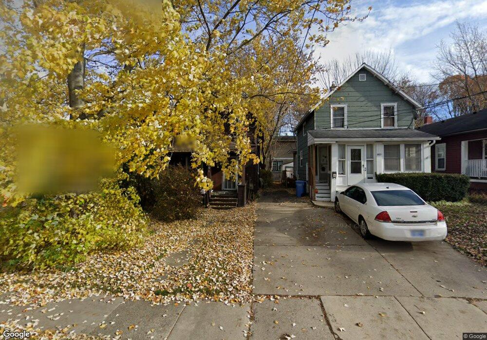
1801 Linval St Lansing, MI 48910
Fabulous Acres NeighborhoodEstimated Value: $67,000 - $82,000
3
Beds
1
Bath
936
Sq Ft
$79/Sq Ft
Est. Value
About This Home
This home is located at 1801 Linval St, Lansing, MI 48910 and is currently estimated at $74,283, approximately $79 per square foot. 1801 Linval St is a home located in Ingham County with nearby schools including Lyons Elementary School, Pattengill Academy, and Eastern High School.
Ownership History
Date
Name
Owned For
Owner Type
Purchase Details
Closed on
Aug 25, 2017
Sold by
Sheets David W
Bought by
Rotier Jennifer
Current Estimated Value
Purchase Details
Closed on
Sep 25, 2015
Sold by
Sheets David W
Bought by
D W Sheets Ii Llc
Purchase Details
Closed on
Dec 27, 2011
Sold by
Sheets David W
Bought by
D W Sheets I Llc
Purchase Details
Closed on
Jun 23, 2009
Sold by
Donovan Shaun
Bought by
David W Sheets Trust
Purchase Details
Closed on
Jan 25, 2008
Sold by
Citimortgage Inc
Bought by
The Secretary Of Housing & Urban Develop
Purchase Details
Closed on
Jul 19, 2007
Sold by
Phillips Barbara A
Bought by
Citimortgage Inc
Purchase Details
Closed on
Jan 26, 1999
Sold by
Maidlow Fredric P and Maidlow Fred
Bought by
Phillips Barbara A
Home Financials for this Owner
Home Financials are based on the most recent Mortgage that was taken out on this home.
Original Mortgage
$22,185
Interest Rate
6.88%
Mortgage Type
FHA
Create a Home Valuation Report for This Property
The Home Valuation Report is an in-depth analysis detailing your home's value as well as a comparison with similar homes in the area
Home Values in the Area
Average Home Value in this Area
Purchase History
| Date | Buyer | Sale Price | Title Company |
|---|---|---|---|
| Rotier Jennifer | -- | None Available | |
| D W Sheets Ii Llc | -- | None Available | |
| D W Sheets I Llc | -- | None Available | |
| David W Sheets Trust | $6,800 | None Available | |
| The Secretary Of Housing & Urban Develop | -- | None Available | |
| Citimortgage Inc | $21,575 | None Available | |
| Phillips Barbara A | $22,000 | First American Title Ins Co |
Source: Public Records
Mortgage History
| Date | Status | Borrower | Loan Amount |
|---|---|---|---|
| Previous Owner | Phillips Barbara A | $22,185 |
Source: Public Records
Tax History
| Year | Tax Paid | Tax Assessment Tax Assessment Total Assessment is a certain percentage of the fair market value that is determined by local assessors to be the total taxable value of land and additions on the property. | Land | Improvement |
|---|---|---|---|---|
| 2025 | $1,123 | $29,900 | $2,800 | $27,100 |
| 2024 | $11 | $23,100 | $2,800 | $20,300 |
| 2023 | $1,321 | $20,600 | $2,800 | $17,800 |
| 2022 | $1,210 | $19,100 | $2,400 | $16,700 |
| 2021 | $1,183 | $17,000 | $2,300 | $14,700 |
| 2020 | $1,174 | $15,800 | $2,300 | $13,500 |
| 2019 | $1,131 | $14,400 | $2,300 | $12,100 |
| 2018 | $1,075 | $12,500 | $2,300 | $10,200 |
| 2017 | $990 | $12,500 | $2,300 | $10,200 |
| 2016 | $951 | $12,300 | $2,300 | $10,000 |
| 2015 | $951 | $12,100 | $4,583 | $7,517 |
| 2014 | $951 | $11,900 | $3,525 | $8,375 |
Source: Public Records
Map
Nearby Homes
- 534 Isbell St
- 1731 Lyons Ave
- 1701 Lyons Ave
- 704 Mckim Ave
- 1601 Bailey St
- 1535 Linval St
- 1731 Herbert St
- 1522 Bailey St
- 2118 Roberts Ln
- 1515 Linval St
- 315 E Mount Hope Ave
- 311 E Mount Hope Ave
- 307 E Mount Hope Ave
- 506 Christiancy St
- 1807 Teel Ave
- 147 Isbell St
- 145 Isbell St
- 1437 Ada St
- 1917 Teel Ave
- 555 Tisdale Ave
Your Personal Tour Guide
Ask me questions while you tour the home.