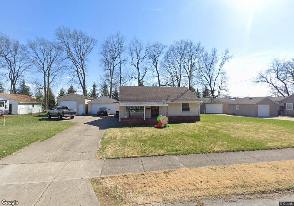
1801 Memorial Dr Springfield, OH 45505
Estimated Value: $79,000 - $165,000
2
Beds
1
Bath
848
Sq Ft
$126/Sq Ft
Est. Value
About This Home
This home is located at 1801 Memorial Dr, Springfield, OH 45505 and is currently estimated at $107,059, approximately $126 per square foot. 1801 Memorial Dr is a home located in Clark County with nearby schools including Kenwood Elementary School, Hayward Middle School, and Springfield High School.
Ownership History
Date
Name
Owned For
Owner Type
Purchase Details
Closed on
Oct 31, 2025
Sold by
Sawyer Sherri A
Bought by
S & C Investments Llc
Current Estimated Value
Purchase Details
Closed on
Nov 17, 2023
Sold by
Sawyer Timothy J and Sawyer Lori A
Bought by
Sawyer Sherri A
Home Financials for this Owner
Home Financials are based on the most recent Mortgage that was taken out on this home.
Original Mortgage
$35,000
Interest Rate
7.57%
Mortgage Type
New Conventional
Purchase Details
Closed on
Nov 16, 2017
Sold by
Sodders George A and Sodders Christa K
Bought by
Sawyer Timothy J and Sawyer Lori A
Create a Home Valuation Report for This Property
The Home Valuation Report is an in-depth analysis detailing your home's value as well as a comparison with similar homes in the area
Home Values in the Area
Average Home Value in this Area
Purchase History
| Date | Buyer | Sale Price | Title Company |
|---|---|---|---|
| S & C Investments Llc | $78,000 | American Homeland Title | |
| Sawyer Sherri A | $43,800 | City Title | |
| Sawyer Sherri A | $43,800 | City Title | |
| Sawyer Timothy J | $40,000 | None Available |
Source: Public Records
Mortgage History
| Date | Status | Borrower | Loan Amount |
|---|---|---|---|
| Previous Owner | Sawyer Sherri A | $35,000 |
Source: Public Records
Tax History
| Year | Tax Paid | Tax Assessment Tax Assessment Total Assessment is a certain percentage of the fair market value that is determined by local assessors to be the total taxable value of land and additions on the property. | Land | Improvement |
|---|---|---|---|---|
| 2025 | $1,439 | $37,820 | $6,400 | $31,420 |
| 2024 | $1,403 | $28,400 | $5,580 | $22,820 |
| 2023 | $1,403 | $28,400 | $5,580 | $22,820 |
| 2022 | $1,437 | $28,400 | $5,580 | $22,820 |
| 2021 | $1,236 | $22,490 | $3,430 | $19,060 |
| 2020 | $1,239 | $22,490 | $3,430 | $19,060 |
| 2019 | $1,242 | $22,490 | $3,430 | $19,060 |
| 2018 | $1,133 | $19,690 | $2,950 | $16,740 |
| 2017 | $621 | $19,026 | $2,947 | $16,079 |
| 2016 | $622 | $19,026 | $2,947 | $16,079 |
| 2015 | $371 | $19,026 | $2,947 | $16,079 |
| 2014 | $738 | $19,026 | $2,947 | $16,079 |
| 2013 | $730 | $19,026 | $2,947 | $16,079 |
Source: Public Records
Map
Nearby Homes
- 1621 Victory Dr
- 1806 N Sweetbriar Ln
- 2040 N Hadley Rd
- 1724 S Belmont Ave
- 2218 Tanager Rd
- 2108 Sunset Ave
- 2390 Old Selma Rd
- 1823 Rutland Ave
- 1440 Selma Rd
- 1225 Beacon St
- 2215 Hackberry St
- 2210 Hackberry St
- 2214 Hackberry St
- 2216 Hackberry St
- 1213 Gable St
- 1247 Selma Rd
- 1714 Kenton St
- 1652 Kenton St
- 2560 Kenton St
- 1846 Ohio Ave
- 1811 Memorial Dr
- 1735 Memorial Dr
- 1802 Memorial Dr
- 1723 Memorial Dr
- 1821 Memorial Dr
- 1808 Memorial Dr
- 1732 Memorial Dr
- 1822 Memorial Dr
- 1722 Memorial Dr
- 1835 Memorial Dr
- 1713 Memorial Dr
- 1803 Victory Dr
- 1737 Victory Dr
- 1832 Memorial Dr
- 1714 Memorial Dr
- 1817 Victory Dr
- 1727 Victory Dr
- 1703 Memorial Dr
- 1903 Memorial Dr
- 1831 Victory Dr
Your Personal Tour Guide
Ask me questions while you tour the home.