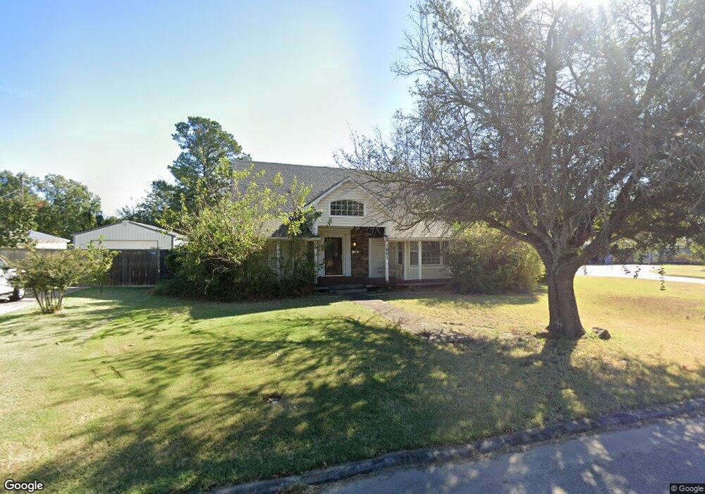
1801 N Union Ave Shawnee, OK 74804
Estimated Value: $265,762 - $330,000
4
Beds
2
Baths
2,450
Sq Ft
$120/Sq Ft
Est. Value
About This Home
This home is located at 1801 N Union Ave, Shawnee, OK 74804 and is currently estimated at $293,441, approximately $119 per square foot. 1801 N Union Ave is a home located in Pottawatomie County with nearby schools including Will Rogers Elementary School, Shawnee Middle School, and Shawnee High School.
Ownership History
Date
Name
Owned For
Owner Type
Purchase Details
Closed on
Apr 1, 2015
Sold by
Durrett Patricia
Bought by
Williams Aaron Riley and Williams Tiffany Nicole
Current Estimated Value
Purchase Details
Closed on
Apr 10, 1996
Sold by
Driver Voncille
Bought by
Lilley Alan and Lilley Mary
Purchase Details
Closed on
Jun 27, 1958
Sold by
James Robert M and James Helen Marie
Bought by
Carruth T B and Carruth Edith
Create a Home Valuation Report for This Property
The Home Valuation Report is an in-depth analysis detailing your home's value as well as a comparison with similar homes in the area
Home Values in the Area
Average Home Value in this Area
Purchase History
| Date | Buyer | Sale Price | Title Company |
|---|---|---|---|
| Williams Aaron Riley | -- | Choice Title Insurance | |
| Lilley Alan | $60,500 | -- | |
| Carruth T B | -- | Choice Title Insurance |
Source: Public Records
Tax History Compared to Growth
Tax History
| Year | Tax Paid | Tax Assessment Tax Assessment Total Assessment is a certain percentage of the fair market value that is determined by local assessors to be the total taxable value of land and additions on the property. | Land | Improvement |
|---|---|---|---|---|
| 2024 | $1,847 | $19,240 | $1,248 | $17,992 |
| 2023 | $1,847 | $18,679 | $1,680 | $16,999 |
| 2022 | $1,814 | $18,679 | $1,680 | $16,999 |
| 2021 | $1,781 | $18,679 | $1,680 | $16,999 |
| 2020 | $1,846 | $19,274 | $1,680 | $17,594 |
| 2019 | $1,970 | $19,869 | $1,680 | $18,189 |
| 2018 | $1,949 | $20,049 | $1,680 | $18,369 |
| 2017 | $1,882 | $19,655 | $1,248 | $18,407 |
| 2016 | $1,949 | $20,104 | $1,248 | $18,856 |
| 2015 | $2,093 | $21,921 | $1,248 | $20,673 |
| 2014 | $2,226 | $23,258 | $1,800 | $21,458 |
Source: Public Records
Map
Nearby Homes
- 1816 N Bell Ave
- 1822 N Phil Ave
- 1817 N Bell Ave
- 1901 N Bell Ave
- 1510 N Union Ave
- 1602 N Bdwy
- 1607 N Beard Ave
- 1712 N Pennsylvania Ave
- 2021 N Broadway Ave
- 401 E Federal St
- 0 Independence and Minnesota St
- 1710 N Park Ave
- 1925 N Park Ave
- 1217 N Market Ave
- 1324 N Park Ave
- 2001 N Mckinley Ave
- 10 W Midland St
- 202 W Franklin St
- 806 E Midland St
- 2415 N Minnesota Cir
- 1809 N Union Ave
- 210 E Cammack
- 210 E Cammack
- 1818 N Philadelphia Ave
- 1824 N Philadelphia Ave
- 1721 N Union Ave
- 1802 N Union Ave
- 1820 N Park Ave
- 1736 N Union Ave
- 1820 N Phil Ave
- 1822 N Union Ave
- 1826 N Union Ave
- 1811 N Philadelphia Ave
- 1830 N Union Ave
- 209 E Cammack
- 1819 N Philadelphia Ave
- 1722 N Union Ave
- 1805 N Park Ave
- 1805 N Phil Ave
- 1837 N Philadelphia Ave