Estimated Value: $262,000 - $293,000
1
Bed
1
Bath
584
Sq Ft
$475/Sq Ft
Est. Value
About This Home
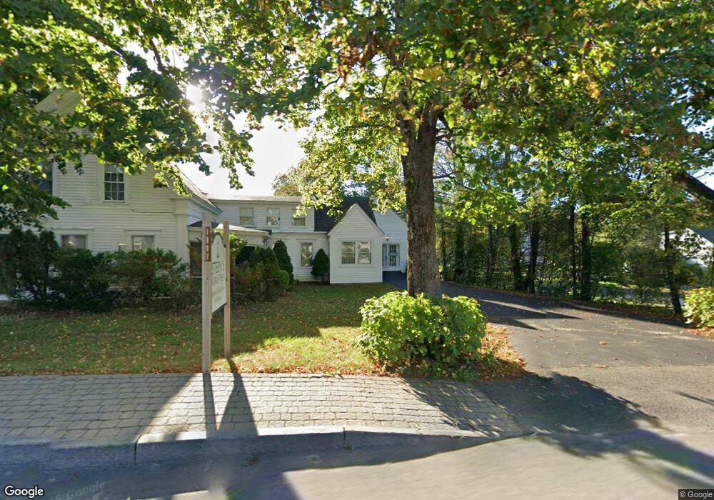
This home is located at 1801 Post Rd Unit 197, Wells, ME 04090 and is currently estimated at $277,254, approximately $474 per square foot. 1801 Post Rd Unit 197 is a home located in York County with nearby schools including Wells Junior High School, Wells Elementary School, and Wells High School.
Ownership History
Date
Name
Owned For
Owner Type
Purchase Details
Closed on
Mar 29, 2024
Sold by
Williams Lt and Williams
Bought by
Lynch Amybeth
Current Estimated Value
Home Financials for this Owner
Home Financials are based on the most recent Mortgage that was taken out on this home.
Original Mortgage
$100,000
Outstanding Balance
$98,285
Interest Rate
6.77%
Mortgage Type
Purchase Money Mortgage
Estimated Equity
$178,969
Purchase Details
Closed on
Dec 26, 2014
Sold by
Williams Ft and Williams
Bought by
Williams Joel and Williams Elaine A
Create a Home Valuation Report for This Property
The Home Valuation Report is an in-depth analysis detailing your home's value as well as a comparison with similar homes in the area
Home Values in the Area
Average Home Value in this Area
Purchase History
| Date | Buyer | Sale Price | Title Company |
|---|---|---|---|
| Lynch Amybeth | -- | None Available | |
| Lynch Amybeth | -- | None Available | |
| Lynch Amybeth | -- | None Available | |
| Lynch Amybeth | -- | None Available | |
| Williams Joel | -- | -- | |
| Williams Lt | -- | -- | |
| Williams Joel | -- | -- |
Source: Public Records
Mortgage History
| Date | Status | Borrower | Loan Amount |
|---|---|---|---|
| Open | Lynch Amybeth | $100,000 | |
| Closed | Lynch Amybeth | $100,000 |
Source: Public Records
Tax History Compared to Growth
Tax History
| Year | Tax Paid | Tax Assessment Tax Assessment Total Assessment is a certain percentage of the fair market value that is determined by local assessors to be the total taxable value of land and additions on the property. | Land | Improvement |
|---|---|---|---|---|
| 2024 | $1,475 | $242,630 | $124,430 | $118,200 |
| 2023 | $1,485 | $249,150 | $124,430 | $124,720 |
| 2022 | $1,282 | $122,520 | $56,570 | $65,950 |
| 2021 | $1,289 | $122,520 | $56,570 | $65,950 |
| 2020 | $1,284 | $122,520 | $56,570 | $65,950 |
| 2019 | $1,277 | $122,520 | $56,570 | $65,950 |
| 2018 | $1,242 | $122,520 | $56,570 | $65,950 |
| 2017 | $1,245 | $122,520 | $56,570 | $65,950 |
| 2016 | $1,233 | $122,520 | $56,570 | $65,950 |
| 2015 | $1,219 | $122,520 | $56,570 | $65,950 |
| 2013 | $1,117 | $122,520 | $56,570 | $65,950 |
Source: Public Records
Map
Nearby Homes
- 1762 Post Rd Unit 206
- 1762 Post Rd Unit 233
- 99 Harbor Rd Unit Lot 52
- 99 Harbor Rd Unit Lot 54
- 2073 Post Rd Unit 5
- 2090 Post Rd Unit 4B
- 47 Whistle Stop Cir
- 89 Skyline Cir
- 66 Nicholas Dr
- 1413 Post Rd Unit 58
- 500 Atlantic Ave Unit 2
- 1373 Post Rd Unit 10A
- 1373 Post Rd Unit 4E
- 1373 Post Rd Unit 2C
- 1373 Post Rd Unit 6B
- 1373 Post Rd Unit 1F
- 50 Coles Hill Rd
- 1351 Post Rd Unit 49
- 90 Poplar Park Dr
- Lots 1-6 Pike Rd
- 1801 Post Rd
- 1801 Post Rd Unit 205
- 1801 Post Rd Unit 204
- 1801 Post Rd Unit 203
- 1801 Post Rd Unit 202
- 1801 Post Rd Unit 201
- 1801 Post Rd Unit 200
- 1801 Post Rd Unit 199
- 1801 Post Rd Unit 198
- 1801 Post Rd Unit 196
- 1801 Post Rd Unit 195
- 1801 Post Rd Unit 194
- 1801 Post Rd Unit 193
- 1801 Post Rd Unit 192
- 1801 Post Rd Unit 191
- 1801 Post Rd Unit 190
- 1801 Post Rd Unit 189
- 1801 Post Rd Unit 188
- 1801 Post Rd Unit 187
- 1801 Post Rd Unit 186