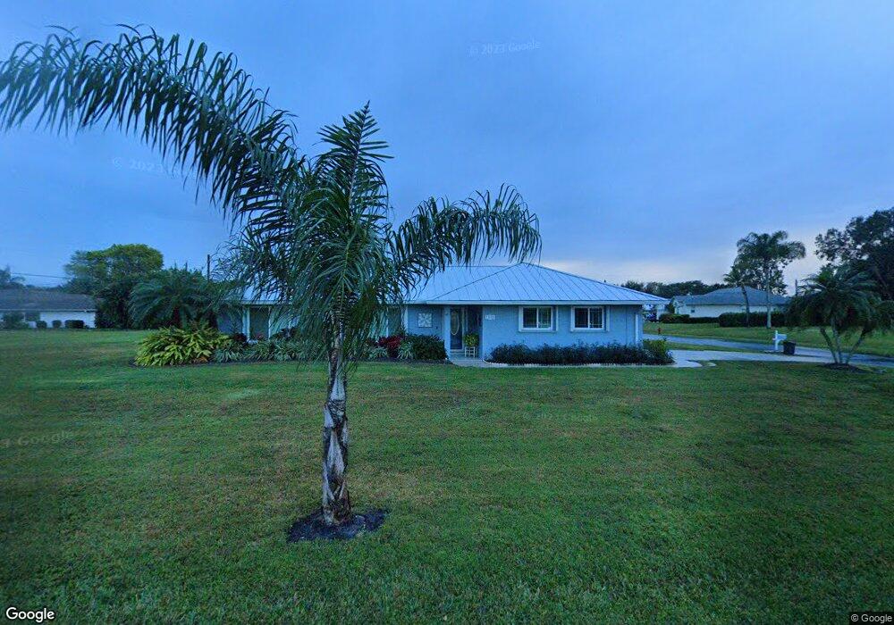
1801 SE Adair Rd Port Saint Lucie, FL 34952
Sandpiper Bay NeighborhoodEstimated Value: $430,000 - $457,000
3
Beds
2
Baths
1,682
Sq Ft
$266/Sq Ft
Est. Value
About This Home
This home is located at 1801 SE Adair Rd, Port Saint Lucie, FL 34952 and is currently estimated at $447,245, approximately $265 per square foot. 1801 SE Adair Rd is a home located in St. Lucie County with nearby schools including Morningside Elementary School, Mariposa Elementary School, and Floresta Elementary School.
Ownership History
Date
Name
Owned For
Owner Type
Purchase Details
Closed on
Sep 18, 2025
Sold by
Reed William O and Reed Cathy R
Bought by
Reed William O and Reed Cathy R
Current Estimated Value
Purchase Details
Closed on
Jul 27, 2001
Sold by
Turner Dorothy B
Bought by
Reed William O and Reed Cathy R
Home Financials for this Owner
Home Financials are based on the most recent Mortgage that was taken out on this home.
Original Mortgage
$85,000
Interest Rate
7.09%
Create a Home Valuation Report for This Property
The Home Valuation Report is an in-depth analysis detailing your home's value as well as a comparison with similar homes in the area
Home Values in the Area
Average Home Value in this Area
Purchase History
| Date | Buyer | Sale Price | Title Company |
|---|---|---|---|
| Reed William O | -- | None Listed On Document | |
| Reed William O | $126,000 | -- |
Source: Public Records
Mortgage History
| Date | Status | Borrower | Loan Amount |
|---|---|---|---|
| Previous Owner | Reed William O | $85,000 |
Source: Public Records
Tax History Compared to Growth
Tax History
| Year | Tax Paid | Tax Assessment Tax Assessment Total Assessment is a certain percentage of the fair market value that is determined by local assessors to be the total taxable value of land and additions on the property. | Land | Improvement |
|---|---|---|---|---|
| 2024 | $3,538 | $161,926 | -- | -- |
| 2023 | $3,538 | $157,210 | $0 | $0 |
| 2022 | $3,400 | $152,632 | $0 | $0 |
| 2021 | $3,313 | $148,187 | $0 | $0 |
| 2020 | $3,326 | $146,142 | $0 | $0 |
| 2019 | $3,294 | $142,857 | $0 | $0 |
| 2018 | $3,144 | $140,194 | $0 | $0 |
| 2017 | $2,980 | $170,100 | $64,700 | $105,400 |
| 2016 | $2,940 | $180,900 | $60,400 | $120,500 |
| 2015 | $2,965 | $149,000 | $43,100 | $105,900 |
| 2014 | $2,833 | $127,484 | $0 | $0 |
Source: Public Records
Map
Nearby Homes
- 1795 SE Adair Rd
- 1899 SE Adair Rd
- 1814 SE Erwin Rd
- 3001 SE Pine Valley St
- 1701 SE Canora Rd
- 2950 SE Aba St
- 2042 SE Pyramid Rd
- 3060 SE Darien Rd
- 1951 SE Erwin Rd
- 3068 SE Darien Rd
- 2801 SE Farley Rd
- 1838 SE van Kleff Ave
- 3013 SE Darien Rd
- 1993 SE Giffen Ave
- 2082 SE Pyramid Rd
- 3034 SE Dalhart Rd
- 1822 SE Beving Ave
- 2789 SE Bluem Way
- 2012 SE Giffen Ave
- 2781 SE Bluem Way
- 1802 SE Elrose St
- 1815 SE Adair Rd
- 1812 SE Elrose St
- 1798 SE Westmoreland Blvd
- 1822 SE Adair Rd
- 1829 SE Adair Rd
- 1813 SE Westmoreland Blvd
- 1822 SE Elrose St
- 1786 SE Westmoreland Blvd
- 1842 SE Adair Rd
- 1801 SE Elrose St
- 1807 SE Elrose St
- 1787 SE Adair Rd
- 1771 SE Canora Rd
- 1794 SE Elrose St
- 1832 SE Elrose St
- 1843 SE Adair Rd
- 1785 SE Westmoreland Blvd Unit B
- 1785 SE Westmoreland Blvd
- 1791 SE Elrose St