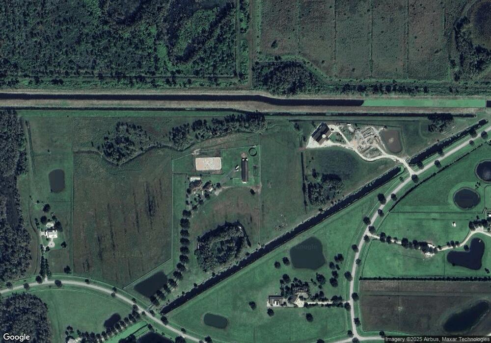
1801 SW Trailside Path Stuart, FL 34997
Estimated Value: $1,609,000 - $2,387,000
3
Beds
5
Baths
3,944
Sq Ft
$513/Sq Ft
Est. Value
About This Home
This home is located at 1801 SW Trailside Path, Stuart, FL 34997 and is currently estimated at $2,022,719, approximately $512 per square foot. 1801 SW Trailside Path is a home located in Martin County with nearby schools including Crystal Lake Elementary School, Dr. David L. Anderson Middle School, and South Fork High School.
Ownership History
Date
Name
Owned For
Owner Type
Purchase Details
Closed on
Apr 30, 2009
Sold by
Black Robert A and Black Sherry A
Bought by
Teeters William E and Teeters Edna Lou
Current Estimated Value
Purchase Details
Closed on
Jun 12, 2006
Sold by
Bacon Douglas A and Bacon Sondra Gibson
Bought by
Black Robert A and Black Sherry A
Home Financials for this Owner
Home Financials are based on the most recent Mortgage that was taken out on this home.
Original Mortgage
$750,000
Interest Rate
6.87%
Mortgage Type
Fannie Mae Freddie Mac
Purchase Details
Closed on
Feb 21, 2002
Sold by
Trailside Land Company
Bought by
Bacon Douglas A and Bacon Sondra Gibson
Home Financials for this Owner
Home Financials are based on the most recent Mortgage that was taken out on this home.
Original Mortgage
$101,000
Interest Rate
6.81%
Create a Home Valuation Report for This Property
The Home Valuation Report is an in-depth analysis detailing your home's value as well as a comparison with similar homes in the area
Home Values in the Area
Average Home Value in this Area
Purchase History
| Date | Buyer | Sale Price | Title Company |
|---|---|---|---|
| Teeters William E | $750,000 | Capital Abstract & Title | |
| Black Robert A | $901,500 | Shore To Shore Title Inc | |
| Bacon Douglas A | $199,000 | -- |
Source: Public Records
Mortgage History
| Date | Status | Borrower | Loan Amount |
|---|---|---|---|
| Previous Owner | Black Robert A | $750,000 | |
| Previous Owner | Bacon Douglas A | $101,000 |
Source: Public Records
Tax History Compared to Growth
Tax History
| Year | Tax Paid | Tax Assessment Tax Assessment Total Assessment is a certain percentage of the fair market value that is determined by local assessors to be the total taxable value of land and additions on the property. | Land | Improvement |
|---|---|---|---|---|
| 2025 | $21,624 | $1,352,340 | -- | -- |
| 2024 | $22,755 | $1,270,449 | -- | -- |
| 2023 | $22,755 | $1,340,830 | $0 | $0 |
| 2022 | $19,873 | $1,089,264 | $0 | $0 |
| 2021 | $17,520 | $990,240 | $350,180 | $640,060 |
| 2020 | $16,948 | $953,350 | $340,170 | $613,180 |
| 2019 | $16,983 | $943,620 | $350,180 | $593,440 |
| 2018 | $16,969 | $947,970 | $280,140 | $667,830 |
| 2017 | $14,793 | $880,150 | $300,150 | $580,000 |
| 2016 | $13,838 | $796,160 | $214,110 | $582,050 |
| 2015 | -- | $778,220 | $190,100 | $588,120 |
| 2014 | -- | $624,620 | $0 | $0 |
Source: Public Records
Map
Nearby Homes
- 2986 SW Trailside Path
- 2393 SW Trailside Path
- 11733 SW Citrus Blvd
- 11666 SW Meadowlark Cir
- 6112 SW Banks St
- 6152 SW Banks St
- 11013 SW Redwing Dr
- 4500 SW Green Ridge Ln
- 0000 SW Green Ridge Ln
- 10361 SW Highpointe Dr Unit Prestige 268
- 10261 SW Highpointe Dr Unit Renown 278
- 10241 SW Citrus Blvd
- 4925 SW Cornerstone Way Unit Mystique 219
- 10200 SW Highpointe Dr Unit Ashby 97
- 13700 SW Groveside Dr
- 2346 SW 96th St
- 9941 SW Legacy Dr
- 2574 SW Monarch Trail
- 2686 SW Monarch Trail
- 9674 SW Purple Martin Way
- 1951 SW Trailside Run
- 1951 SW Trailside Run
- 1901 SW Trailside Run
- 1949 SW Trailside Path
- 3578 SW Trailside Path
- 1950 SW Trailside Run
- 968 SW Trailside Run
- 1001 SW Trailside Run
- 2023 SW Trailside Path
- 3208 SW Trailside Path
- 3578 SW Trailside Path
- 2986 SW Trailside Path
- 2023 SW Trailside Path
- 3430 SW Trailside Path
- 2171 SW Trailside Path
- 3133 SW Trailside Path
- 3429 SW Trailside Path
- 2245 SW Trailside Path
- 3281 SW Trailside Path
- 2985 SW Trailside Path
