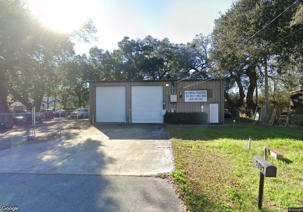
1801 W 9 Mile Rd Pensacola, FL 32534
Estimated Value: $314,071
--
Bed
1
Bath
4,000
Sq Ft
$79/Sq Ft
Est. Value
About This Home
This home is located at 1801 W 9 Mile Rd, Pensacola, FL 32534 and is currently estimated at $314,071, approximately $78 per square foot. 1801 W 9 Mile Rd is a home located in Escambia County with nearby schools including Lincoln Park Elementary School, Beulah Middle School, and J.M. Tate Senior High School.
Ownership History
Date
Name
Owned For
Owner Type
Purchase Details
Closed on
Sep 13, 2022
Sold by
Method Environmental Corp
Bought by
Aaa Towing & Transport Llc
Current Estimated Value
Purchase Details
Closed on
Dec 17, 2010
Sold by
Sherwood Electric Co Inc
Bought by
Method Environmental Corporation
Home Financials for this Owner
Home Financials are based on the most recent Mortgage that was taken out on this home.
Original Mortgage
$180,000
Interest Rate
4.18%
Mortgage Type
Seller Take Back
Create a Home Valuation Report for This Property
The Home Valuation Report is an in-depth analysis detailing your home's value as well as a comparison with similar homes in the area
Home Values in the Area
Average Home Value in this Area
Purchase History
| Date | Buyer | Sale Price | Title Company |
|---|---|---|---|
| Aaa Towing & Transport Llc | $310,000 | -- | |
| Method Environmental Corporation | $190,000 | Attorney |
Source: Public Records
Mortgage History
| Date | Status | Borrower | Loan Amount |
|---|---|---|---|
| Previous Owner | Method Environmental Corporation | $180,000 |
Source: Public Records
Tax History Compared to Growth
Tax History
| Year | Tax Paid | Tax Assessment Tax Assessment Total Assessment is a certain percentage of the fair market value that is determined by local assessors to be the total taxable value of land and additions on the property. | Land | Improvement |
|---|---|---|---|---|
| 2024 | $2,985 | $218,008 | $49,659 | $168,349 |
| 2023 | $2,985 | $209,124 | $41,383 | $167,741 |
| 2022 | $2,792 | $198,646 | $41,383 | $157,263 |
| 2021 | $2,587 | $171,524 | $0 | $0 |
| 2020 | $2,514 | $169,094 | $0 | $0 |
| 2019 | $2,469 | $164,343 | $0 | $0 |
| 2018 | $2,351 | $152,602 | $0 | $0 |
| 2017 | $0 | $144,782 | $0 | $0 |
| 2016 | $2,232 | $138,620 | $0 | $0 |
| 2015 | $2,071 | $127,628 | $0 | $0 |
| 2014 | $2,060 | $126,417 | $0 | $0 |
Source: Public Records
Map
Nearby Homes
- 1518 Farragut Way
- 55 Newport St
- 8913 Brigade Trail
- 8964 Abbington Dr
- 8920 Brigade Trail
- 8916 Brigade Trail
- 428 Mayberry St
- 1921 Larkspur Cir
- 116 Mt Pilot St
- 213 Newberry St
- 8907 Abbington Dr
- 412 Mayberry St
- 1412 Croquet Dr
- 1422 Starlight Dr
- 1420 Starlight Dr
- 1587 Iroquois Ct
- 1578 Iroquois Ct
- 1590 Iroquois Ct
- 1433 Claridge Place
- 1403 Twilight Dr
- 1785 W Nine Mile Rd
- 9214 Waring Rd
- 9214 Waring Rd Unit 1&2
- 9214 Waring Rd Unit 2&3
- 9214 Waring Rd Unit Whole
- 9214 Waring Rd Unit 1
- 1783 W Nine Mile Rd
- 1783 W Nine Mile Rd
- 1995 W 9 Mile Rd
- 1822 Blackbird Ln
- 1559 W 9 Mile Rd Unit 3000-3228.1411655
- 1559 W 9 Mile Rd Unit 3000-3210.1411654
- 1559 W 9 Mile Rd Unit 3000-3112.1411652
- 1559 W 9 Mile Rd Unit 1000-1114.1411656
- 1559 W 9 Mile Rd Unit 1000-1205.1411653
- W W 9 Mile Rd
- 1811 Blackbird Ln
- 1861 W Nine Mile Rd
- 1559 W Nine Mile Rd
- 9200 Waring Rd