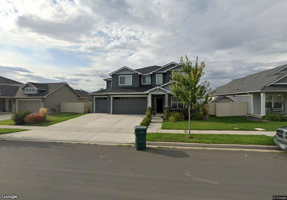
1801 W Midway Ave Post Falls, ID 83854
West Seltice NeighborhoodEstimated Value: $649,015 - $732,000
4
Beds
3
Baths
3,120
Sq Ft
$221/Sq Ft
Est. Value
About This Home
This home is located at 1801 W Midway Ave, Post Falls, ID 83854 and is currently estimated at $689,754, approximately $221 per square foot. 1801 W Midway Ave is a home located in Kootenai County with nearby schools including West Ridge Elementary School, River City Middle School, and Post Falls High School.
Ownership History
Date
Name
Owned For
Owner Type
Purchase Details
Closed on
Jun 9, 2021
Sold by
Mcclinton Laura B
Bought by
Mcclinton Laura B and Winstead Alan
Current Estimated Value
Home Financials for this Owner
Home Financials are based on the most recent Mortgage that was taken out on this home.
Original Mortgage
$335,000
Outstanding Balance
$303,301
Interest Rate
2.9%
Mortgage Type
New Conventional
Estimated Equity
$386,453
Purchase Details
Closed on
Jul 17, 2019
Sold by
Sorbonne Homes Llc and Mcclinton Laura B
Bought by
Mcclinton Laura B
Create a Home Valuation Report for This Property
The Home Valuation Report is an in-depth analysis detailing your home's value as well as a comparison with similar homes in the area
Home Values in the Area
Average Home Value in this Area
Purchase History
| Date | Buyer | Sale Price | Title Company |
|---|---|---|---|
| Mcclinton Laura B | -- | Pioneer Title Kootenai Cnty | |
| Mcclinton Laura B | -- | Pioneer Title Kootenai Cnty |
Source: Public Records
Mortgage History
| Date | Status | Borrower | Loan Amount |
|---|---|---|---|
| Open | Mcclinton Laura B | $335,000 |
Source: Public Records
Tax History Compared to Growth
Tax History
| Year | Tax Paid | Tax Assessment Tax Assessment Total Assessment is a certain percentage of the fair market value that is determined by local assessors to be the total taxable value of land and additions on the property. | Land | Improvement |
|---|---|---|---|---|
| 2024 | $2,635 | $604,500 | $155,000 | $449,500 |
| 2023 | $2,635 | $645,915 | $120,000 | $525,915 |
| 2022 | $3,400 | $680,865 | $110,000 | $570,865 |
| 2021 | $3,007 | $423,510 | $90,000 | $333,510 |
| 2020 | $3,253 | $386,760 | $75,000 | $311,760 |
| 2019 | $860 | $362,420 | $70,000 | $292,420 |
| 2018 | $945 | $70,000 | $70,000 | $0 |
Source: Public Records
Map
Nearby Homes
- 1992 W Malad Ave
- 1622 N Minam Loop
- 1968 W Platte Ct
- 2066 W Platte Ct
- 2084 W Platte Ct
- 2097 W Platte Ct
- 1733 N Minam Loop
- Cottonwood + Plan at Montrose - Clearwater Collection
- Hawthorn Plan at Montrose - Clearwater Collection
- Enclave Plan at Montrose
- Prairie View Plan at Montrose
- Whistler Plan at Montrose
- The Cobblestone Plan at Montrose
- Willow Plan at Montrose - Clearwater Collection
- Empress Plan at Montrose
- Sequoia Plan at Montrose - Clearwater Collection
- Cypress Plan at Montrose - Clearwater Collection
- Park Ridge Plan at Montrose
- Sequoia + Plan at Montrose - Clearwater Collection
- Cottonwood Plan at Montrose - Clearwater Collection
- 1781 W Midway Ave
- 1821 W Midway Ave
- 1853 W Midway Ave
- 1679 N Wollaston Dr
- 1896 W Alsea Loop
- 1679 N Wollaston Dr
- 1699 N Wollaston Dr
- 1896 W Alsea Ave
- 1602 N Minam Loop
- 1608 N Minam Loop
- 1608 N Minam Loop
- 1602 N Minam Loop
- 1892 W Alsea Ave
- 1892 W Alsea Loop
- 1699 N Wollaston Dr
- 1721 N Wollaston Dr
- 1721 N Wollaston Dr
- 1629 Wollaston
- 1883 W Midway Ave
- 1629 N Wollaston Dr