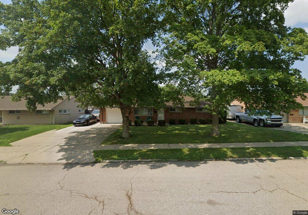
1801 W Stroop Rd Dayton, OH 45439
Estimated Value: $175,000 - $188,000
3
Beds
1
Bath
1,040
Sq Ft
$175/Sq Ft
Est. Value
About This Home
This home is located at 1801 W Stroop Rd, Dayton, OH 45439 and is currently estimated at $182,074, approximately $175 per square foot. 1801 W Stroop Rd is a home located in Montgomery County with nearby schools including Southdale Elementary School, Van Buren Middle School, and Kettering Fairmont High School.
Ownership History
Date
Name
Owned For
Owner Type
Purchase Details
Closed on
Apr 23, 2016
Sold by
Wickline Bradley and Wickline Bradley E
Bought by
Miller Michael Joseph and Miller Margo Ann
Current Estimated Value
Purchase Details
Closed on
Jul 31, 2003
Sold by
Groff David J
Bought by
Wickline Bradley
Home Financials for this Owner
Home Financials are based on the most recent Mortgage that was taken out on this home.
Original Mortgage
$73,200
Interest Rate
5.47%
Mortgage Type
Purchase Money Mortgage
Purchase Details
Closed on
Jul 15, 2003
Sold by
Estate Of Viola L Groff
Bought by
Groff Richard H
Home Financials for this Owner
Home Financials are based on the most recent Mortgage that was taken out on this home.
Original Mortgage
$73,200
Interest Rate
5.47%
Mortgage Type
Purchase Money Mortgage
Create a Home Valuation Report for This Property
The Home Valuation Report is an in-depth analysis detailing your home's value as well as a comparison with similar homes in the area
Home Values in the Area
Average Home Value in this Area
Purchase History
| Date | Buyer | Sale Price | Title Company |
|---|---|---|---|
| Miller Michael Joseph | $74,800 | Landmark Title Agency South | |
| Wickline Bradley | $91,500 | -- | |
| Groff Richard H | -- | -- |
Source: Public Records
Mortgage History
| Date | Status | Borrower | Loan Amount |
|---|---|---|---|
| Previous Owner | Wickline Bradley | $73,200 |
Source: Public Records
Tax History Compared to Growth
Tax History
| Year | Tax Paid | Tax Assessment Tax Assessment Total Assessment is a certain percentage of the fair market value that is determined by local assessors to be the total taxable value of land and additions on the property. | Land | Improvement |
|---|---|---|---|---|
| 2024 | $2,926 | $45,920 | $10,850 | $35,070 |
| 2023 | $2,926 | $45,920 | $10,850 | $35,070 |
| 2022 | $2,397 | $29,680 | $7,000 | $22,680 |
| 2021 | $2,222 | $29,680 | $7,000 | $22,680 |
| 2020 | $2,228 | $29,680 | $7,000 | $22,680 |
| 2019 | $2,262 | $26,650 | $7,000 | $19,650 |
| 2018 | $2,274 | $26,650 | $7,000 | $19,650 |
| 2017 | $2,101 | $26,650 | $7,000 | $19,650 |
| 2016 | $2,190 | $26,780 | $7,000 | $19,780 |
| 2015 | $2,093 | $26,780 | $7,000 | $19,780 |
| 2014 | $2,093 | $26,780 | $7,000 | $19,780 |
| 2012 | -- | $31,210 | $8,400 | $22,810 |
Source: Public Records
Map
Nearby Homes
- 1692 Hillwood Dr
- 2090 Mattis Dr
- 4051 Ellery Ave
- 4207 S Dixie Dr
- 4301 Tait Rd
- 1952 Tait Circle Rd
- 1905 Tait Circle Rd
- 2639 Blanchard Ave
- 3720 Ridgeleigh Rd Unit D
- 4629 Richwood Dr
- 4661 Richwood Dr
- 2050 William Ln
- 1349 Tamerlane Rd
- 2571 Cluster Ave
- 4792 Loxley Dr
- 3225 Southdale Dr Unit 1
- 1314 Ridgeview Ave
- 1955 Kresswood Cir
- 5084 Mays Ave
- 4400 Royal Ridge Way
- 1813 W Stroop Rd
- 1799 W Stroop Rd
- 1772 Hillwood Dr
- 1780 Hillwood Dr
- 1764 Hillwood Dr
- 1785 W Stroop Rd
- 1825 W Stroop Rd
- 1756 Hillwood Dr
- 1788 Hillwood Dr
- 1837 W Stroop Rd
- 1773 W Stroop Rd
- 2160 W Stroop Rd
- 2146 W Stroop Rd
- 1804 Hillwood Dr
- 1748 Hillwood Dr
- 2174 W Stroop Rd
- 2132 W Stroop Rd
- 1849 W Stroop Rd
- 1761 W Stroop Rd
- 1765 Hillwood Dr