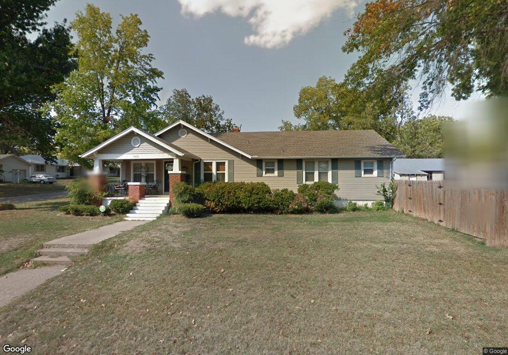
1802 E 10th St Shawnee, OK 74801
Estimated Value: $188,000 - $222,000
3
Beds
2
Baths
2,181
Sq Ft
$93/Sq Ft
Est. Value
About This Home
This home is located at 1802 E 10th St, Shawnee, OK 74801 and is currently estimated at $203,076, approximately $93 per square foot. 1802 E 10th St is a home located in Pottawatomie County with nearby schools including Horace Mann Elementary School, Shawnee Middle School, and Shawnee High School.
Ownership History
Date
Name
Owned For
Owner Type
Purchase Details
Closed on
Sep 7, 2007
Sold by
Weaver Robert E and Weaver Ann
Bought by
Orange Shalanda and Orange Joe W
Current Estimated Value
Home Financials for this Owner
Home Financials are based on the most recent Mortgage that was taken out on this home.
Original Mortgage
$124,900
Outstanding Balance
$87,833
Interest Rate
6.72%
Mortgage Type
Unknown
Estimated Equity
$115,243
Purchase Details
Closed on
Jan 25, 1994
Sold by
Hollis Ray and Hollis Martha
Bought by
Weaver Robert
Create a Home Valuation Report for This Property
The Home Valuation Report is an in-depth analysis detailing your home's value as well as a comparison with similar homes in the area
Purchase History
| Date | Buyer | Sale Price | Title Company |
|---|---|---|---|
| Orange Shalanda | $125,000 | None Available | |
| Weaver Robert | $54,500 | -- |
Source: Public Records
Mortgage History
| Date | Status | Borrower | Loan Amount |
|---|---|---|---|
| Open | Orange Shalanda | $124,900 |
Source: Public Records
Tax History
| Year | Tax Paid | Tax Assessment Tax Assessment Total Assessment is a certain percentage of the fair market value that is determined by local assessors to be the total taxable value of land and additions on the property. | Land | Improvement |
|---|---|---|---|---|
| 2025 | $1,786 | $18,888 | $722 | $18,166 |
| 2024 | $1,756 | $18,338 | $722 | $17,616 |
| 2023 | $1,756 | $17,804 | $1,680 | $16,124 |
| 2022 | $1,724 | $17,804 | $1,680 | $16,124 |
| 2021 | $1,693 | $17,804 | $1,680 | $16,124 |
| 2020 | $1,747 | $18,286 | $1,673 | $16,613 |
| 2019 | $1,749 | $17,753 | $1,576 | $16,177 |
| 2018 | $1,661 | $17,236 | $1,543 | $15,693 |
| 2017 | $1,588 | $16,735 | $1,456 | $15,279 |
| 2016 | $1,556 | $16,247 | $1,391 | $14,856 |
| 2015 | $1,478 | $15,773 | $1,315 | $14,458 |
| 2014 | $1,432 | $15,313 | $1,208 | $14,105 |
Source: Public Records
Map
Nearby Homes
- 1416 E 9th St
- 1330 E Main St
- 1330 E Whittaker St
- 1313 E Whittaker St
- 703 N Roosevelt Ave
- 301 Clubhouse Dr
- 2305 E Main St
- 648 N Cleveland Ave
- 1337 E Margaret St
- 321 S Lindale Ave
- 1327 E Fay St
- 1322 E Margaret St
- 1314 E Margaret St
- 911 N Pesotum Ave
- 1207 E 10th St
- 1824 E Remington St
- 1119 E 11th St
- 2310 Lakeside Cir
- 1 Country Club Rd
- 0 E Fay St
- 311 N Roosevelt Ave
- 223 N Roosevelt Ave
- 1824 E 10th St
- 312 N Tenbrook Ave
- 314 N Tenbrook Ave
- 318 N Tenbrook Ave
- 312 N Roosevelt Ave
- 316 N Roosevelt Ave
- 1730 E 10th St
- 311 N Tenbrook Ave
- 1825 E 10th St
- 101 Cedar Creek Ln
- 100 Cedar Creek Ln
- 315 N Tenbrook Ave
- 308 N Roosevelt Ave
- 208 N Tenbrook Ave
- 309 N Roosevelt Ave
- 329 N Roosevelt Ave
- 218 N Roosevelt Ave
- 205 N Tenbrook Ave
Your Personal Tour Guide
Ask me questions while you tour the home.