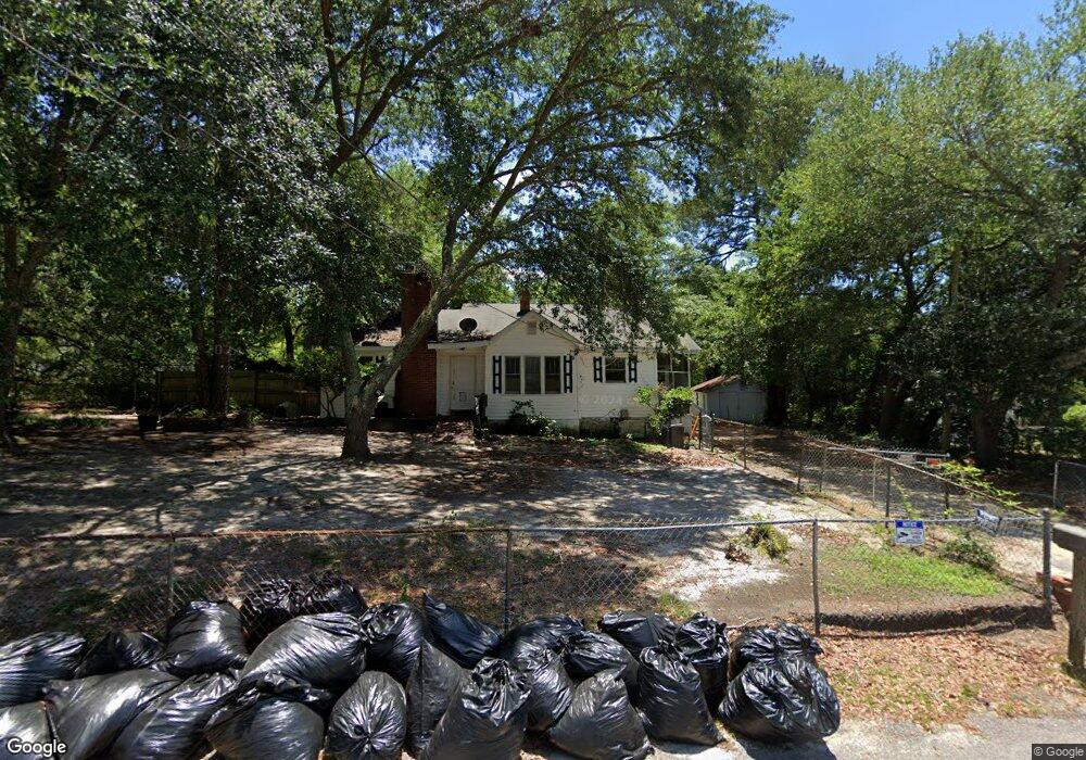
1802 Lynhurst Dr Camden, SC 29020
Estimated Value: $87,641 - $175,000
3
Beds
1
Bath
1,210
Sq Ft
$106/Sq Ft
Est. Value
About This Home
This home is located at 1802 Lynhurst Dr, Camden, SC 29020 and is currently estimated at $127,660, approximately $105 per square foot. 1802 Lynhurst Dr is a home located in Kershaw County with nearby schools including Jackson School, Pine Tree Hill Elementary School, and Camden Middle School.
Ownership History
Date
Name
Owned For
Owner Type
Purchase Details
Closed on
Apr 25, 2018
Sold by
Burton Iii Oneil B
Bought by
Castor Ashley
Current Estimated Value
Home Financials for this Owner
Home Financials are based on the most recent Mortgage that was taken out on this home.
Original Mortgage
$80,303
Outstanding Balance
$68,911
Interest Rate
4.44%
Mortgage Type
New Conventional
Estimated Equity
$58,749
Purchase Details
Closed on
Mar 9, 2011
Sold by
Burton O`Neil
Bought by
Burton O`Neil
Create a Home Valuation Report for This Property
The Home Valuation Report is an in-depth analysis detailing your home's value as well as a comparison with similar homes in the area
Home Values in the Area
Average Home Value in this Area
Purchase History
| Date | Buyer | Sale Price | Title Company |
|---|---|---|---|
| Castor Ashley | $79,500 | Connell Law Firm Llc | |
| Burton O`Neil | -- | -- |
Source: Public Records
Mortgage History
| Date | Status | Borrower | Loan Amount |
|---|---|---|---|
| Open | Castor Ashley | $80,303 |
Source: Public Records
Tax History Compared to Growth
Tax History
| Year | Tax Paid | Tax Assessment Tax Assessment Total Assessment is a certain percentage of the fair market value that is determined by local assessors to be the total taxable value of land and additions on the property. | Land | Improvement |
|---|---|---|---|---|
| 2025 | $1,241 | $63,800 | $10,000 | $53,800 |
| 2024 | $1,241 | $63,800 | $10,000 | $53,800 |
| 2023 | $704 | $63,800 | $10,000 | $53,800 |
| 2022 | $415 | $63,800 | $10,000 | $53,800 |
| 2021 | $382 | $63,800 | $10,000 | $53,800 |
| 2020 | $347 | $54,500 | $7,000 | $47,500 |
| 2019 | $359 | $54,500 | $7,000 | $47,500 |
| 2018 | $349 | $54,500 | $7,000 | $47,500 |
| 2017 | $1,035 | $54,500 | $7,000 | $47,500 |
| 2016 | $1,045 | $55,700 | $6,500 | $49,200 |
| 2015 | $867 | $55,700 | $6,500 | $49,200 |
| 2014 | $867 | $0 | $0 | $0 |
Source: Public Records
Map
Nearby Homes
- 1221 Mcrae Rd
- 1514 Lewis St
- 1517 Albert St
- 805 Mcrae Rd
- 276 Shadowbrook Way
- 236 Shadowbrook Way
- 285 Shadowbrook Way
- 1518 Woodlawn Dr
- 165 Shadowbrook Way
- 125 Shadowbrook Way
- 66 Elizabeth St
- 2503 Haile St
- 1205 Jefferson Davis Hwy
- 1853 Hasty Rd
- 1820 Camden Ave
- 1010 Pineview St
- 1103 Woodlawn Dr
- 1906 State Road S-28-387
- 1725 Haile St
- 1 Belle Ct
- 1802 Lyndhurst Dr
- 1803 Lyndhurst Dr
- 1900 Hilton St
- 1800 Lyndhurst Dr
- 1800 Lynhurst
- 1901 Hilton St
- 1808 Hilton St
- 1707 Branham Ave
- 1709 Branham Ave
- 1807 Lyndhurst Dr
- 1902 Hilton St
- 1809 Hilton St
- 1806 Hilton St
- 1909 Barfield St
- 1715 Lyndhurst Dr
- 1907 Hilton St
- 1714 Lyndhurst Dr
- 1911 Barfield St
- 1801 Branham Ave
- 1804 Hilton St