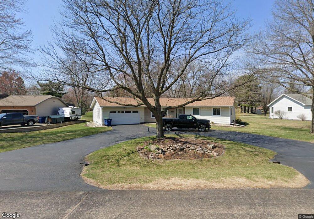
1802 Macaw Ave Wausau, WI 54401
Estimated Value: $220,358 - $355,000
--
Bed
--
Bath
--
Sq Ft
0.37
Acres
About This Home
This home is located at 1802 Macaw Ave, Wausau, WI 54401 and is currently estimated at $282,590. 1802 Macaw Ave is a home located in Marathon County with nearby schools including Rib Mountain Elementary School, John Muir Middle School, and West High School.
Ownership History
Date
Name
Owned For
Owner Type
Purchase Details
Closed on
May 20, 2005
Sold by
Bolton Douglas E and Aulwes Bolton Mary M
Bought by
Schilling Derek W and Listle Joy M
Current Estimated Value
Home Financials for this Owner
Home Financials are based on the most recent Mortgage that was taken out on this home.
Original Mortgage
$111,200
Outstanding Balance
$58,241
Interest Rate
5.91%
Mortgage Type
New Conventional
Estimated Equity
$224,349
Create a Home Valuation Report for This Property
The Home Valuation Report is an in-depth analysis detailing your home's value as well as a comparison with similar homes in the area
Home Values in the Area
Average Home Value in this Area
Purchase History
| Date | Buyer | Sale Price | Title Company |
|---|---|---|---|
| Schilling Derek W | $139,000 | None Available |
Source: Public Records
Mortgage History
| Date | Status | Borrower | Loan Amount |
|---|---|---|---|
| Open | Schilling Derek W | $111,200 |
Source: Public Records
Tax History Compared to Growth
Tax History
| Year | Tax Paid | Tax Assessment Tax Assessment Total Assessment is a certain percentage of the fair market value that is determined by local assessors to be the total taxable value of land and additions on the property. | Land | Improvement |
|---|---|---|---|---|
| 2024 | $1,594 | $178,600 | $32,200 | $146,400 |
| 2023 | $3,192 | $178,600 | $32,200 | $146,400 |
| 2022 | $3,361 | $178,600 | $32,200 | $146,400 |
| 2021 | $3,263 | $178,600 | $32,200 | $146,400 |
| 2020 | $3,255 | $178,600 | $32,200 | $146,400 |
| 2019 | $3,088 | $178,600 | $32,200 | $146,400 |
| 2018 | $3,191 | $154,800 | $29,000 | $125,800 |
| 2017 | $3,104 | $154,800 | $29,000 | $125,800 |
| 2016 | $3,121 | $154,800 | $29,000 | $125,800 |
| 2015 | $2,976 | $153,900 | $29,000 | $124,900 |
| 2014 | $2,925 | $153,900 | $29,000 | $124,900 |
Source: Public Records
Map
Nearby Homes
- 227815 Sharptail Rd
- 150811 County Road Nn
- 150811 Cth Nn
- 227308 Shrike Ave
- 226936 Boulder Ridge Cir
- 150609 Lavender Ln
- 917 S 21st Place
- 2117 Sherman St
- 227825 Nuthatch Ln
- 1423 Lake St
- 1601 Chellis St Unit 1607,1611Chellis,142
- 1419 Lake St
- 1438 Madison St
- 310 Lisbeth Rd
- 2812 Hubbill Ave
- 226440 Kingbird Ave
- 909 S 14th Ave
- 210 S 45th Ave
- 151257 Kingfisher Ln
- 1708 Garfield Ave
- 1706 Macaw Ave
- 1804 Macaw Ave
- 228360 Macaw Ave
- 1801 Falcon Ave
- 1803 Falcon Ave
- 1707 Falcon Ave
- 228385 Macaw Ave
- 228468 Macaw Ave
- 3408 Skylark Ln
- 1702 Macaw Ave
- 3409 Swallow Ln
- 3410 Skylark Ln
- 1803 Macaw Ave
- 1701 Falcon Ave
- 3310 Skylark Ln
- 3407 Skylark Ln
- 3308 Skylark Ln
- 1800 Falcon Ave
- 150040 Swallow Ln
- 1902 Macaw Ave