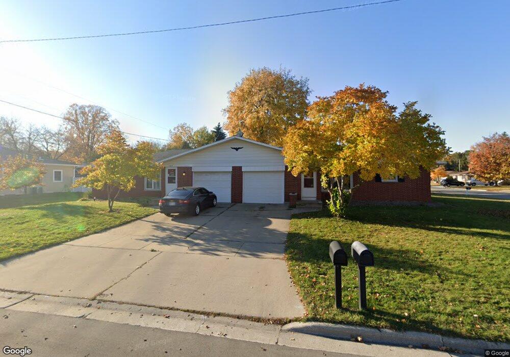
1802 Sahara Dr Unit 1804 Green Bay, WI 54304
John Muir Park NeighborhoodEstimated Value: $318,000 - $347,000
5
Beds
3
Baths
1,900
Sq Ft
$176/Sq Ft
Est. Value
About This Home
This home is located at 1802 Sahara Dr Unit 1804, Green Bay, WI 54304 and is currently estimated at $334,525, approximately $176 per square foot. 1802 Sahara Dr Unit 1804 is a home located in Brown County with nearby schools including Kennedy Elementary School, Lombardi Middle School, and Southwest High School.
Ownership History
Date
Name
Owned For
Owner Type
Purchase Details
Closed on
Aug 9, 2018
Sold by
Wilke James M and Wilke Christine A
Bought by
Depas James D
Current Estimated Value
Home Financials for this Owner
Home Financials are based on the most recent Mortgage that was taken out on this home.
Original Mortgage
$100,000
Outstanding Balance
$86,846
Interest Rate
4.5%
Mortgage Type
Purchase Money Mortgage
Estimated Equity
$247,679
Purchase Details
Closed on
Sep 24, 2008
Sold by
Stoehr Donald G and Stoehr Ruth A
Bought by
Wilke James M and Wilke Christine A
Home Financials for this Owner
Home Financials are based on the most recent Mortgage that was taken out on this home.
Original Mortgage
$120,000
Interest Rate
6.52%
Mortgage Type
Purchase Money Mortgage
Create a Home Valuation Report for This Property
The Home Valuation Report is an in-depth analysis detailing your home's value as well as a comparison with similar homes in the area
Home Values in the Area
Average Home Value in this Area
Purchase History
| Date | Buyer | Sale Price | Title Company |
|---|---|---|---|
| Depas James D | $165,000 | Liberty Title | |
| Wilke James M | $160,000 | Land Office Title Corp |
Source: Public Records
Mortgage History
| Date | Status | Borrower | Loan Amount |
|---|---|---|---|
| Open | Depas James D | $100,000 | |
| Previous Owner | Wilke James M | $120,000 |
Source: Public Records
Tax History Compared to Growth
Tax History
| Year | Tax Paid | Tax Assessment Tax Assessment Total Assessment is a certain percentage of the fair market value that is determined by local assessors to be the total taxable value of land and additions on the property. | Land | Improvement |
|---|---|---|---|---|
| 2024 | $4,208 | $214,700 | $37,900 | $176,800 |
| 2023 | $4,078 | $214,700 | $37,900 | $176,800 |
| 2022 | $3,943 | $214,700 | $37,900 | $176,800 |
| 2021 | $3,916 | $157,400 | $32,300 | $125,100 |
| 2020 | $3,827 | $157,400 | $32,300 | $125,100 |
| 2019 | $4,308 | $157,400 | $32,300 | $125,100 |
| 2018 | $3,611 | $157,400 | $32,300 | $125,100 |
| 2017 | $3,518 | $157,400 | $32,300 | $125,100 |
| 2016 | $3,472 | $157,400 | $32,300 | $125,100 |
| 2015 | $3,442 | $157,400 | $32,300 | $125,100 |
| 2014 | $3,637 | $157,400 | $32,300 | $125,100 |
| 2013 | $3,637 | $157,400 | $32,300 | $125,100 |
Source: Public Records
Map
Nearby Homes
- 1522 Argonne Dr
- 1428 Argonne Dr
- 1307 Blue Ridge Dr
- 1500 S Fisk St
- 1526 Rockdale St
- 1444 Liberty St
- 1921 Beech Tree Dr
- 1288 Canterbury Rd
- 1450 Woodmont Way
- 1471 Parkway Dr
- 1110 Brookwood Dr
- 1100 Brookwood Dr
- 1077 Brookwood Dr
- 2031 Bradbury Ln
- 1427 Russell St
- 1348 Liberty St
- 1217 Morris Ave
- 1973 Knotty Pine Dr
- 1514 Ashley Ct
- 1201 S Fisk St
- 1571 Careful Dr
- 1806 Sahara Dr Unit 1808
- 1576 Kennedy Dr
- 1577 Careful Dr
- 1801 Sahara Dr Unit 1803
- 1807 Sahara Dr Unit 1809
- 1568 Careful Dr
- 1560 Careful Dr
- 1578 Kennedy Dr
- 1574 Careful Dr
- 1556 Careful Dr
- 1583 Careful Dr
- 1545 Careful Dr
- 1546 Kennedy Dr
- 1584 Kennedy Dr
- 1578 Careful Dr
- 1550 Careful Dr
- 1825 Sahara Ct Unit 1827
- 1589 Careful Dr
- 1584 Careful Dr