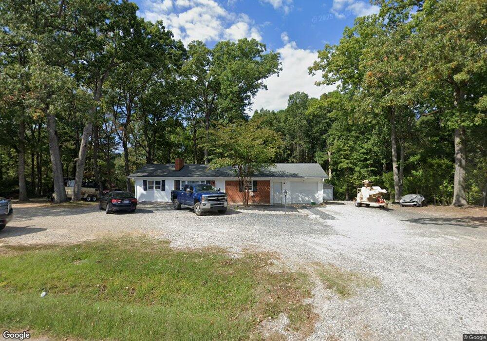
1802 Sherron Rd Durham, NC 27703
Eastern Durham NeighborhoodEstimated Value: $283,000 - $341,000
3
Beds
1
Bath
1,073
Sq Ft
$280/Sq Ft
Est. Value
About This Home
This home is located at 1802 Sherron Rd, Durham, NC 27703 and is currently estimated at $300,083, approximately $279 per square foot. 1802 Sherron Rd is a home located in Durham County with nearby schools including Spring Valley Elementary School, John W Neal Middle School, and Southern School of Energy & Sustainability.
Ownership History
Date
Name
Owned For
Owner Type
Purchase Details
Closed on
May 4, 2021
Sold by
Wright Ronnie Alan
Bought by
Calix Santos L Lopez
Current Estimated Value
Home Financials for this Owner
Home Financials are based on the most recent Mortgage that was taken out on this home.
Original Mortgage
$185,400
Outstanding Balance
$167,756
Interest Rate
3%
Mortgage Type
New Conventional
Estimated Equity
$132,327
Purchase Details
Closed on
Oct 15, 2009
Sold by
Petty Julia S and Petty Julia B
Bought by
Wright Ronnie Alan
Home Financials for this Owner
Home Financials are based on the most recent Mortgage that was taken out on this home.
Original Mortgage
$116,844
Interest Rate
5.05%
Mortgage Type
FHA
Create a Home Valuation Report for This Property
The Home Valuation Report is an in-depth analysis detailing your home's value as well as a comparison with similar homes in the area
Home Values in the Area
Average Home Value in this Area
Purchase History
| Date | Buyer | Sale Price | Title Company |
|---|---|---|---|
| Calix Santos L Lopez | $215,000 | None Available | |
| Wright Ronnie Alan | $119,000 | None Available |
Source: Public Records
Mortgage History
| Date | Status | Borrower | Loan Amount |
|---|---|---|---|
| Open | Calix Santos L Lopez | $185,400 | |
| Previous Owner | Wright Ronnie Alan | $116,844 |
Source: Public Records
Tax History Compared to Growth
Tax History
| Year | Tax Paid | Tax Assessment Tax Assessment Total Assessment is a certain percentage of the fair market value that is determined by local assessors to be the total taxable value of land and additions on the property. | Land | Improvement |
|---|---|---|---|---|
| 2025 | $2,163 | $296,022 | $116,200 | $179,822 |
| 2024 | $1,621 | $147,723 | $33,220 | $114,503 |
| 2023 | $1,559 | $147,723 | $33,220 | $114,503 |
| 2022 | $1,509 | $147,723 | $33,220 | $114,503 |
| 2021 | $1,296 | $147,723 | $33,220 | $114,503 |
| 2020 | $1,266 | $147,723 | $33,220 | $114,503 |
| 2019 | $1,251 | $147,723 | $33,220 | $114,503 |
| 2018 | $1,144 | $123,917 | $33,220 | $90,697 |
| 2017 | $1,107 | $127,357 | $33,220 | $94,137 |
| 2016 | $1,102 | $127,357 | $33,220 | $94,137 |
| 2015 | $1,007 | $94,072 | $30,306 | $63,766 |
| 2014 | $1,012 | $94,072 | $30,306 | $63,766 |
Source: Public Records
Map
Nearby Homes
- 1821 S Mineral Springs Rd
- 1120 Constellation Cir
- 1122 Constellation Cir
- 1118 Constellation Cir
- 1116 Constellation Cir
- 500 Kings Lake Way
- 1023 Constellation Cir
- 1020 Constellation Cir
- 1029 Constellation Cir
- 1031 Constellation Cir
- 1033 Constellation Cir
- 3201 Gypsum Dr
- 3205 Gypsum Dr
- 3210 Gypsum Dr
- 3207 Gypsum Dr
- 3212 Gypsum Dr
- 2221 Mica Ridge Ln
- 3214 Gypsum Dr
- 3216 Gypsum Dr
- 3211 Gypsum Dr
- 1728 Sherron Rd
- 6 Wooten Ct
- 7 Wooten Ct
- 1718 Waddell Ct
- 4 Wooten Ct
- 1714 Waddell Ct
- 1716 Waddell Ct
- 5 Wooten Ct
- 1824 Sherron Rd
- 100 Callandale Ln
- 1712 Waddell Ct
- 3 Wooten Ct
- 101 Callandale Ln
- 1722 Waddell Ct
- 1714 Sherron Rd
- 1710 Waddell Ct
- 1908 Sherron Rd
- 1902 Pattersons Mill Rd
- 1709 Waddell Ct
- 1614 Pattersons Mill Rd