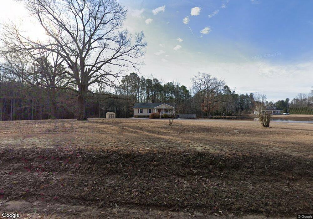
18024 Doggetts Fork Rd Ruther Glen, VA 22546
Estimated Value: $376,912 - $440,000
3
Beds
3
Baths
1,356
Sq Ft
$293/Sq Ft
Est. Value
About This Home
This home is located at 18024 Doggetts Fork Rd, Ruther Glen, VA 22546 and is currently estimated at $396,978, approximately $292 per square foot. 18024 Doggetts Fork Rd is a home located in Caroline County with nearby schools including Caroline Middle School and Caroline High School.
Ownership History
Date
Name
Owned For
Owner Type
Purchase Details
Closed on
Nov 15, 2000
Sold by
Beasley Wallae T
Bought by
Littleton Roy T
Current Estimated Value
Home Financials for this Owner
Home Financials are based on the most recent Mortgage that was taken out on this home.
Original Mortgage
$128,750
Outstanding Balance
$47,103
Interest Rate
7.78%
Estimated Equity
$349,875
Create a Home Valuation Report for This Property
The Home Valuation Report is an in-depth analysis detailing your home's value as well as a comparison with similar homes in the area
Home Values in the Area
Average Home Value in this Area
Purchase History
| Date | Buyer | Sale Price | Title Company |
|---|---|---|---|
| Littleton Roy T | $125,000 | -- |
Source: Public Records
Mortgage History
| Date | Status | Borrower | Loan Amount |
|---|---|---|---|
| Open | Littleton Roy T | $128,750 |
Source: Public Records
Tax History Compared to Growth
Tax History
| Year | Tax Paid | Tax Assessment Tax Assessment Total Assessment is a certain percentage of the fair market value that is determined by local assessors to be the total taxable value of land and additions on the property. | Land | Improvement |
|---|---|---|---|---|
| 2025 | $288,624 | $374,836 | $63,100 | $311,736 |
| 2024 | $1,799 | $233,700 | $54,900 | $178,800 |
| 2023 | $1,799 | $233,700 | $54,900 | $178,800 |
| 2022 | $1,799 | $233,700 | $54,900 | $178,800 |
| 2021 | $1,799 | $233,700 | $54,900 | $178,800 |
| 2020 | $1,645 | $198,200 | $38,900 | $159,300 |
| 2019 | $1,645 | $198,200 | $38,900 | $159,300 |
| 2018 | $1,645 | $198,200 | $38,900 | $159,300 |
| 2017 | $1,645 | $198,200 | $38,900 | $159,300 |
| 2016 | $1,625 | $198,200 | $38,900 | $159,300 |
| 2015 | $1,350 | $187,500 | $38,900 | $148,600 |
| 2014 | $1,350 | $187,500 | $38,900 | $148,600 |
Source: Public Records
Map
Nearby Homes
- 17258 Doggetts Fork Rd
- 0 Gregory Rd Unit VACV2007864
- 28231 Lewis Moore Rd
- 0 Lewis Moore Rd
- 0 Peters Ln
- Lot 16 Tax Id 94A-2 Jennings Dr
- Lot 43A & 34B Jennings Dr
- 17437 Frog Level Rd
- 0 White Oak Dr
- 0 Dry Bridge Rd Unit VACV2008142
- TBD Dry Bridge Rd
- 0 Dry Bridge Rd Unit VACV2008102
- 0 Brownstone Rd
- Parcel 84-A-25 Brownstone Rd
- 28053 Signboard Rd
- 13499 Wingfield Ln
- 0 Old Dawn Rd
- 13263 Courtland Ln
- 29400 Secretariat Rd
- 15332 Dawn Blvd
- 18074 Doggetts Fork Rd
- 26293 Old Pitts Rd
- 26309 Old Pitts Rd
- 26325 Old Pitts Rd
- 18094 Doggetts Fork Rd
- 17456 Doggetts Fork Rd
- 26316 Old Pitts Rd
- 0 Old Pitts (35f) Rd
- 0 Old Pitts (35e) Rd
- 26349 Old Pitts Rd
- 17430 Doggetts Fork Rd
- 17440 Doggetts Fork Rd
- 17408 Doggetts Fork Rd
- 18162 Doggetts Fork Rd
- 17343 Doggetts Fork Rd
- 17310 Jocasta Ave
- 17331 Doggetts Fork Rd
- 17306 Jocasta Ave
- 17319 Doggetts Fork Rd
- 17311 Jocasta Ave