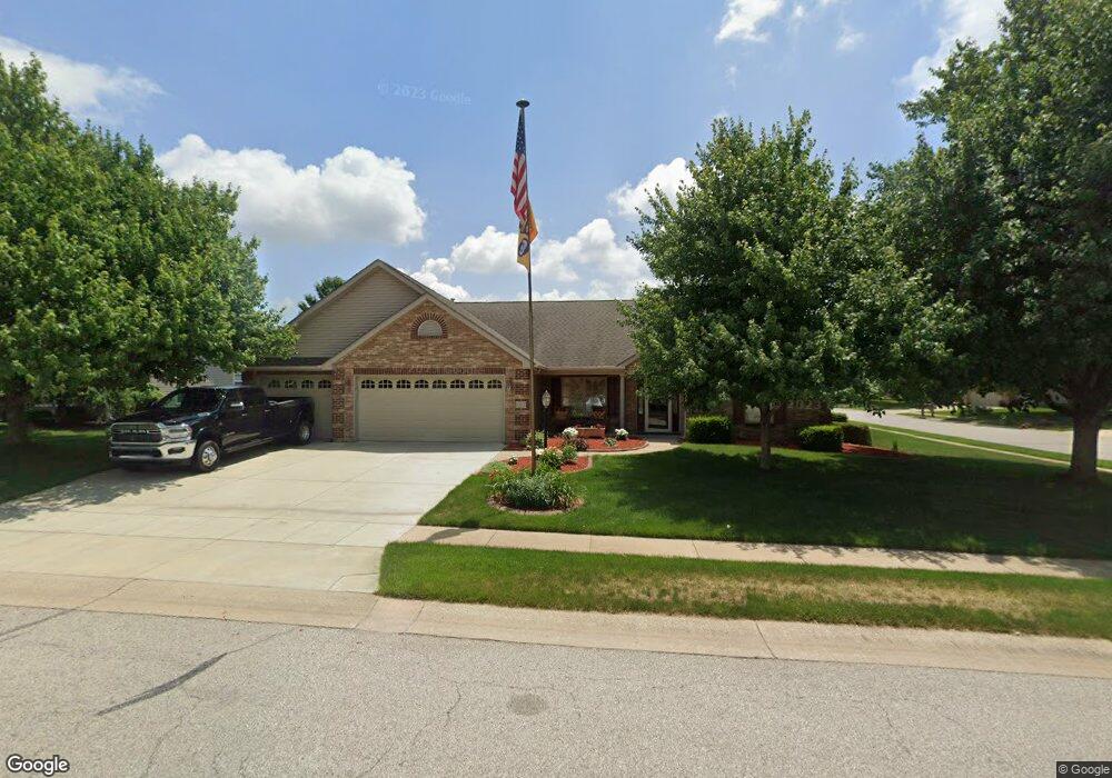
1803 Abbotsbury Way Lafayette, IN 47909
Estimated Value: $387,000 - $409,000
4
Beds
2
Baths
2,349
Sq Ft
$169/Sq Ft
Est. Value
About This Home
This home is located at 1803 Abbotsbury Way, Lafayette, IN 47909 and is currently estimated at $396,832, approximately $168 per square foot. 1803 Abbotsbury Way is a home located in Tippecanoe County with nearby schools including Wea Ridge Elementary School, Wea Ridge Middle School, and McCutcheon High School.
Ownership History
Date
Name
Owned For
Owner Type
Purchase Details
Closed on
Oct 29, 2004
Sold by
Homes By Prairie Lafayette Llc
Bought by
Worstell Jack T and Worstell Shelia S
Current Estimated Value
Home Financials for this Owner
Home Financials are based on the most recent Mortgage that was taken out on this home.
Original Mortgage
$210,600
Outstanding Balance
$110,922
Interest Rate
6.62%
Mortgage Type
Stand Alone First
Estimated Equity
$285,910
Purchase Details
Closed on
Jun 3, 2004
Sold by
Cedar Run Ltd Inc
Bought by
Homes By Prairie Lafayette Llc
Home Financials for this Owner
Home Financials are based on the most recent Mortgage that was taken out on this home.
Original Mortgage
$177,597
Interest Rate
5.81%
Mortgage Type
Unknown
Create a Home Valuation Report for This Property
The Home Valuation Report is an in-depth analysis detailing your home's value as well as a comparison with similar homes in the area
Home Values in the Area
Average Home Value in this Area
Purchase History
| Date | Buyer | Sale Price | Title Company |
|---|---|---|---|
| Worstell Jack T | -- | -- | |
| Homes By Prairie Lafayette Llc | -- | -- |
Source: Public Records
Mortgage History
| Date | Status | Borrower | Loan Amount |
|---|---|---|---|
| Open | Worstell Jack T | $210,600 | |
| Previous Owner | Homes By Prairie Lafayette Llc | $177,597 |
Source: Public Records
Tax History Compared to Growth
Tax History
| Year | Tax Paid | Tax Assessment Tax Assessment Total Assessment is a certain percentage of the fair market value that is determined by local assessors to be the total taxable value of land and additions on the property. | Land | Improvement |
|---|---|---|---|---|
| 2024 | $3,488 | $348,200 | $62,700 | $285,500 |
| 2023 | $3,361 | $334,600 | $62,700 | $271,900 |
| 2022 | $2,871 | $288,000 | $38,700 | $249,300 |
| 2021 | $2,637 | $264,600 | $38,700 | $225,900 |
| 2020 | $2,440 | $244,300 | $38,700 | $205,600 |
| 2019 | $2,290 | $229,300 | $38,700 | $190,600 |
| 2018 | $2,236 | $221,400 | $38,700 | $182,700 |
| 2017 | $2,245 | $222,300 | $38,700 | $183,600 |
| 2016 | $2,235 | $221,300 | $38,700 | $182,600 |
| 2014 | $2,105 | $208,900 | $38,700 | $170,200 |
| 2013 | $2,118 | $210,300 | $38,700 | $171,600 |
Source: Public Records
Map
Nearby Homes
- 1817 Kingfisher Dr
- 1821 Whisper Valley Dr
- 2003 Kingfisher Dr
- 60 Canyon Creek Ct
- 1800 E 430 S
- 8151 John Adams Rd
- 8165 John Adams Rd
- 8171 John Adams Rd
- 8157 John Adams Rd
- TBD John Adams Rd
- 3906 John Adams Rd
- 1120 Stoneripple Cir
- 934 Ravenstone Dr
- 1007 Waterstone Dr
- 3303 Crosspoint Ct S
- 4076 Scoria St
- 4056 Druze Ave
- 920 N Wagon Wheel Trail
- 3861 Ensley St
- 936 Brookridge Ct
- 1807 Abbotsbury Way
- 3917 Kyverdale Dr
- 1812 Kyverdale Dr
- 1811 Abbotsbury Way
- 1802 Abbotsbury Way
- 3916 Kyverdale Dr
- 1806 Abbotsbury Way
- 3912 Kyverdale Dr
- 1816 Kyverdale Dr
- 3920 Kyverdale Dr
- 1810 Abbotsbury Way
- 1815 Abbotsbury Way
- 3908 Kyverdale Dr
- 1820 Kyverdale Dr
- 3904 Kyverdale Dr
- 3924 Kyverdale Dr
- 1805 Kingfisher Dr
- 1811 Kyverdale Dr
- 1819 Abbotsbury Way
- 1815 Kyverdale Dr