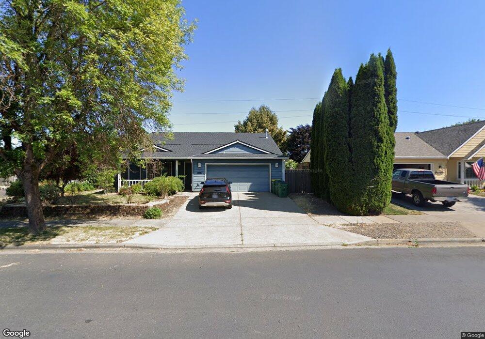
1803 Hartford Dr Forest Grove, OR 97116
Estimated Value: $440,000 - $522,000
3
Beds
2
Baths
1,532
Sq Ft
$309/Sq Ft
Est. Value
About This Home
This home is located at 1803 Hartford Dr, Forest Grove, OR 97116 and is currently estimated at $473,667, approximately $309 per square foot. 1803 Hartford Dr is a home located in Washington County with nearby schools including Harvey Clarke Elementary School, Tom McCall Upper Elementary School, and Neil Armstrong Middle School.
Ownership History
Date
Name
Owned For
Owner Type
Purchase Details
Closed on
Mar 22, 2005
Sold by
Mitchell Charles A and Mitchell Tanya L
Bought by
Driver Brian C
Current Estimated Value
Home Financials for this Owner
Home Financials are based on the most recent Mortgage that was taken out on this home.
Original Mortgage
$189,999
Outstanding Balance
$95,173
Interest Rate
5.53%
Mortgage Type
VA
Estimated Equity
$378,494
Purchase Details
Closed on
Nov 18, 1999
Sold by
Fieldcrest Investments Llc
Bought by
Mitchell Charles A and Mitchell Tanya L
Home Financials for this Owner
Home Financials are based on the most recent Mortgage that was taken out on this home.
Original Mortgage
$143,910
Interest Rate
7.82%
Mortgage Type
Purchase Money Mortgage
Create a Home Valuation Report for This Property
The Home Valuation Report is an in-depth analysis detailing your home's value as well as a comparison with similar homes in the area
Home Values in the Area
Average Home Value in this Area
Purchase History
| Date | Buyer | Sale Price | Title Company |
|---|---|---|---|
| Driver Brian C | $186,000 | Transnation Title Agency Or | |
| Mitchell Charles A | $159,900 | Fidelity National Title Co |
Source: Public Records
Mortgage History
| Date | Status | Borrower | Loan Amount |
|---|---|---|---|
| Open | Driver Brian C | $189,999 | |
| Previous Owner | Mitchell Charles A | $143,910 |
Source: Public Records
Tax History Compared to Growth
Tax History
| Year | Tax Paid | Tax Assessment Tax Assessment Total Assessment is a certain percentage of the fair market value that is determined by local assessors to be the total taxable value of land and additions on the property. | Land | Improvement |
|---|---|---|---|---|
| 2026 | $3,435 | $192,900 | -- | -- |
| 2025 | $3,435 | $187,290 | -- | -- |
| 2024 | $3,314 | $181,840 | -- | -- |
| 2023 | $3,314 | $176,550 | $0 | $0 |
| 2022 | $2,898 | $176,550 | $0 | $0 |
| 2021 | $2,860 | $166,420 | $0 | $0 |
| 2020 | $2,845 | $161,580 | $0 | $0 |
| 2019 | $2,782 | $156,880 | $0 | $0 |
| 2018 | $2,696 | $152,320 | $0 | $0 |
| 2017 | $2,613 | $147,890 | $0 | $0 |
| 2016 | $2,540 | $143,590 | $0 | $0 |
| 2015 | $2,442 | $139,410 | $0 | $0 |
| 2014 | $2,430 | $135,350 | $0 | $0 |
Source: Public Records
Map
Nearby Homes
- 1815 35th Ave
- 3522 Arleen Ct
- 2180 36th Ave
- 2150 36th Ave
- 2130 36th Ave
- 2120 36th Ave
- 2160 36th Ave
- 2117 36th Ave Unit Lot 64
- 2133 36th Ave Unit Lot 62
- 3300 N Main St Unit 110
- 3655 Fieldstone St
- 3594 Ash St Unit Lot 25
- 3651 Tiana St
- 3605 Main St
- 2035 35th Ave
- Pacific Plan at Davis Estates
- Newport Plan at Davis Estates
- Dahlia Plan at Davis Estates
- Azalea Plan at Davis Estates
- 3609 Main St
- 1811 Hartford Dr
- 1817 Hartford Dr
- 1735 Hartford Dr
- 3335 B St
- 1810 Hartford Dr
- 1729 Hartford Dr
- 3334 B St
- 1818 Hartford Dr
- 3329 B St
- 1829 Hartford Dr
- 1802 Silverstone Dr
- 1826 Hartford Dr
- 1814 Silverstone Dr
- 1728 Hartford Dr
- 1723 Hartford Dr
- 3323 B St
- 1820 Silverstone Dr
- 1758 Silverstone Dr
- 1766 Silverstone Dr