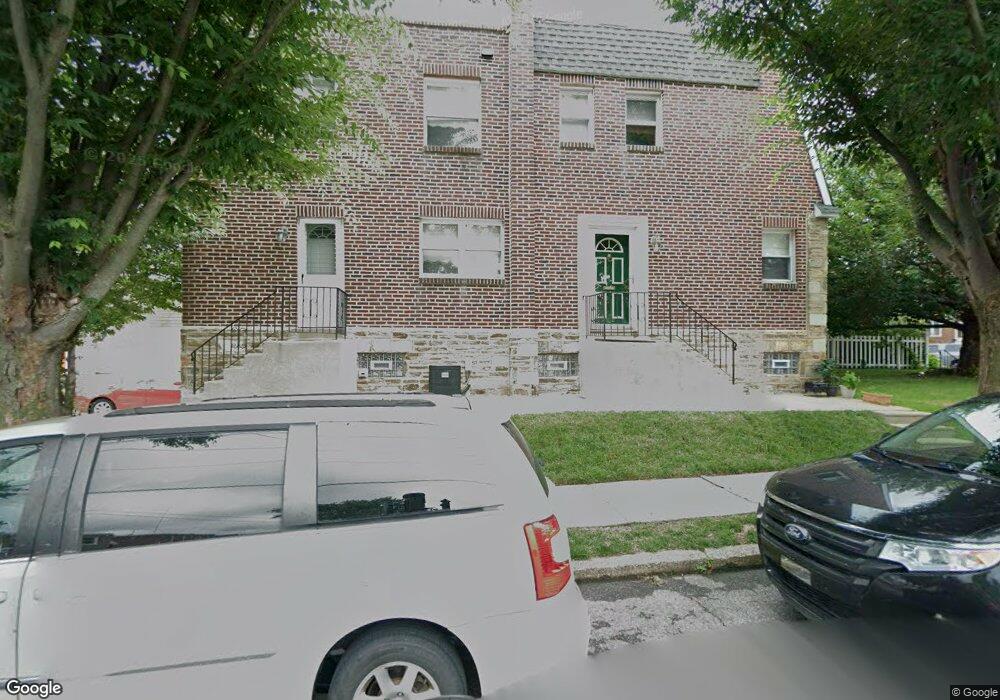
1803 Hoffnagle St Philadelphia, PA 19152
Rhawnhurst NeighborhoodEstimated Value: $294,000 - $328,000
3
Beds
2
Baths
1,328
Sq Ft
$238/Sq Ft
Est. Value
About This Home
This home is located at 1803 Hoffnagle St, Philadelphia, PA 19152 and is currently estimated at $316,494, approximately $238 per square foot. 1803 Hoffnagle St is a home located in Philadelphia County with nearby schools including Farrell Louis H School, Northeast High School, and Tacony Academy Charter School.
Ownership History
Date
Name
Owned For
Owner Type
Purchase Details
Closed on
Nov 10, 2008
Sold by
Fannie Mae
Bought by
Maker Mikhail
Current Estimated Value
Home Financials for this Owner
Home Financials are based on the most recent Mortgage that was taken out on this home.
Original Mortgage
$151,180
Outstanding Balance
$101,228
Interest Rate
6.49%
Mortgage Type
FHA
Estimated Equity
$215,266
Purchase Details
Closed on
Jul 21, 2008
Sold by
Nouryousefi Yousef
Bought by
Federal National Mortgage Association
Create a Home Valuation Report for This Property
The Home Valuation Report is an in-depth analysis detailing your home's value as well as a comparison with similar homes in the area
Home Values in the Area
Average Home Value in this Area
Purchase History
| Date | Buyer | Sale Price | Title Company |
|---|---|---|---|
| Maker Mikhail | $154,500 | None Available | |
| Federal National Mortgage Association | $140,000 | None Available |
Source: Public Records
Mortgage History
| Date | Status | Borrower | Loan Amount |
|---|---|---|---|
| Open | Maker Mikhail | $151,180 |
Source: Public Records
Tax History Compared to Growth
Tax History
| Year | Tax Paid | Tax Assessment Tax Assessment Total Assessment is a certain percentage of the fair market value that is determined by local assessors to be the total taxable value of land and additions on the property. | Land | Improvement |
|---|---|---|---|---|
| 2025 | $3,325 | $297,000 | $59,400 | $237,600 |
| 2024 | $3,325 | $297,000 | $59,400 | $237,600 |
| 2023 | $3,325 | $237,500 | $47,500 | $190,000 |
| 2022 | $2,885 | $237,500 | $47,500 | $190,000 |
| 2021 | $2,885 | $0 | $0 | $0 |
| 2020 | $2,885 | $0 | $0 | $0 |
| 2019 | $2,626 | $0 | $0 | $0 |
| 2018 | $2,410 | $0 | $0 | $0 |
| 2017 | $2,410 | $0 | $0 | $0 |
| 2016 | $2,410 | $0 | $0 | $0 |
| 2015 | $2,307 | $0 | $0 | $0 |
| 2014 | -- | $172,200 | $39,690 | $132,510 |
| 2012 | -- | $23,552 | $3,986 | $19,566 |
Source: Public Records
Map
Nearby Homes
- 1702 Arthur St
- 1617 Solly Ave
- 1711 Kendrick St
- 1716 Bergen St
- 1704 Stanwood St
- 1804 Megargee St
- 1828 Megargee St
- 1625 Rhawn St
- 1718 Rhawn St
- 1931 33 Rhawn St
- 2013 Fuller St
- 1712 Tustin St
- 2155 Benson St
- 1719 Loney St
- 1907 Tustin St
- 2162 Strahle St
- 7950 Algon Ave
- 1443 Rhawn St
- 1620 Loney St
- 1832 Mower St
- 1803 Hoffnagle St
- 1801 Hoffnagle St
- 1805 Hoffnagle St
- 1807 Hoffnagle St
- 1809 Hoffnagle St
- 1811 Hoffnagle St
- 1802 Benson St
- 1800 Benson St
- 1804 Benson St
- 1806 Benson St
- 1813 Hoffnagle St
- 1808 Benson St
- 1734 Benson St
- 1810 Benson St
- 1815 Hoffnagle St
- 1732 Benson St
- 1812 Benson St
- 1826 Benson St
- 1800 Hoffnagle St