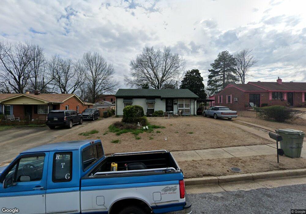
1803 Patrick Rd Memphis, TN 38114
Southeast Memphis NeighborhoodEstimated Value: $62,330 - $83,000
About This Home
This home is located at 1803 Patrick Rd, Memphis, TN 38114 and is currently estimated at $73,583, approximately $85 per square foot. 1803 Patrick Rd is a home located in Shelby County with nearby schools including Hamilton High School, Memphis College Preparatory, and Southern Avenue Charter School of Academic Excellence Creat.
Ownership History
We collect this data history from publicly available records. To have your information removed, we recommend requesting removal directly through your county’s website.
Purchase Details
Home Financials for this Owner
Home Financials are based on the most recent Mortgage that was taken out on this home.Purchase Details
Purchase Details
Home Financials for this Owner
Home Financials are based on the most recent Mortgage that was taken out on this home.Purchase Details
Home Financials for this Owner
Home Financials are based on the most recent Mortgage that was taken out on this home.Purchase Details
Purchase Details
Purchase Details
Home Values in the Area
Average Home Value in this Area
Purchase History
We collect this data history from publicly available records. To have your information removed, we recommend requesting removal directly through your county’s website.
| Date | Buyer | Sale Price | Title Company |
|---|---|---|---|
| $49,950 | -- | ||
| $50,175 | -- | ||
| $50,175 | -- | ||
| $46,000 | -- | ||
| $46,000 | -- | ||
| $19,500 | -- | ||
| $19,500 | -- | ||
| $32,294 | -- | ||
| $32,294 | -- | ||
| -- | First Title Corporation | ||
| -- | First Title Corporation | ||
| $17,026 | Memphis Title | ||
| $17,026 | Memphis Title |
Mortgage History
We collect this data history from publicly available records. To have your information removed, we recommend requesting removal directly through your county’s website.
| Date | Status | Borrower | Loan Amount |
|---|---|---|---|
| Open | $50,064 | ||
| Previous Owner | $46,447 | ||
| Previous Owner | $16,575 | ||
| Closed | $2,390 | ||
| Closed | $3,383 |
Tax History
We collect this data history from publicly available records. To have your information removed, we recommend requesting removal directly through your county’s website.
| Year | Tax Paid | Tax Assessment Tax Assessment Total Assessment is a certain percentage of the fair market value that is determined by local assessors to be the total taxable value of land and additions on the property. | Land | Improvement |
|---|---|---|---|---|
| 2025 | $320 | $11,900 | $2,750 | $9,150 |
| 2024 | $275 | $8,125 | $1,125 | $7,000 |
| 2023 | $495 | $8,125 | $1,125 | $7,000 |
| 2022 | $495 | $8,125 | $1,125 | $7,000 |
| 2021 | $501 | $8,125 | $1,125 | $7,000 |
| 2020 | $551 | $7,600 | $1,125 | $6,475 |
| 2019 | $551 | $7,600 | $1,125 | $6,475 |
| 2018 | $551 | $7,600 | $1,125 | $6,475 |
| 2017 | $312 | $7,600 | $1,125 | $6,475 |
| 2016 | $341 | $7,800 | $0 | $0 |
| 2014 | $341 | $7,800 | $0 | $0 |
Map
- 2442 Manchester Rd
- 1687 E Alcy Rd
- 2525 Rozelle St
- 2569 Rozelle St
- 0 Bridgeport Dr Unit 10214295
- 2352 Verdun Cove
- 1992 Carbondale Dr
- 2944 Millbranch Rd
- 2440 Sparks St
- 1493 E Alcy Rd
- 1489 Lockhaven Ave
- 1490 Lockhaven Ave
- 2601 Darlene St
- 0 Carlton Rd
- 2394 Warren St
- 2344 Warren St
- 2196 Ketchum Rd
- 1484 E Dempster Ave
- 0 W Hollyford Rd
- 2136 Sparks St
- 1809 Patrick Rd
- 1797 Patrick Rd
- 1791 Patrick Rd
- 2529 Sherrie St
- 1817 Patrick Rd
- 1802 Wendy Dr
- 1796 Wendy Dr
- 1808 Wendy Dr
- 1783 Patrick Rd
- 1802 Patrick Rd
- 1808 Patrick Rd
- 1796 Patrick Rd
- 1818 Wendy Dr
- 1790 Patrick Rd
- 1782 Wendy Dr
- 2501 Sherrie St
- 1777 Patrick Rd
- 1784 Patrick Rd
- 2520 Sherrie St
- 1776 Wendy Dr
Ask me questions while you tour the home.