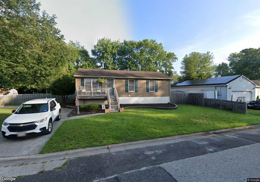
1803 Pond Ave Mays Landing, NJ 08330
Estimated Value: $267,787 - $321,000
--
Bed
--
Bath
1,008
Sq Ft
$293/Sq Ft
Est. Value
About This Home
This home is located at 1803 Pond Ave, Mays Landing, NJ 08330 and is currently estimated at $295,596, approximately $293 per square foot. 1803 Pond Ave is a home located in Atlantic County with nearby schools including Joseph Shaner School, George L. Hess Educational Complex, and William Davies Middle School.
Ownership History
Date
Name
Owned For
Owner Type
Purchase Details
Closed on
Mar 25, 2022
Sold by
Dunn James S and Dunn Kathleen
Bought by
Dunn James and Dunn Shannon
Current Estimated Value
Home Financials for this Owner
Home Financials are based on the most recent Mortgage that was taken out on this home.
Original Mortgage
$162,800
Interest Rate
4.72%
Mortgage Type
FHA
Purchase Details
Closed on
Mar 16, 1984
Bought by
Dunn James S and Dunn Kathleen
Create a Home Valuation Report for This Property
The Home Valuation Report is an in-depth analysis detailing your home's value as well as a comparison with similar homes in the area
Home Values in the Area
Average Home Value in this Area
Purchase History
| Date | Buyer | Sale Price | Title Company |
|---|---|---|---|
| Dunn James | $183,000 | Infinity Title | |
| Dunn James S | -- | -- |
Source: Public Records
Mortgage History
| Date | Status | Borrower | Loan Amount |
|---|---|---|---|
| Previous Owner | Dunn James | $162,800 |
Source: Public Records
Tax History Compared to Growth
Tax History
| Year | Tax Paid | Tax Assessment Tax Assessment Total Assessment is a certain percentage of the fair market value that is determined by local assessors to be the total taxable value of land and additions on the property. | Land | Improvement |
|---|---|---|---|---|
| 2025 | $5,692 | $165,900 | $58,300 | $107,600 |
| 2024 | $5,692 | $165,900 | $58,300 | $107,600 |
| 2023 | $5,352 | $165,900 | $58,300 | $107,600 |
| 2022 | $5,352 | $165,900 | $58,300 | $107,600 |
| 2021 | $5,340 | $165,900 | $58,300 | $107,600 |
| 2020 | $5,340 | $165,900 | $58,300 | $107,600 |
| 2019 | $5,354 | $165,900 | $58,300 | $107,600 |
| 2018 | $5,166 | $165,900 | $58,300 | $107,600 |
| 2017 | $5,085 | $165,900 | $58,300 | $107,600 |
| 2016 | $4,942 | $165,900 | $58,300 | $107,600 |
| 2015 | $4,775 | $165,900 | $58,300 | $107,600 |
| 2014 | $4,771 | $181,600 | $63,300 | $118,300 |
Source: Public Records
Map
Nearby Homes
- 5926 Berry Dr
- 5910 Redwood Ct
- 5906 Vine Dr
- 5910 Somerset Dr
- 000 Apple St
- 55 Lewis Dr
- 0 Apple St
- 40 Vender Ln
- 18 Lewis Dr
- 94 Merlino Ln
- Rt 50 and Cedar
- 42 Ernst Ct
- Bl 531 Lot 8&9 Adams Ave
- 5761 Cedar Ave
- 0 Cape May Ave
- Lot:11.02-12.02 Estelle Ave
- B:534 L:11.01 Estelle Ave
- B:534 L:12.02 Estelle Ave
- B:534 L:11.02 Estelle Ave
- 22 Ernst Ct
- 5908 Elmhurst Dr
- 1805 Pond Ave
- 5906 Elmhurst Dr
- 5913 Elmhurst Dr
- 5907 Elmhurst Dr
- 5928 Berry Dr
- 1714 Candlewood Dr
- 5915 Elmhurst Dr
- 1804 Pond Ave
- 1714 Branch Dr
- 5905 Elmhurst Dr
- 5929 Berry Dr
- 5904 Cedarcroft Dr
- 1712 Candlewood Dr
- 5922 Clover Leaf Dr
- 5920 Clover Leaf Dr
- 1715 Branch Dr
- 5927 Berry Dr
- 5907 Cedarcroft Dr
- 1712 Branch Dr