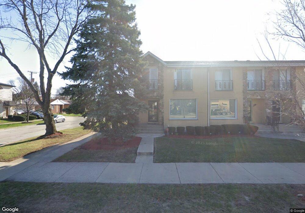
1803 S Mannheim Rd Westchester, IL 60154
Estimated Value: $233,000 - $404,000
3
Beds
3
Baths
1,800
Sq Ft
$190/Sq Ft
Est. Value
About This Home
This home is located at 1803 S Mannheim Rd, Westchester, IL 60154 and is currently estimated at $342,656, approximately $190 per square foot. 1803 S Mannheim Rd is a home located in Cook County with nearby schools including Westchester Primary School, Westchester Intermediate School, and Westchester Middle School.
Ownership History
Date
Name
Owned For
Owner Type
Purchase Details
Closed on
Nov 21, 2016
Sold by
Romas Kathy and Romas Kathy
Bought by
Smith Willie B and Smith Barbara A
Current Estimated Value
Home Financials for this Owner
Home Financials are based on the most recent Mortgage that was taken out on this home.
Original Mortgage
$205,178
Outstanding Balance
$164,462
Interest Rate
3.37%
Mortgage Type
FHA
Estimated Equity
$178,194
Create a Home Valuation Report for This Property
The Home Valuation Report is an in-depth analysis detailing your home's value as well as a comparison with similar homes in the area
Home Values in the Area
Average Home Value in this Area
Purchase History
| Date | Buyer | Sale Price | Title Company |
|---|---|---|---|
| Smith Willie B | $209,000 | Stewart Title |
Source: Public Records
Mortgage History
| Date | Status | Borrower | Loan Amount |
|---|---|---|---|
| Open | Smith Willie B | $205,178 |
Source: Public Records
Tax History Compared to Growth
Tax History
| Year | Tax Paid | Tax Assessment Tax Assessment Total Assessment is a certain percentage of the fair market value that is determined by local assessors to be the total taxable value of land and additions on the property. | Land | Improvement |
|---|---|---|---|---|
| 2024 | $6,216 | $27,001 | $1,922 | $25,079 |
| 2023 | $5,034 | $27,001 | $1,922 | $25,079 |
| 2022 | $5,034 | $19,923 | $1,647 | $18,276 |
| 2021 | $4,900 | $19,922 | $1,647 | $18,275 |
| 2020 | $5,748 | $19,922 | $1,647 | $18,275 |
| 2019 | $6,699 | $23,714 | $1,509 | $22,205 |
| 2018 | $6,612 | $23,714 | $1,509 | $22,205 |
| 2017 | $6,485 | $23,714 | $1,509 | $22,205 |
| 2016 | $6,039 | $20,706 | $1,372 | $19,334 |
| 2015 | $5,961 | $20,706 | $1,372 | $19,334 |
| 2014 | $5,824 | $20,706 | $1,372 | $19,334 |
| 2013 | $5,652 | $22,482 | $1,372 | $21,110 |
Source: Public Records
Map
Nearby Homes
- 10324 Wight St
- 1908 Belleview Ave
- 1803 Balmoral Ave
- 10567 Waterford Dr
- 10461 Dorchester St
- 1921 Buckingham Ave
- 1860 Buckingham Ave
- 1811 Downing Ave
- 10531 Camelot St
- 10524 Camelot St
- 1847 Newcastle Ave
- 10630 W Cermak Rd Unit 2E
- 1318 Balmoral Ave
- 1907 Suffolk Ave
- 1245 S Mannheim Rd Unit 2
- 1247 S Mannheim Rd Unit 3
- 1406 Portsmouth Ave
- 2205 Mayfair Ave
- 2230 Kensington Ave
- 1244 Westchester Blvd
- 1807 S Mannheim Rd
- 1815 S Mannheim Rd
- 1811 S Mannheim Rd
- 1817 S Mannheim Rd
- 10345 Kent St
- 1657 S Mannheim Rd
- 10339 Kent St
- 10344 Kent St
- 1651 S Mannheim Rd
- 1660 S Mannheim Rd
- 1800 S Mannheim Rd
- 10335 Kent St
- 10344 Oxford St
- 1806 S Mannheim Rd Unit 1
- 1806 S Mannheim Rd
- 10338 Kent St
- 1656 S Mannheim Rd
- 1812 S Mannheim Rd
- 1650 S Mannheim Rd Unit GARDEN
- 1650 S Mannheim Rd Unit 2