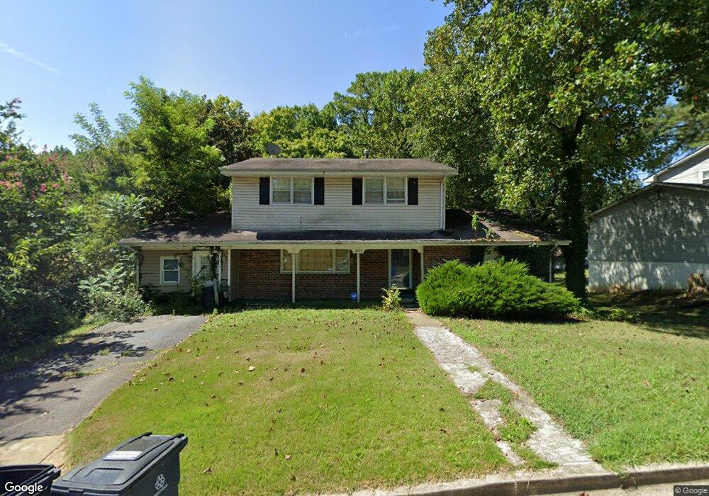
1803 Taylor Ave Fort Washington, MD 20744
Estimated Value: $467,000 - $482,000
5
Beds
3
Baths
2,183
Sq Ft
$217/Sq Ft
Est. Value
About This Home
This home is located at 1803 Taylor Ave, Fort Washington, MD 20744 and is currently estimated at $473,981, approximately $217 per square foot. 1803 Taylor Ave is a home located in Prince George's County with nearby schools including Fort Washington Forest Elementary School, Accokeek Academy, and Friendly High School.
Ownership History
Date
Name
Owned For
Owner Type
Purchase Details
Closed on
Jun 29, 2009
Sold by
U S Bank National Association
Bought by
Sewell Donna
Current Estimated Value
Purchase Details
Closed on
Jan 26, 2009
Sold by
Palmer Lloyd and Palmer Violet
Bought by
U S Bank National Association
Purchase Details
Closed on
Aug 3, 2005
Sold by
Howard David
Bought by
Palmer Lloyd
Home Financials for this Owner
Home Financials are based on the most recent Mortgage that was taken out on this home.
Original Mortgage
$274,000
Interest Rate
6.45%
Mortgage Type
Adjustable Rate Mortgage/ARM
Purchase Details
Closed on
Sep 25, 2001
Sold by
Asseged Major
Bought by
Howard David and Nathaniel Bennet
Create a Home Valuation Report for This Property
The Home Valuation Report is an in-depth analysis detailing your home's value as well as a comparison with similar homes in the area
Home Values in the Area
Average Home Value in this Area
Purchase History
| Date | Buyer | Sale Price | Title Company |
|---|---|---|---|
| Sewell Donna | $217,900 | -- | |
| U S Bank National Association | $328,000 | -- | |
| Palmer Lloyd | $347,000 | -- | |
| Howard David | $160,000 | -- |
Source: Public Records
Mortgage History
| Date | Status | Borrower | Loan Amount |
|---|---|---|---|
| Previous Owner | Palmer Lloyd | $274,000 | |
| Previous Owner | Palmer Lloyd | $68,500 |
Source: Public Records
Tax History Compared to Growth
Tax History
| Year | Tax Paid | Tax Assessment Tax Assessment Total Assessment is a certain percentage of the fair market value that is determined by local assessors to be the total taxable value of land and additions on the property. | Land | Improvement |
|---|---|---|---|---|
| 2025 | $4,801 | $379,733 | -- | -- |
| 2024 | $4,801 | $346,700 | $102,200 | $244,500 |
| 2023 | $4,702 | $342,867 | $0 | $0 |
| 2022 | $4,558 | $339,033 | $0 | $0 |
| 2021 | $4,040 | $335,200 | $101,100 | $234,100 |
| 2020 | $3,252 | $322,833 | $0 | $0 |
| 2019 | $1,551 | $310,467 | $0 | $0 |
| 2018 | $4,073 | $298,100 | $76,100 | $222,000 |
| 2017 | $3,900 | $271,700 | $0 | $0 |
| 2016 | -- | $245,300 | $0 | $0 |
| 2015 | $4,339 | $218,900 | $0 | $0 |
| 2014 | $4,339 | $218,900 | $0 | $0 |
Source: Public Records
Map
Nearby Homes
- 13318 Chalfont Ave
- 1916 Taylor Ave
- 1410 Fillmore Rd
- 14005 Livingston Rd
- 13503 Harrison Ave
- 12904 Chalfont Ave
- 2421 Baileys Pond Rd
- 12806 Monroe Ave
- 2001 Medinah Ridge Rd
- 2608 Saint Marys View Rd
- 2201 Herring Creek Dr
- 13102 Gerry Rd
- 14311 Livingston Rd
- 0 Joseph Dr
- 2504 Brandy Ln
- 13803 Stroh Ct
- 0 Saint James Rd
- 2509 Brandy Ln
- 804 Cascade Dr
- 802 Cornish St
- 1801 Taylor Ave
- 1805 Taylor Ave
- 1727 Taylor Ave
- 1723 Taylor Ave
- 1807 Taylor Ave
- 1806 Taylor Ave
- 1802 Taylor Ave
- 13408 Taylor Ct
- 1721 Taylor Ave
- 1809 Taylor Ave
- 1728 Taylor Ave
- 1719 Taylor Ave
- 1812 Taylor Ave
- 1726 Taylor Ave
- 13406 Taylor Ct
- 1818 Taylor Ave
- 1717 Taylor Ave
- 1820 Taylor Ave
- 1724 Taylor Ave
- 1811 Taylor Ave