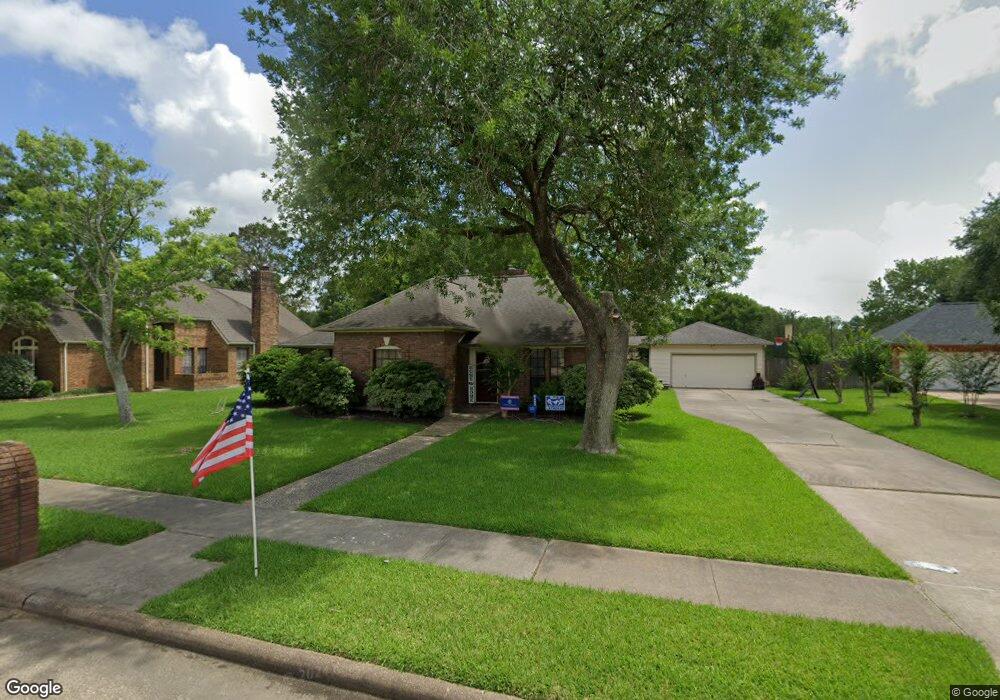
1803 Twin Oaks St Friendswood, TX 77546
Estimated Value: $361,514 - $412,000
--
Bed
2
Baths
1,888
Sq Ft
$209/Sq Ft
Est. Value
About This Home
This home is located at 1803 Twin Oaks St, Friendswood, TX 77546 and is currently estimated at $394,629, approximately $209 per square foot. 1803 Twin Oaks St is a home located in Galveston County with nearby schools including C.W. Cline Elementary School, Windsong Elementary School, and Friendswood Junior High School.
Ownership History
Date
Name
Owned For
Owner Type
Purchase Details
Closed on
Apr 26, 2006
Sold by
Keith Walter Thompson and Keith Yoneko Asano
Bought by
Mast Craig A and Mast Denise L
Current Estimated Value
Home Financials for this Owner
Home Financials are based on the most recent Mortgage that was taken out on this home.
Original Mortgage
$85,000
Outstanding Balance
$49,031
Interest Rate
6.33%
Mortgage Type
Fannie Mae Freddie Mac
Estimated Equity
$345,598
Purchase Details
Closed on
May 3, 2001
Sold by
Keith Walter Thompson
Bought by
Keith Walter Thompson and Keith Walter T
Create a Home Valuation Report for This Property
The Home Valuation Report is an in-depth analysis detailing your home's value as well as a comparison with similar homes in the area
Home Values in the Area
Average Home Value in this Area
Purchase History
| Date | Buyer | Sale Price | Title Company |
|---|---|---|---|
| Mast Craig A | -- | South Land Title Company | |
| Keith Walter Thompson | -- | -- |
Source: Public Records
Mortgage History
| Date | Status | Borrower | Loan Amount |
|---|---|---|---|
| Open | Mast Craig A | $85,000 |
Source: Public Records
Tax History Compared to Growth
Tax History
| Year | Tax Paid | Tax Assessment Tax Assessment Total Assessment is a certain percentage of the fair market value that is determined by local assessors to be the total taxable value of land and additions on the property. | Land | Improvement |
|---|---|---|---|---|
| 2025 | $5,174 | $371,770 | $46,700 | $325,070 |
| 2024 | $5,174 | $341,622 | -- | -- |
| 2023 | $5,174 | $310,565 | $0 | $0 |
| 2022 | $6,218 | $282,332 | $0 | $0 |
| 2021 | $5,995 | $297,720 | $46,700 | $251,020 |
| 2020 | $5,621 | $252,930 | $46,700 | $206,230 |
| 2019 | $5,386 | $212,120 | $46,700 | $165,420 |
| 2018 | $5,468 | $214,090 | $46,700 | $167,390 |
| 2017 | $5,563 | $216,110 | $46,700 | $169,410 |
| 2016 | $5,058 | $203,060 | $46,700 | $156,360 |
| 2015 | $1,608 | $186,310 | $46,700 | $139,610 |
| 2014 | $1,514 | $160,950 | $46,700 | $114,250 |
Source: Public Records
Map
Nearby Homes
- 1802 Creekside Dr
- 1906 Blue Quail Dr
- 1010 High Ridge Dr
- 1608 Keystone Dr
- 1217 Red Wing Dr
- 1531 Briar Bend Dr
- 506 Lakeside Ln
- 1606 Falcon Ridge Blvd
- 505 Hunters Ln
- 1305 Edgewater Dr
- 705 High Ridge Dr
- 1509 Windsor Dr
- 1783 Lake Crest Ln
- 1668 Turner Ct
- 1804 Sandy Lake Dr
- 2202 Calm Pond Ct
- 2120 Lila Sky Ln
- 1532 River Point Dr
- 1556 River Point Dr
- 111 Dunbar Unit 501
- 1801 Twin Oaks St
- 1005 Middlecreek St
- 1007 Middlecreek St
- 1102 Twin Oaks St
- 1101 Middlecreek St
- 1104 Twin Oaks St
- 1010 Middlecreek St
- 1103 Middlecreek St
- 1100 Middlecreek St
- 1006 Middlecreek St
- 1102 Middlecreek St
- 1001 Middlecreek St
- 1106 Twin Oaks St
- 1004 Middlecreek St
- 1105 Middlecreek St
- 1106 Bob White Dr
- 1002 Middlecreek St
- 1107 Twin Oaks St
- 1108 Bob White Dr
- 1715 Keystone Dr