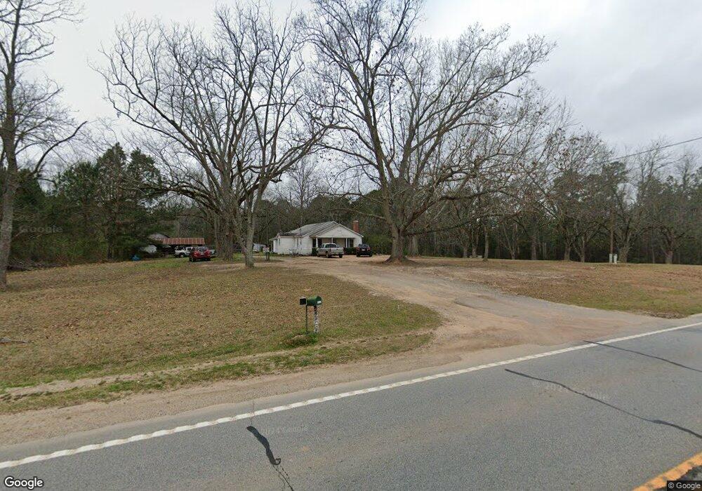
1803 Wrens Hwy Thomson, GA 30824
Estimated Value: $267,000 - $726,413
2
Beds
2
Baths
1,462
Sq Ft
$298/Sq Ft
Est. Value
About This Home
This home is located at 1803 Wrens Hwy, Thomson, GA 30824 and is currently estimated at $435,853, approximately $298 per square foot. 1803 Wrens Hwy is a home with nearby schools including Thomson High School.
Ownership History
Date
Name
Owned For
Owner Type
Purchase Details
Closed on
Nov 4, 2019
Sold by
Pearson David W
Bought by
L & D Land & Timber Llc
Current Estimated Value
Purchase Details
Closed on
Nov 20, 2008
Sold by
Pearson Alma
Bought by
Pearson David
Purchase Details
Closed on
Jun 3, 1998
Sold by
Pearson Willard E
Bought by
Pearson Alma Louise
Purchase Details
Closed on
Oct 1, 1945
Bought by
Pearson Willard E
Create a Home Valuation Report for This Property
The Home Valuation Report is an in-depth analysis detailing your home's value as well as a comparison with similar homes in the area
Home Values in the Area
Average Home Value in this Area
Purchase History
| Date | Buyer | Sale Price | Title Company |
|---|---|---|---|
| L & D Land & Timber Llc | -- | -- | |
| Pearson David | -- | -- | |
| Pearson Alma Louise | -- | -- | |
| Pearson Willard E | -- | -- |
Source: Public Records
Tax History Compared to Growth
Tax History
| Year | Tax Paid | Tax Assessment Tax Assessment Total Assessment is a certain percentage of the fair market value that is determined by local assessors to be the total taxable value of land and additions on the property. | Land | Improvement |
|---|---|---|---|---|
| 2025 | $2,324 | $219,373 | $175,603 | $43,770 |
| 2024 | $2,324 | $207,139 | $165,527 | $41,612 |
| 2023 | $2,273 | $205,412 | $165,527 | $39,885 |
| 2022 | $2,340 | $204,685 | $165,527 | $39,158 |
| 2021 | $2,106 | $191,432 | $160,942 | $30,490 |
| 2020 | $1,808 | $210,578 | $184,896 | $25,682 |
| 2019 | $1,712 | $207,620 | $184,896 | $22,724 |
| 2018 | $1,268 | $195,795 | $184,667 | $11,128 |
| 2017 | $1,197 | $195,795 | $184,667 | $11,128 |
| 2016 | $5,662 | $195,795 | $184,667 | $11,128 |
| 2015 | $1,254 | $174,492 | $153,186 | $21,306 |
| 2014 | $1,257 | $174,493 | $153,187 | $21,306 |
| 2013 | -- | $174,493 | $153,186 | $21,306 |
Source: Public Records
Map
Nearby Homes
- 1543 Wrens Hwy
- 000 Wrens Hwy
- 789 George McDuffie Rd
- 0 Wrens Hwy Unit 10652460
- 0 Wrens Hwy Unit 549833
- 1008 Wrens Hwy
- 354 King St
- 118 Langham St
- 67 Shadowmoor Cir
- 415 Stonewall Dr
- 306 Michael St
- 709 Pine Lane Dr
- 1761 Augusta Hwy
- 609 Hillcrest Dr
- 416 Forrest Clary Dr
- 1280 Acadia Dr
- 1009 Berkley Ct
- 1037 Berkley Ct
- 1085 Berkley Ct