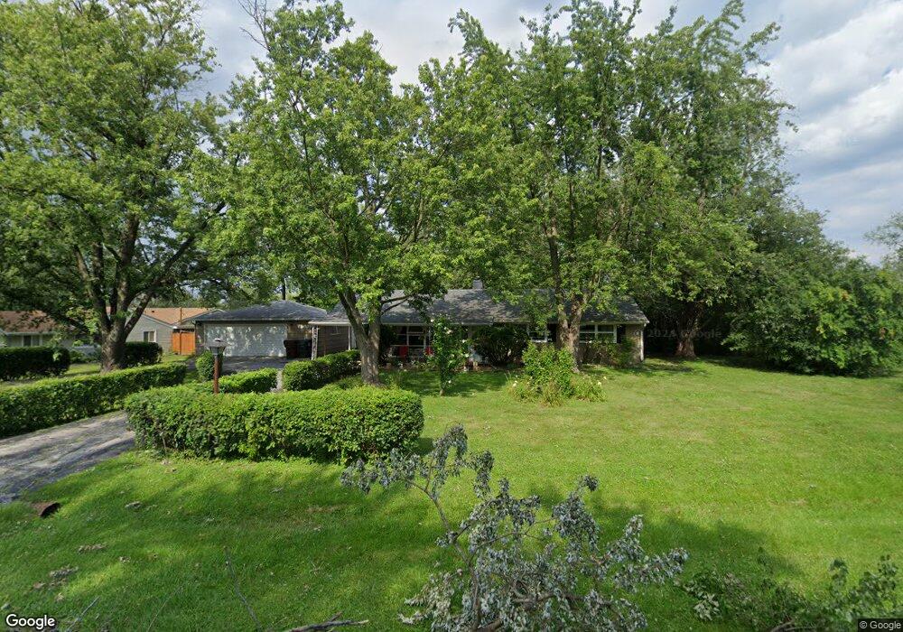
18035 Michael Ave Country Club Hills, IL 60478
Estimated Value: $188,000 - $214,852
3
Beds
1
Bath
1,376
Sq Ft
$145/Sq Ft
Est. Value
About This Home
This home is located at 18035 Michael Ave, Country Club Hills, IL 60478 and is currently estimated at $199,213, approximately $144 per square foot. 18035 Michael Ave is a home located in Cook County with nearby schools including Zenon J Sykuta School, Meadowview Intermediate School, and Southwood Middle School.
Ownership History
Date
Name
Owned For
Owner Type
Purchase Details
Closed on
Jul 29, 1994
Sold by
Boylan Beatrice D
Bought by
Losee Gloria G
Current Estimated Value
Home Financials for this Owner
Home Financials are based on the most recent Mortgage that was taken out on this home.
Original Mortgage
$66,000
Interest Rate
8.53%
Purchase Details
Closed on
Jul 5, 1994
Sold by
Boylan Timothy M
Bought by
Boylan Beatrice D
Home Financials for this Owner
Home Financials are based on the most recent Mortgage that was taken out on this home.
Original Mortgage
$66,000
Interest Rate
8.53%
Purchase Details
Closed on
Dec 28, 1993
Sold by
Boylan Beatrice D and Boylan Beatrice
Bought by
Boylan Timothy M and Boylan Jennifer J
Create a Home Valuation Report for This Property
The Home Valuation Report is an in-depth analysis detailing your home's value as well as a comparison with similar homes in the area
Home Values in the Area
Average Home Value in this Area
Purchase History
| Date | Buyer | Sale Price | Title Company |
|---|---|---|---|
| Losee Gloria G | $82,500 | -- | |
| Boylan Beatrice D | -- | -- | |
| Boylan Timothy M | -- | -- |
Source: Public Records
Mortgage History
| Date | Status | Borrower | Loan Amount |
|---|---|---|---|
| Closed | Losee Gloria G | $66,000 |
Source: Public Records
Tax History Compared to Growth
Tax History
| Year | Tax Paid | Tax Assessment Tax Assessment Total Assessment is a certain percentage of the fair market value that is determined by local assessors to be the total taxable value of land and additions on the property. | Land | Improvement |
|---|---|---|---|---|
| 2024 | $1,703 | $12,999 | $6,499 | $6,500 |
| 2023 | $2,002 | $14,032 | $7,532 | $6,500 |
| 2022 | $2,002 | $9,685 | $6,456 | $3,229 |
| 2021 | $2,145 | $9,685 | $6,456 | $3,229 |
| 2020 | $2,510 | $9,685 | $6,456 | $3,229 |
| 2019 | $3,191 | $10,497 | $5,918 | $4,579 |
| 2018 | $3,043 | $10,497 | $5,918 | $4,579 |
| 2017 | $3,063 | $10,497 | $5,918 | $4,579 |
| 2016 | $2,749 | $8,338 | $5,380 | $2,958 |
| 2015 | $3,765 | $8,338 | $5,380 | $2,958 |
| 2014 | $4,584 | $9,652 | $5,380 | $4,272 |
| 2013 | $4,593 | $10,496 | $5,380 | $5,116 |
Source: Public Records
Map
Nearby Homes
- 17940 Michael Ave
- 17925 John Ave
- 4826 Summerhill Dr
- 4421 179th St
- 18300 Lavergne Ave
- 18331 John Ave
- 5013 180th St
- 18038 Juneway Ct
- 18351 Anthony Ave
- 4656 176th Place
- 4411 177th Place
- 18057 Juneway Ct
- 18207 Ravisloe Terrace
- 18115 Idlewild Dr
- 18109 Idlewild Dr
- 4501 185th St
- 4640 185th Place
- 17942 Edwards Ave
- 4847 175th St
- 18037 Edwards Ave
- 18015 Michael Ave Unit 3
- 18040 Thomas Ln
- 18030 Thomas Ln
- 18005 Michael Ave
- 18040 Michael Ave
- 18050 Michael Ave
- 18030 Michael Ave
- 18020 Michael Ave
- 18020 John Ave
- 18010 Michael Ave
- 18037 Thomas Ln
- 18033 Thomas Ln
- 17955 Michael Ave
- 18041 Thomas Ln
- 18010 John Ave
- 18045 Thomas Ln
- 18029 Thomas Ln
- 17960 Michael Ave
- 4730 181st St
- 4720 181st St