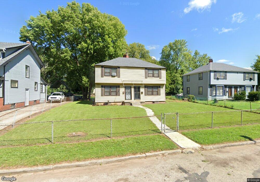
1804 Cole St Unit 806 Columbus, OH 43205
South of Main NeighborhoodEstimated Value: $238,000 - $315,000
4
Beds
2
Baths
1,779
Sq Ft
$156/Sq Ft
Est. Value
About This Home
This home is located at 1804 Cole St Unit 806, Columbus, OH 43205 and is currently estimated at $276,667, approximately $155 per square foot. 1804 Cole St Unit 806 is a home located in Franklin County with nearby schools including Ohio Avenue Elementary School, Champion Middle School, and East High School.
Ownership History
Date
Name
Owned For
Owner Type
Purchase Details
Closed on
Oct 8, 2002
Sold by
Scroggs Teresa S
Bought by
Scruggs Rodney R
Current Estimated Value
Purchase Details
Closed on
Sep 6, 1996
Sold by
Est Bobbie L Smith Jr
Bought by
Rodney R Scruggs
Home Financials for this Owner
Home Financials are based on the most recent Mortgage that was taken out on this home.
Original Mortgage
$32,000
Interest Rate
8.27%
Mortgage Type
New Conventional
Purchase Details
Closed on
Feb 1, 1989
Create a Home Valuation Report for This Property
The Home Valuation Report is an in-depth analysis detailing your home's value as well as a comparison with similar homes in the area
Home Values in the Area
Average Home Value in this Area
Purchase History
| Date | Buyer | Sale Price | Title Company |
|---|---|---|---|
| Scruggs Rodney R | -- | -- | |
| Rodney R Scruggs | $40,000 | -- | |
| -- | -- | -- |
Source: Public Records
Mortgage History
| Date | Status | Borrower | Loan Amount |
|---|---|---|---|
| Previous Owner | Rodney R Scruggs | $32,000 |
Source: Public Records
Tax History Compared to Growth
Tax History
| Year | Tax Paid | Tax Assessment Tax Assessment Total Assessment is a certain percentage of the fair market value that is determined by local assessors to be the total taxable value of land and additions on the property. | Land | Improvement |
|---|---|---|---|---|
| 2024 | $2,732 | $59,610 | $30,210 | $29,400 |
| 2023 | $2,698 | $59,605 | $30,205 | $29,400 |
| 2022 | $1,061 | $19,960 | $3,120 | $16,840 |
| 2021 | $1,063 | $19,960 | $3,120 | $16,840 |
| 2020 | $1,064 | $19,960 | $3,120 | $16,840 |
| 2019 | $1,034 | $16,630 | $2,590 | $14,040 |
| 2018 | $927 | $16,630 | $2,590 | $14,040 |
| 2017 | $1,034 | $16,630 | $2,590 | $14,040 |
| 2016 | $904 | $13,300 | $3,500 | $9,800 |
| 2015 | $823 | $13,300 | $3,500 | $9,800 |
| 2014 | $825 | $13,300 | $3,500 | $9,800 |
| 2013 | $428 | $14,000 | $3,675 | $10,325 |
Source: Public Records
Map
Nearby Homes
- 1800 E Fulton St
- 639 Bulen Ave
- 572 Bulen Ave
- 751 Bulen Ave
- 1747 E Mound St
- 1779 E Main St
- 623 Seymour Ave
- 849 Lyman Ave
- 756 Seymour Ave
- 707 Seymour Ave
- 1612 Cole St
- 711 Seymour Ave
- 1751 Bide A Wee Park Ave
- 780-782 Seymour Ave
- 688 Berkeley Rd
- 768 Berkeley Rd
- 782 Berkeley Rd
- 0 Lilley Ave
- 1825-1827 Bryden Rd
- 395-397 Stoddart Ave
- 1798 Cole St
- 1812 Cole St Unit 814
- 1812 Cole St Unit 14
- 1812-1814 Cole St
- 1792 Cole St
- 1786 Cole St
- 671 Rhoads Ave Unit 673
- 665 Rhoads Ave Unit 667
- 665-667 Rhoads Ave
- 671-673 Rhoads Ave
- 667 Rhoads Ave
- 679 Rhoads Ave
- 659 Rhoads Ave
- 651 Rhoads Ave Unit 653
- 1811 E Fulton St
- 1819 E Fulton St
- 1825 E Fulton St
- 1801 E Fulton St
- 658 Bulen Ave
- 653 Rhoads Ave