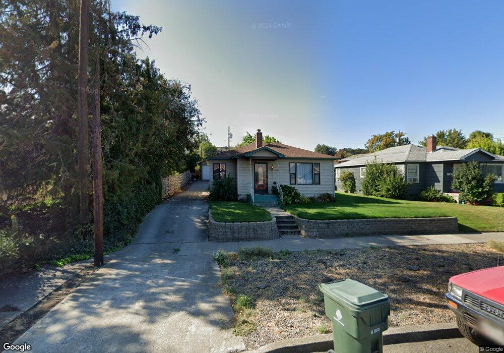
1804 E 9th St the Dalles, OR 97058
Estimated Value: $317,817 - $360,000
2
Beds
1
Bath
1,146
Sq Ft
$296/Sq Ft
Est. Value
About This Home
This home is located at 1804 E 9th St, the Dalles, OR 97058 and is currently estimated at $338,909, approximately $295 per square foot. 1804 E 9th St is a home located in Wasco County with nearby schools including Dry Hollow Elementary School, The Dalles Middle School, and The Dalles High School.
Ownership History
Date
Name
Owned For
Owner Type
Purchase Details
Closed on
Mar 2, 2015
Sold by
Wahlstrom Jim C and Wahlstrom Michele T
Bought by
Krueger Jacob and Krueger Marian M
Current Estimated Value
Home Financials for this Owner
Home Financials are based on the most recent Mortgage that was taken out on this home.
Original Mortgage
$125,681
Outstanding Balance
$95,012
Interest Rate
3.57%
Mortgage Type
FHA
Estimated Equity
$243,897
Purchase Details
Closed on
Nov 14, 2013
Sold by
Taylor Jerry and Howell Betty
Bought by
Langston Mathew A and Knight Kathleen K
Home Financials for this Owner
Home Financials are based on the most recent Mortgage that was taken out on this home.
Original Mortgage
$19,000
Interest Rate
4.17%
Mortgage Type
Purchase Money Mortgage
Create a Home Valuation Report for This Property
The Home Valuation Report is an in-depth analysis detailing your home's value as well as a comparison with similar homes in the area
Purchase History
| Date | Buyer | Sale Price | Title Company |
|---|---|---|---|
| Krueger Jacob | -- | Wasco Title | |
| Langston Mathew A | $139,000 | Amerititle |
Source: Public Records
Mortgage History
| Date | Status | Borrower | Loan Amount |
|---|---|---|---|
| Open | Krueger Jacob | $125,681 | |
| Previous Owner | Langston Mathew A | $19,000 |
Source: Public Records
Tax History
| Year | Tax Paid | Tax Assessment Tax Assessment Total Assessment is a certain percentage of the fair market value that is determined by local assessors to be the total taxable value of land and additions on the property. | Land | Improvement |
|---|---|---|---|---|
| 2025 | $2,555 | $142,219 | -- | -- |
| 2024 | $2,485 | $138,077 | -- | -- |
| 2023 | $2,413 | $134,056 | $0 | $0 |
| 2022 | $2,265 | $420,260 | $0 | $0 |
| 2021 | $2,195 | $408,019 | $0 | $0 |
| 2020 | $2,141 | $396,135 | $0 | $0 |
| 2019 | $2,261 | $384,597 | $0 | $0 |
| 2018 | $2,198 | $110,995 | $0 | $0 |
| 2017 | $2,128 | $107,762 | $0 | $0 |
| 2016 | $2,082 | $104,623 | $0 | $0 |
| 2015 | $2,029 | $101,576 | $0 | $0 |
| 2014 | $1,990 | $98,617 | $0 | $0 |
Source: Public Records
Map
Nearby Homes
- 1020 Oregon St
- 1532 E 10th St
- 1300 View Ct
- 1625 E 13th Place
- 1509 Quinton St
- 1514 E 10th St
- 1620 E 13th Place
- 1508 E 12th St
- 2318 E 13th St
- 1904 Quinton St
- 1514 E 14th St
- 1501 E 14th St
- 2410 E 12th St
- 1903 Golden Way
- 1211 E 10th St
- 101 N Boat Basin Rd
- 101 N Boat Basin Rd Unit A-09
- 2444 E 10th St
- 1125 E 8th St
- 1117 E 9th St
- 1800 E 9th St
- 1810 E 9th St
- 1016 Oregon St
- 1805 E 10th St
- 1724 E 9th St
- 1815 E 9th St
- 1817 E 9th St
- 1803 E 9th St
- 1729 E 10th St
- 1820 E 9th St
- 1819 E 9th St
- 1720 E 9th St
- 1725 E 9th St
- 1815 E 10th St
- 0 E 10th St Unit 23512614
- 0 E 10th St Unit 22603773
- 0 E 10th St
- 1821 E 9th St
- 1725 E 10th St
- 1721 E 9th St
Your Personal Tour Guide
Ask me questions while you tour the home.