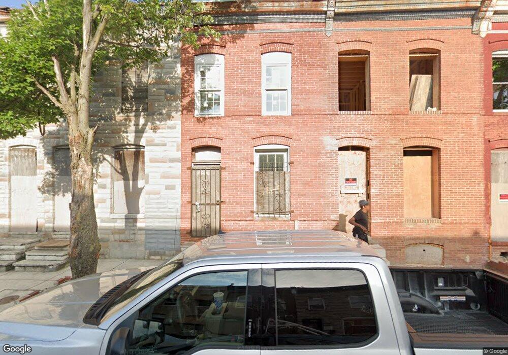
1804 N Port St Baltimore, MD 21213
Broadway East NeighborhoodEstimated Value: $57,000
--
Bed
1
Bath
546
Sq Ft
$104/Sq Ft
Est. Value
About This Home
This home is located at 1804 N Port St, Baltimore, MD 21213 and is currently estimated at $57,000, approximately $104 per square foot. 1804 N Port St is a home located in Baltimore City with nearby schools including Harford Heights Elementary School, Booker T. Washington Middle School, and Paul Laurence Dunbar Community High School.
Ownership History
Date
Name
Owned For
Owner Type
Purchase Details
Closed on
Jun 8, 2022
Sold by
One House At A Time Incorporated
Bought by
Port St Holdings Llc
Current Estimated Value
Purchase Details
Closed on
Feb 16, 2022
Sold by
One House At A Time Incorporated
Bought by
Port St Holdings Llc
Purchase Details
Closed on
Aug 17, 2006
Sold by
Jacmar Corporation
Bought by
Johnson Keith and Wade Laquisha
Create a Home Valuation Report for This Property
The Home Valuation Report is an in-depth analysis detailing your home's value as well as a comparison with similar homes in the area
Home Values in the Area
Average Home Value in this Area
Purchase History
| Date | Buyer | Sale Price | Title Company |
|---|---|---|---|
| Port St Holdings Llc | $5,000 | Cotton Duck Title | |
| Port St Holdings Llc | $5,000 | Cotton Duck Title | |
| Johnson Keith | $16,500 | -- |
Source: Public Records
Tax History Compared to Growth
Tax History
| Year | Tax Paid | Tax Assessment Tax Assessment Total Assessment is a certain percentage of the fair market value that is determined by local assessors to be the total taxable value of land and additions on the property. | Land | Improvement |
|---|---|---|---|---|
| 2025 | $438 | $25,000 | $5,000 | $20,000 |
| 2024 | $438 | $18,667 | $0 | $0 |
| 2023 | $291 | $12,333 | $0 | $0 |
| 2022 | $142 | $6,000 | $2,000 | $4,000 |
| 2021 | $142 | $6,000 | $2,000 | $4,000 |
| 2020 | $142 | $6,000 | $2,000 | $4,000 |
| 2019 | $258 | $11,000 | $3,000 | $8,000 |
| 2018 | $260 | $11,000 | $3,000 | $8,000 |
| 2017 | $260 | $11,000 | $0 | $0 |
| 2016 | $71 | $12,000 | $0 | $0 |
| 2015 | $71 | $11,400 | $0 | $0 |
| 2014 | $71 | $10,800 | $0 | $0 |
Source: Public Records
Map
Nearby Homes
- 2432 E Lafayette Ave
- 1807 N Milton Ave
- 1713 N Patterson Park Ave
- 2427 E Lanvale St
- 1625 N Milton Ave
- 1927 Belair Rd
- 1532 N Patterson Park Ave
- 2122 E North Ave
- 1949 N Collington Ave
- 1837 N Chester St
- 1955 N Collington Ave
- 1509 N Patterson Park Ave
- 1521 N Collington Ave
- 1748 N Chester St
- 2408 Llewelyn Ave
- 2708 E Federal St
- 2107 Cliftwood Ave
- 2114 Cliftwood Ave
- 1417 N Milton Ave
- 2032 E North Ave
- 1806 N Port St
- 1808 N Port St
- 1802 N Port St
- 1810 N Port St
- 1800 N Port St
- 1812 N Port St
- 1814 N Port St
- 1816 N Port St
- 1811 N Montford Ave
- 1813 N Montford Ave
- 1809 N Montford Ave
- 1815 N Montford Ave
- 1807 N Montford Ave
- 1817 N Montford Ave
- 1818 N Port St
- 1805 N Montford Ave
- 2414 E Lafayette Ave
- 1821 N Montford Ave
- 2416 E Lafayette Ave
- 2412 E Lafayette Ave