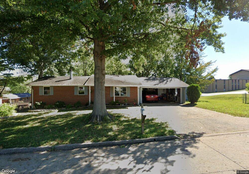
1804 Randol Ave Cape Girardeau, MO 63701
Estimated Value: $188,000 - $203,000
3
Beds
2
Baths
1,125
Sq Ft
$175/Sq Ft
Est. Value
About This Home
This home is located at 1804 Randol Ave, Cape Girardeau, MO 63701 and is currently estimated at $196,755, approximately $174 per square foot. 1804 Randol Ave is a home with nearby schools including Alma Schrader Elementary School, Central Middle School, and Central Junior High School.
Ownership History
Date
Name
Owned For
Owner Type
Purchase Details
Closed on
Apr 13, 2009
Sold by
Zimmerman Lanny B and Zimmerman Casey M
Bought by
Zimmerman Lanny B and Zimmerman Casey M
Current Estimated Value
Home Financials for this Owner
Home Financials are based on the most recent Mortgage that was taken out on this home.
Original Mortgage
$84,000
Outstanding Balance
$53,951
Interest Rate
5.24%
Mortgage Type
New Conventional
Estimated Equity
$142,804
Purchase Details
Closed on
Jul 25, 2005
Sold by
Brunkhorst Betty Lou and Brunkhorst Gene R
Bought by
Zimmerman Lanny Bruce
Home Financials for this Owner
Home Financials are based on the most recent Mortgage that was taken out on this home.
Original Mortgage
$85,000
Interest Rate
5.61%
Mortgage Type
New Conventional
Create a Home Valuation Report for This Property
The Home Valuation Report is an in-depth analysis detailing your home's value as well as a comparison with similar homes in the area
Home Values in the Area
Average Home Value in this Area
Purchase History
| Date | Buyer | Sale Price | Title Company |
|---|---|---|---|
| Zimmerman Lanny B | -- | Abstract And Title Co Inc | |
| Zimmerman Lanny Bruce | -- | None Available |
Source: Public Records
Mortgage History
| Date | Status | Borrower | Loan Amount |
|---|---|---|---|
| Open | Zimmerman Lanny B | $84,000 | |
| Previous Owner | Zimmerman Lanny Bruce | $85,000 |
Source: Public Records
Tax History Compared to Growth
Tax History
| Year | Tax Paid | Tax Assessment Tax Assessment Total Assessment is a certain percentage of the fair market value that is determined by local assessors to be the total taxable value of land and additions on the property. | Land | Improvement |
|---|---|---|---|---|
| 2025 | $11 | $22,640 | $2,410 | $20,230 |
| 2024 | $11 | $21,560 | $2,290 | $19,270 |
| 2023 | $1,121 | $21,560 | $2,290 | $19,270 |
| 2022 | $1,033 | $19,870 | $2,110 | $17,760 |
| 2021 | $1,033 | $19,870 | $2,110 | $17,760 |
| 2020 | $1,036 | $19,870 | $2,110 | $17,760 |
| 2019 | $1,035 | $19,870 | $0 | $0 |
| 2018 | $1,033 | $19,870 | $0 | $0 |
| 2017 | $1,035 | $19,870 | $0 | $0 |
| 2016 | $1,031 | $19,870 | $0 | $0 |
| 2015 | $1,032 | $19,870 | $0 | $0 |
| 2014 | $1,037 | $19,870 | $0 | $0 |
Source: Public Records
Map
Nearby Homes
- 2412 Masters Dr
- 2550 Marvin St
- 1701 Brookwood Dr
- 1938 Westwood Dr
- 2237 Sherwood Dr
- 2449 Janet Dr
- 1966 Randol Ave
- 2323 Brookwood Dr
- 1912 Perryville Rd
- 1960 Briarwood Dr
- 1623 Lexington Ave
- 1246 Marilyn Dr
- 1717 Perryville Rd
- 3002 Melrose Ave
- 1608 Lexington Ave
- 2062 Concord Place
- 2323 Jean Ann Dr
- 1572 Lexington Ave
- 1415 N Clark St
- 1910 Sherwood Dr
- 1809 Randol Ave
- 2443 Glenridge Dr
- 1805 Randol Ave
- 2439 Glenridge Dr
- 1813 Randol Ave
- 2500 Lynnwood Dr
- 2435 Glenridge Dr
- 1817 Randol Ave
- 2431 Glenridge Dr
- 1821 Randol Ave
- 2506 Lynnwood Dr
- 1808 Margaret St
- 2427 Glenridge Dr
- 2440 Glenridge Dr
- 2444 Glenridge Dr
- 1804 Margaret St
- 1812 Margaret St
- 2512 Lynnwood Dr
- 1816 Margaret St
- 2436 Glenridge Dr