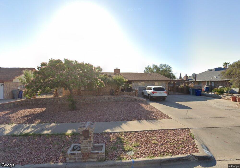
1804 Tom Bolt Dr El Paso, TX 79936
Vista Del Sol NeighborhoodEstimated Value: $271,195 - $320,000
--
Bed
2
Baths
1,929
Sq Ft
$148/Sq Ft
Est. Value
About This Home
This home is located at 1804 Tom Bolt Dr, El Paso, TX 79936 and is currently estimated at $286,299, approximately $148 per square foot. 1804 Tom Bolt Dr is a home located in El Paso County with nearby schools including Tierra Del Sol Elementary School, J M Hanks High School, and EL PASO LEADERSHIP ACADEMY - MIDDLE EAST.
Ownership History
Date
Name
Owned For
Owner Type
Purchase Details
Closed on
Jun 6, 2017
Sold by
Marquez Evangelina R
Bought by
Perez Leticia M
Current Estimated Value
Purchase Details
Closed on
Jan 24, 2014
Sold by
Marquez Evangelina
Bought by
Perez Leticia Isela M
Purchase Details
Closed on
May 12, 2004
Sold by
Perez Leticia M
Bought by
Marquez Carlos L and Marquez Evangelina R
Purchase Details
Closed on
Dec 2, 1998
Sold by
Perez Ramon
Bought by
Perez Leticia M
Create a Home Valuation Report for This Property
The Home Valuation Report is an in-depth analysis detailing your home's value as well as a comparison with similar homes in the area
Home Values in the Area
Average Home Value in this Area
Purchase History
| Date | Buyer | Sale Price | Title Company |
|---|---|---|---|
| Perez Leticia M | -- | None Available | |
| Perez Leticia Isela M | -- | None Available | |
| Marquez Carlos L | -- | -- | |
| Perez Leticia M | -- | -- |
Source: Public Records
Mortgage History
| Date | Status | Borrower | Loan Amount |
|---|---|---|---|
| Closed | Perez Leticia M | $0 |
Source: Public Records
Tax History Compared to Growth
Tax History
| Year | Tax Paid | Tax Assessment Tax Assessment Total Assessment is a certain percentage of the fair market value that is determined by local assessors to be the total taxable value of land and additions on the property. | Land | Improvement |
|---|---|---|---|---|
| 2025 | $4,764 | $267,330 | $45,864 | $221,466 |
| 2024 | $4,764 | $244,721 | -- | -- |
| 2023 | $4,474 | $222,474 | $0 | $0 |
| 2022 | $6,281 | $202,249 | $0 | $0 |
| 2021 | $5,976 | $183,863 | $31,450 | $152,413 |
| 2020 | $5,620 | $177,917 | $28,547 | $149,370 |
| 2018 | $5,410 | $173,982 | $28,547 | $145,435 |
| 2017 | $4,985 | $163,225 | $28,547 | $134,678 |
| 2016 | $4,532 | $148,260 | $28,547 | $119,713 |
| 2015 | $2,596 | $148,260 | $28,547 | $119,713 |
| 2014 | $2,596 | $148,812 | $28,547 | $120,265 |
Source: Public Records
Map
Nearby Homes
- 1868 Tom Bolt Dr
- 1817 Hugh Royer Place
- 1739 Jerry Abbott St
- 1804 Jerry Abbott St
- 11204 Bob Mitchell Dr
- 1913 Seagull Dr
- 1901 Bobby Jones Dr
- 1703 Robert Wynn St
- 2001 Bobby Jones Dr Unit A
- 1617 Tommy Aaron Dr
- 1700 Jerry Abbott St
- 2009 Bobby Jones Dr Unit B
- 1607 Tommy Aaron Dr
- 11016 Bob Stone Dr
- 11157 Leo Collins Dr
- 11012 Bob Stone Dr
- 11262 Enid Wilson Ln
- 11268 Enid Wilson Ln
- 11013 Bob Stone Dr
- 2604 Anise Dr
- 1808 Tom Bolt Dr
- 1800 Tom Bolt Dr
- 1809 Tommy Aaron Dr
- 1805 Tommy Aaron Dr
- 1813 Tommy Aaron Dr
- 1812 Tom Bolt Dr
- 1801 Tommy Aaron Dr
- 1805 Tom Bolt Dr
- 1801 Tom Bolt Dr
- 1811 Tom Bolt Dr
- 1811 Tom Bolt Dr Unit n/a
- 1817 Tommy Aaron Dr
- 1816 Tom Bolt Dr
- 1728 Tom Bolt Dr
- 1817 Tom Bolt Dr
- 1808 Tommy Aaron Dr
- 1729 Tom Bolt Dr
- 1821 Tommy Aaron Dr
- 1812 Tommy Aaron Dr
- 1804 Mike Hill Dr