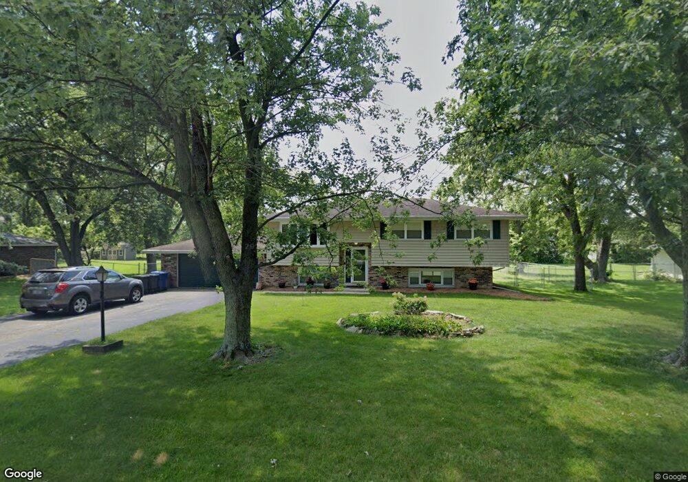
1804 Tomahawk Ridge New Lenox, IL 60451
Estimated Value: $332,000 - $420,000
--
Bed
--
Bath
--
Sq Ft
0.49
Acres
About This Home
This home is located at 1804 Tomahawk Ridge, New Lenox, IL 60451 and is currently estimated at $377,015. 1804 Tomahawk Ridge is a home located in Will County with nearby schools including Spencer Trail, Spencer Pointe, and Spencer Crossing Intermediate School.
Ownership History
Date
Name
Owned For
Owner Type
Purchase Details
Closed on
Apr 13, 2018
Sold by
Fahey Glenda E and Vahldick Herbert M
Bought by
Colwell Eamon N and Colwell Kathryn A
Current Estimated Value
Home Financials for this Owner
Home Financials are based on the most recent Mortgage that was taken out on this home.
Original Mortgage
$213,750
Outstanding Balance
$185,125
Interest Rate
4.75%
Mortgage Type
New Conventional
Estimated Equity
$191,890
Create a Home Valuation Report for This Property
The Home Valuation Report is an in-depth analysis detailing your home's value as well as a comparison with similar homes in the area
Home Values in the Area
Average Home Value in this Area
Purchase History
| Date | Buyer | Sale Price | Title Company |
|---|---|---|---|
| Colwell Eamon N | $225,000 | First American Title |
Source: Public Records
Mortgage History
| Date | Status | Borrower | Loan Amount |
|---|---|---|---|
| Open | Colwell Eamon N | $213,750 |
Source: Public Records
Tax History Compared to Growth
Tax History
| Year | Tax Paid | Tax Assessment Tax Assessment Total Assessment is a certain percentage of the fair market value that is determined by local assessors to be the total taxable value of land and additions on the property. | Land | Improvement |
|---|---|---|---|---|
| 2024 | $7,439 | $103,069 | $33,360 | $69,709 |
| 2023 | $7,439 | $93,955 | $30,410 | $63,545 |
| 2022 | $6,719 | $86,555 | $28,015 | $58,540 |
| 2021 | $6,372 | $81,402 | $26,347 | $55,055 |
| 2020 | $6,185 | $78,498 | $25,407 | $53,091 |
| 2019 | $5,911 | $76,064 | $24,619 | $51,445 |
| 2018 | $5,769 | $73,442 | $23,770 | $49,672 |
| 2017 | $5,471 | $71,331 | $23,087 | $48,244 |
| 2016 | $5,307 | $69,422 | $22,469 | $46,953 |
| 2015 | $5,132 | $67,237 | $21,762 | $45,475 |
| 2014 | $5,132 | $66,407 | $21,493 | $44,914 |
| 2013 | $5,132 | $67,302 | $21,783 | $45,519 |
Source: Public Records
Map
Nearby Homes
- 22559 S Country Ln
- 2980 Oak Rail Dr
- 2124 Sky Harbor Dr
- 2165 High View Rd
- 2125 Sky Harbor Dr
- 2164 Sky Harbor Dr
- 2166 Sky Harbor Dr
- 500 E Laraway Rd
- 550 E Laraway Rd
- 1401 Ottawa Dr
- 2019 Royalglen Dr
- 2185 Bristol Park Rd
- 911 Canongate Ln
- 1501 Glenbrooke Ln
- 2067 Edgeview Dr
- 1515 Glenbrooke Ln
- Avalon Plan at Leigh Creek - Townhome
- Hampton Plan at Leigh Creek - Townhome
- 1781 Orchard Ln
- 1738 Orchard Ln
- 1802 Tomahawk Ridge
- 1806 Tomahawk Ridge
- 1800 Tomahawk Ridge Unit 1
- 1805 Tomahawk Ridge
- 1801 Tomahawk Ridge Unit 1
- 1810 Tomahawk Ridge Unit 1
- 1809 Tomahawk Ridge
- 1821 Pheasant Ln
- 1709 Tomahawk Ridge
- 1710 Tomahawk Ridge
- 1801 Pheasant Ln
- 1761 Pheasant Ln
- 1841 Pheasant Ln
- 1705 Tomahawk Ridge
- 1804 Illini Dr
- 1902 Tomahawk Ridge
- 1806 Illini Dr
- 1861 Pheasant Ln
- 1901 Tomahawk Ridge
- 1741 Pheasant Ln