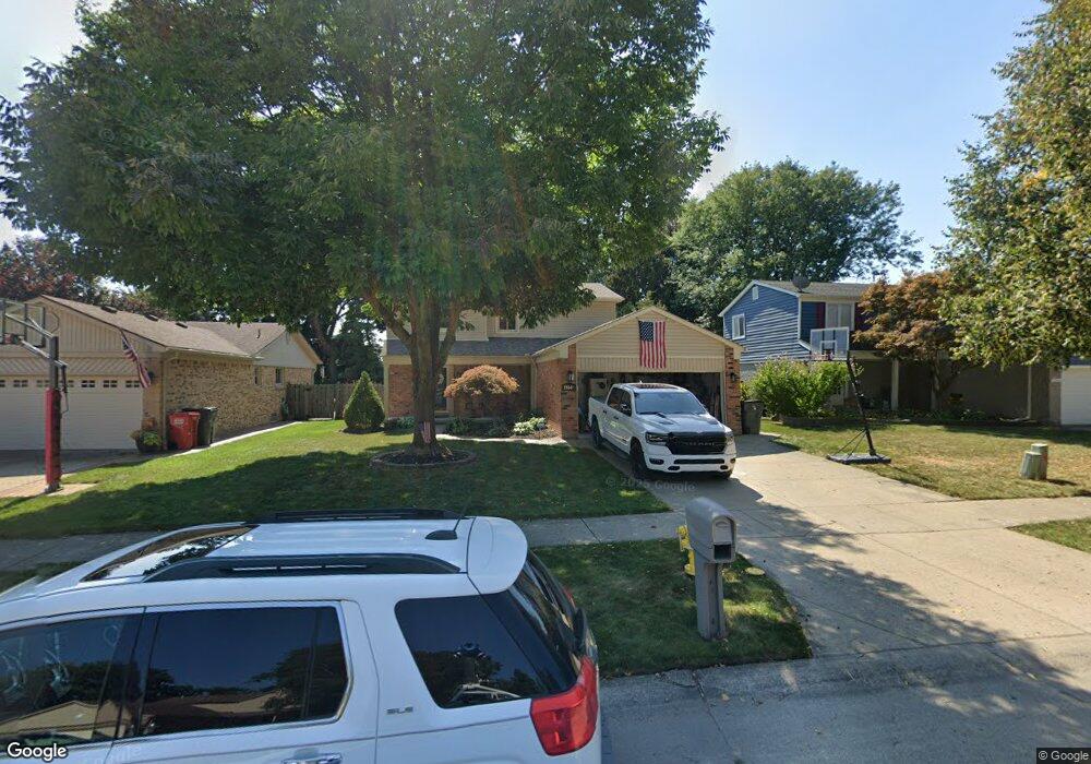
18040 Foxpointe Dr Clinton Township, MI 48038
Estimated Value: $309,844 - $345,000
3
Beds
2
Baths
1,605
Sq Ft
$207/Sq Ft
Est. Value
About This Home
This home is located at 18040 Foxpointe Dr, Clinton Township, MI 48038 and is currently estimated at $331,711, approximately $206 per square foot. 18040 Foxpointe Dr is a home located in Macomb County with nearby schools including Erie Elementary School, Algonquin Middle School, and Chippewa Valley High School.
Ownership History
Date
Name
Owned For
Owner Type
Purchase Details
Closed on
Dec 14, 2018
Sold by
Manauis Roel and Manauis Nina
Bought by
Manauis Roel
Current Estimated Value
Home Financials for this Owner
Home Financials are based on the most recent Mortgage that was taken out on this home.
Original Mortgage
$153,000
Outstanding Balance
$135,065
Interest Rate
4.9%
Mortgage Type
Purchase Money Mortgage
Estimated Equity
$196,646
Purchase Details
Closed on
Feb 18, 1998
Sold by
Rossman H K
Bought by
Manauis R N
Create a Home Valuation Report for This Property
The Home Valuation Report is an in-depth analysis detailing your home's value as well as a comparison with similar homes in the area
Home Values in the Area
Average Home Value in this Area
Purchase History
| Date | Buyer | Sale Price | Title Company |
|---|---|---|---|
| Manauis Roel | -- | Title Source Inc | |
| Manauis R N | $147,900 | -- |
Source: Public Records
Mortgage History
| Date | Status | Borrower | Loan Amount |
|---|---|---|---|
| Open | Manauis Roel | $153,000 |
Source: Public Records
Tax History Compared to Growth
Tax History
| Year | Tax Paid | Tax Assessment Tax Assessment Total Assessment is a certain percentage of the fair market value that is determined by local assessors to be the total taxable value of land and additions on the property. | Land | Improvement |
|---|---|---|---|---|
| 2025 | $3,594 | $121,100 | $0 | $0 |
| 2024 | $2,074 | $112,900 | $0 | $0 |
| 2023 | $1,968 | $102,700 | $0 | $0 |
| 2022 | $3,155 | $94,800 | $0 | $0 |
| 2021 | $3,381 | $81,700 | $0 | $0 |
| 2020 | $1,805 | $83,400 | $0 | $0 |
| 2019 | $2,858 | $87,600 | $0 | $0 |
| 2018 | $3,240 | $89,600 | $0 | $0 |
| 2017 | $3,138 | $82,000 | $18,000 | $64,000 |
| 2016 | $3,326 | $82,000 | $0 | $0 |
| 2015 | -- | $78,400 | $0 | $0 |
| 2014 | -- | $71,200 | $0 | $0 |
| 2011 | -- | $67,600 | $15,400 | $52,200 |
Source: Public Records
Map
Nearby Homes
- 42201 Hidden Brook Dr Unit 68
- 42150 Margaret Dr
- 41825 Alden Dr
- 41416 Justin Dr
- 18144 N Oak Dr
- 42266 Brookview Ln Unit 1
- 41985 Dorchester Ct
- 42407 Creekside Dr Unit 165
- 41664 Stonehenge Manor Dr
- 42184 Toddmark Ln Unit 21
- 42246 Toddmark Ln
- 42222 Toddmark Ln Unit 53
- 18960 Sandhurst Dr
- 41146 Justin Dr
- 42201 Toddmark Ln
- 42003 Toddmark Ln
- 41600 Janet Dr
- 41104 Worthington Unit Bldg 26, Unit 52
- 42501 Eldon Cir
- 17917 Pointe Ct
- 18020 Foxpointe Dr
- 18060 Foxpointe Dr
- 41905 Huntington Ct
- 18080 Foxpointe Dr
- 18000 Foxpointe Dr
- 41900 Huntington Ct
- 41865 Huntington Ct
- 18100 Foxpointe Dr
- 18037 Foxpointe Dr
- 18015 Foxpointe Dr
- 18081 Foxpointe Dr
- 17993 Foxpointe Dr
- 18103 Foxpointe Dr
- 41825 Huntington Ct
- 41870 Huntington Ct
- 17971 Foxpointe Dr
- 41951 Brandywine Dr
- 41931 Brandywine Dr
- 41942 Stratton Dr
- 41911 Brandywine Dr