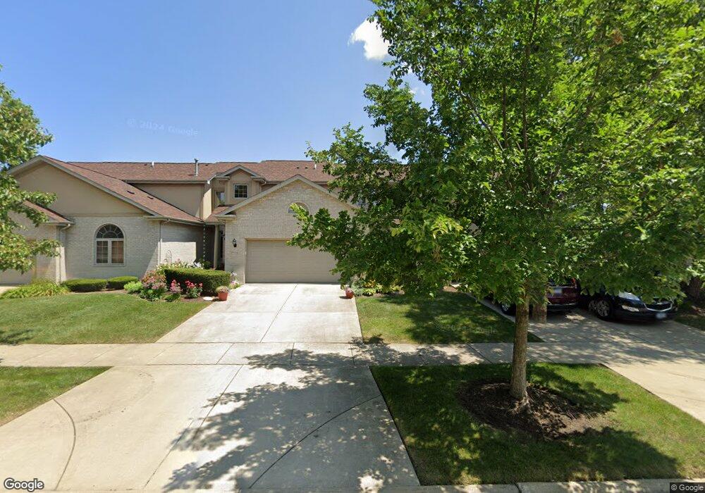
18043 Upland Dr Unit 18043 Tinley Park, IL 60487
Central Tinley Park NeighborhoodEstimated Value: $398,000 - $473,000
3
Beds
3
Baths
2,519
Sq Ft
$174/Sq Ft
Est. Value
About This Home
This home is located at 18043 Upland Dr Unit 18043, Tinley Park, IL 60487 and is currently estimated at $437,324, approximately $173 per square foot. 18043 Upland Dr Unit 18043 is a home located in Cook County with nearby schools including Christa Mcauliffe School, Prairie View Middle School, and Victor J Andrew High School.
Ownership History
Date
Name
Owned For
Owner Type
Purchase Details
Closed on
Sep 29, 2003
Sold by
State Bank Of Countryside
Bought by
Corpolongo Rosann
Current Estimated Value
Home Financials for this Owner
Home Financials are based on the most recent Mortgage that was taken out on this home.
Original Mortgage
$261,000
Interest Rate
4%
Mortgage Type
Unknown
Create a Home Valuation Report for This Property
The Home Valuation Report is an in-depth analysis detailing your home's value as well as a comparison with similar homes in the area
Home Values in the Area
Average Home Value in this Area
Purchase History
| Date | Buyer | Sale Price | Title Company |
|---|---|---|---|
| Corpolongo Rosann | $301,000 | Cti |
Source: Public Records
Mortgage History
| Date | Status | Borrower | Loan Amount |
|---|---|---|---|
| Previous Owner | Corpolongo Rosann | $261,000 |
Source: Public Records
Tax History Compared to Growth
Tax History
| Year | Tax Paid | Tax Assessment Tax Assessment Total Assessment is a certain percentage of the fair market value that is determined by local assessors to be the total taxable value of land and additions on the property. | Land | Improvement |
|---|---|---|---|---|
| 2024 | $8,616 | $37,000 | $3,928 | $33,072 |
| 2023 | $6,130 | $37,000 | $3,928 | $33,072 |
| 2022 | $6,130 | $24,034 | $3,389 | $20,645 |
| 2021 | $5,995 | $24,034 | $3,389 | $20,645 |
| 2020 | $7,035 | $24,034 | $3,389 | $20,645 |
| 2019 | $8,481 | $29,581 | $3,081 | $26,500 |
| 2018 | $8,298 | $29,581 | $3,081 | $26,500 |
| 2017 | $8,096 | $29,581 | $3,081 | $26,500 |
| 2016 | $7,493 | $25,058 | $2,772 | $22,286 |
| 2015 | $7,371 | $25,058 | $2,772 | $22,286 |
| 2014 | $7,326 | $25,058 | $2,772 | $22,286 |
| 2013 | $7,628 | $27,888 | $2,772 | $25,116 |
Source: Public Records
Map
Nearby Homes
- 18055 Upland Dr
- 17964 Upland Dr
- 18248 Murphy Cir Unit 182
- 9058 Newcastle Ct
- 9038 Mansfield Dr Unit 8
- 9313 178th St
- 9051 Mansfield Dr Unit 1
- 17500 Lagrange Rd
- 17595 Drummond Dr Unit 139
- 9260 Windsor Pkwy Unit 80
- 18323 White Oak Ln
- 17533 Pecan Ln
- 17535 S La Grange Rd
- 17535-2 Lagrange Rd
- 9201 175th St
- 9334 Drummond Dr Unit 3
- 17631 Dover Ct
- Fremont Plan at Radcliffe Place
- Calysta Plan at Radcliffe Place
- Danbury Plan at Radcliffe Place
- 18041 Upland Dr Unit 18041
- 18047 Upland Dr
- 18039 Upland Dr
- 18049 Upland Dr
- 18042 Upland Dr Unit 18042
- 18040 Upland Dr
- 18044 Upland Dr
- 18046 Upland Dr Unit 18046
- 18051 Upland Dr
- 9303 Raven Place
- 18053 Upland Dr Unit 18053
- 9305 Raven Place
- 18111 Edgar Place
- 9320 Chestnut Trail
- 9307 Raven Place
- 18113 Edgar Place
- 18113 Edgar Place
- 9309 Raven Place Unit 9309
- 18115 Edgar Place
- 9322 Chestnut Trail