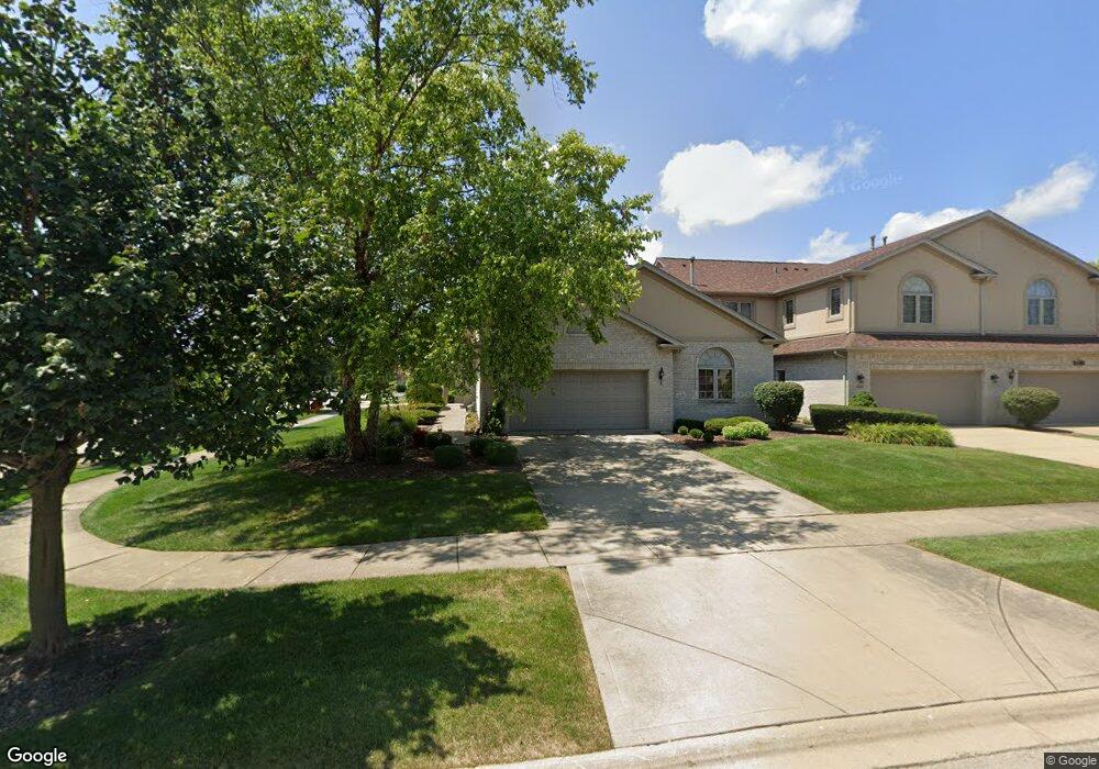
18046 Upland Dr Unit 18046 Tinley Park, IL 60487
Central Tinley Park NeighborhoodEstimated Value: $424,000 - $460,000
3
Beds
3
Baths
2,380
Sq Ft
$185/Sq Ft
Est. Value
About This Home
This home is located at 18046 Upland Dr Unit 18046, Tinley Park, IL 60487 and is currently estimated at $440,387, approximately $185 per square foot. 18046 Upland Dr Unit 18046 is a home located in Cook County with nearby schools including Christa Mcauliffe School, Prairie View Middle School, and Victor J Andrew High School.
Ownership History
Date
Name
Owned For
Owner Type
Purchase Details
Closed on
Dec 11, 2006
Sold by
Carr Ronald P and Carr Ruthann
Bought by
Carr Ronald P and Carr Ruthann
Current Estimated Value
Purchase Details
Closed on
May 20, 2003
Sold by
State Bank Of Countryside
Bought by
Carr Ronald P and Carr Ruthann
Home Financials for this Owner
Home Financials are based on the most recent Mortgage that was taken out on this home.
Original Mortgage
$90,000
Interest Rate
5.78%
Mortgage Type
Unknown
Purchase Details
Closed on
Aug 20, 2002
Sold by
Republic Bank Of Chicago
Bought by
State Bank Of Countryside and Trust #02-2441
Home Financials for this Owner
Home Financials are based on the most recent Mortgage that was taken out on this home.
Original Mortgage
$296,000
Interest Rate
4.75%
Create a Home Valuation Report for This Property
The Home Valuation Report is an in-depth analysis detailing your home's value as well as a comparison with similar homes in the area
Home Values in the Area
Average Home Value in this Area
Purchase History
| Date | Buyer | Sale Price | Title Company |
|---|---|---|---|
| Carr Ronald P | -- | None Available | |
| Carr Ronald P | $335,000 | Cti | |
| Carr Ronald P | $335,000 | Cti | |
| State Bank Of Countryside | $334,000 | -- |
Source: Public Records
Mortgage History
| Date | Status | Borrower | Loan Amount |
|---|---|---|---|
| Closed | Carr Ronald P | $90,000 | |
| Previous Owner | State Bank Of Countryside | $296,000 |
Source: Public Records
Tax History Compared to Growth
Tax History
| Year | Tax Paid | Tax Assessment Tax Assessment Total Assessment is a certain percentage of the fair market value that is determined by local assessors to be the total taxable value of land and additions on the property. | Land | Improvement |
|---|---|---|---|---|
| 2024 | $8,616 | $37,000 | $3,928 | $33,072 |
| 2023 | $6,321 | $37,000 | $3,928 | $33,072 |
| 2022 | $6,321 | $23,885 | $3,389 | $20,496 |
| 2021 | $6,173 | $23,885 | $3,389 | $20,496 |
| 2020 | $4,898 | $23,885 | $3,389 | $20,496 |
| 2019 | $5,225 | $29,037 | $3,081 | $25,956 |
| 2018 | $5,122 | $29,037 | $3,081 | $25,956 |
| 2017 | $4,898 | $29,037 | $3,081 | $25,956 |
| 2016 | $6,277 | $24,350 | $2,772 | $21,578 |
| 2015 | $6,523 | $24,350 | $2,772 | $21,578 |
| 2014 | $6,498 | $24,350 | $2,772 | $21,578 |
| 2013 | $6,901 | $27,359 | $2,772 | $24,587 |
Source: Public Records
Map
Nearby Homes
- 18055 Upland Dr
- 17964 Upland Dr
- 18248 Murphy Cir Unit 182
- 9313 178th St
- 9058 Newcastle Ct
- 9038 Mansfield Dr Unit 8
- 9051 Mansfield Dr Unit 1
- 17500 Lagrange Rd
- 9280 Windsor Pkwy Unit 92
- 17595 Drummond Dr Unit 139
- 9260 Windsor Pkwy Unit 80
- 17535 S La Grange Rd
- 17535-2 Lagrange Rd
- 17533 Pecan Ln
- 9201 175th St
- 9334 Drummond Dr Unit 3
- 18323 White Oak Ln
- 17631 Dover Ct
- Fremont Plan at Radcliffe Place
- Calysta Plan at Radcliffe Place
- 18044 Upland Dr
- 18042 Upland Dr Unit 18042
- 9320 Chestnut Trail
- 18040 Upland Dr
- 18049 Upland Dr
- 18111 Edgar Place
- 9322 Chestnut Trail
- 9324 Chestnut Trail Unit 9324
- 18113 Edgar Place
- 18113 Edgar Place
- 18047 Upland Dr
- 18043 Upland Dr Unit 18043
- 18110 Edgar Place
- 18115 Edgar Place
- 9307 Raven Place
- 18041 Upland Dr Unit 18041
- 18053 Upland Dr Unit 18053
- 9309 Raven Place Unit 9309
- 9305 Raven Place
- 18112 Edgar Place