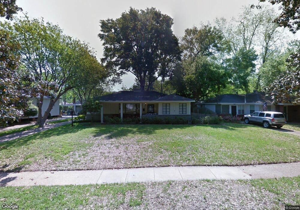
1805 Anniston Ave Shreveport, LA 71105
Broadmoor/Anderson Island/Shreve Isle NeighborhoodEstimated Value: $139,000 - $187,000
3
Beds
2
Baths
1,463
Sq Ft
$113/Sq Ft
Est. Value
About This Home
This home is located at 1805 Anniston Ave, Shreveport, LA 71105 and is currently estimated at $165,587, approximately $113 per square foot. 1805 Anniston Ave is a home located in Caddo Parish with nearby schools including Fairfield Magnet School, Judson Fundamental Elementary School, and Eden Gardens Fundamental Elementary School.
Ownership History
Date
Name
Owned For
Owner Type
Purchase Details
Closed on
Jul 20, 2012
Sold by
Pelton Kevin David
Bought by
Boren Ryan Andrew
Current Estimated Value
Home Financials for this Owner
Home Financials are based on the most recent Mortgage that was taken out on this home.
Original Mortgage
$148,015
Outstanding Balance
$102,318
Interest Rate
3.7%
Mortgage Type
Unknown
Estimated Equity
$63,269
Purchase Details
Closed on
Jul 14, 2011
Sold by
Pelton Christian Dunn
Bought by
Pelton Kevin David
Create a Home Valuation Report for This Property
The Home Valuation Report is an in-depth analysis detailing your home's value as well as a comparison with similar homes in the area
Home Values in the Area
Average Home Value in this Area
Purchase History
| Date | Buyer | Sale Price | Title Company |
|---|---|---|---|
| Boren Ryan Andrew | $144,900 | United Title Of Louisiana In | |
| Pelton Kevin David | -- | None Available |
Source: Public Records
Mortgage History
| Date | Status | Borrower | Loan Amount |
|---|---|---|---|
| Open | Boren Ryan Andrew | $148,015 |
Source: Public Records
Tax History Compared to Growth
Tax History
| Year | Tax Paid | Tax Assessment Tax Assessment Total Assessment is a certain percentage of the fair market value that is determined by local assessors to be the total taxable value of land and additions on the property. | Land | Improvement |
|---|---|---|---|---|
| 2024 | $1,993 | $12,783 | $2,906 | $9,877 |
| 2023 | $1,876 | $11,769 | $2,768 | $9,001 |
| 2022 | $1,876 | $11,769 | $2,768 | $9,001 |
| 2021 | $1,847 | $11,769 | $2,768 | $9,001 |
| 2020 | $1,847 | $11,769 | $2,768 | $9,001 |
| 2019 | $1,835 | $11,347 | $2,768 | $8,579 |
| 2018 | $495 | $11,347 | $2,768 | $8,579 |
| 2017 | $1,864 | $11,347 | $2,768 | $8,579 |
| 2015 | $457 | $11,030 | $2,770 | $8,260 |
| 2014 | $461 | $11,030 | $2,770 | $8,260 |
| 2013 | -- | $11,030 | $2,770 | $8,260 |
Source: Public Records
Map
Nearby Homes
- 1916 Anniston Ave
- 230 Pennsylvania Ave
- 246 Russell Ave
- 142 Lynn Ave
- 245 Stuart Ave
- 240 Carrollton Ave
- 174 Carrollton Ave
- 1836 Bryan Place
- 156 Charles Ave
- 153 Carrollton Ave
- 147 Pennsylvania Ave
- 194 Charles Ave
- 163 Charles Ave
- 129 Carrollton Ave
- 2013 E Kings Hwy
- 2005 E Kings Hwy
- 271 Carrollton Ave
- 233 Charles Ave
- 5707 Anniston Ave
- 144 Norwood St
- 1809 Anniston Ave
- 197 Arthur Ave
- 1815 Anniston Ave
- 190 Richard Ave
- 188 Richard Ave
- 203 Arthur Ave
- 194 Richard Ave
- 186 Richard Ave
- 1810 Anniston Ave
- 187 Arthur Ave
- 191 Arthur Ave
- 1827 Anniston Ave
- 202 Arthur Ave
- 198 Arthur Ave
- 205 Arthur Ave
- 204 Arthur Ave
- 194 Arthur Ave
- 182 Richard Ave
- 1822 Anniston Ave
- 185 Arthur Ave