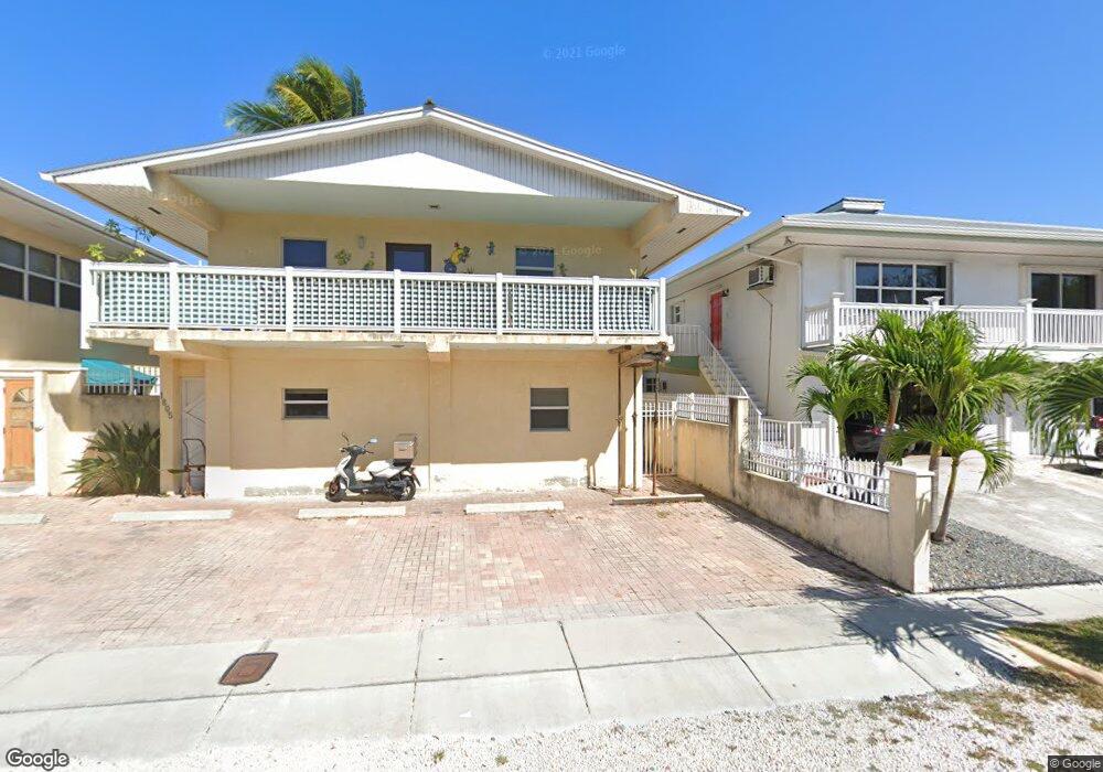
1805 Atlantic Blvd Key West, FL 33040
Mid Town NeighborhoodEstimated Value: $1,819,000 - $1,992,000
9
Beds
8
Baths
3,180
Sq Ft
$594/Sq Ft
Est. Value
About This Home
This home is located at 1805 Atlantic Blvd, Key West, FL 33040 and is currently estimated at $1,888,000, approximately $593 per square foot. 1805 Atlantic Blvd is a home located in Monroe County with nearby schools including Horace O'Bryant School, Key West High School, and May Sands Montessori School.
Ownership History
Date
Name
Owned For
Owner Type
Purchase Details
Closed on
Feb 23, 2022
Sold by
Olin Robert W
Bought by
1803-1805 Atlantic Llc
Current Estimated Value
Purchase Details
Closed on
Mar 15, 2004
Sold by
Ladd Richard C
Bought by
Olin Robert W
Home Financials for this Owner
Home Financials are based on the most recent Mortgage that was taken out on this home.
Original Mortgage
$669,500
Interest Rate
5.25%
Mortgage Type
Commercial
Purchase Details
Closed on
Aug 28, 2001
Bought by
Olin Robert W
Create a Home Valuation Report for This Property
The Home Valuation Report is an in-depth analysis detailing your home's value as well as a comparison with similar homes in the area
Home Values in the Area
Average Home Value in this Area
Purchase History
| Date | Buyer | Sale Price | Title Company |
|---|---|---|---|
| 1803-1805 Atlantic Llc | $2,400,000 | Oropeza Stones Cardenas Pllc | |
| Olin Robert W | $1,030,000 | -- | |
| Olin Robert W | $375,000 | -- |
Source: Public Records
Mortgage History
| Date | Status | Borrower | Loan Amount |
|---|---|---|---|
| Previous Owner | Olin Robert W | $669,500 |
Source: Public Records
Tax History Compared to Growth
Tax History
| Year | Tax Paid | Tax Assessment Tax Assessment Total Assessment is a certain percentage of the fair market value that is determined by local assessors to be the total taxable value of land and additions on the property. | Land | Improvement |
|---|---|---|---|---|
| 2024 | $10,377 | $1,028,936 | $343,804 | $685,132 |
| 2023 | $10,377 | $1,017,716 | $346,801 | $670,915 |
| 2022 | $8,578 | $984,258 | $297,258 | $687,000 |
| 2021 | $7,542 | $665,899 | $222,352 | $443,547 |
| 2020 | $8,014 | $676,217 | $220,483 | $455,734 |
| 2019 | $7,690 | $635,151 | $167,231 | $467,920 |
| 2018 | $8,164 | $678,427 | $186,850 | $491,577 |
| 2017 | $8,266 | $677,536 | $0 | $0 |
| 2016 | $8,123 | $626,423 | $0 | $0 |
| 2015 | $8,055 | $617,481 | $0 | $0 |
| 2014 | $7,624 | $532,376 | $0 | $0 |
Source: Public Records
Map
Nearby Homes
- 1819 Atlantic Blvd
- 1719 Atlantic Blvd
- 1616 Bertha St Unit 2
- 1701 Atlantic Blvd
- 1621 Josephine St
- 1611 Josephine St
- 1625 Patricia St
- 1800 Atlantic Blvd Unit 337C
- 1800 Atlantic Blvd Unit 410A
- 1800 Atlantic Blvd Unit 327C
- 1901 S Roosevelt Blvd Unit 104
- 1901 S Roosevelt Blvd Unit 406W
- 1901 S Roosevelt Blvd Unit 209W
- 1901 S Roosevelt Blvd Unit 201W
- 1901 S Roosevelt Blvd Unit 202W
- 1719 Laird St
- 1619 Rose St
- 1616 Atlantic Blvd Unit 13
- 1616 Atlantic Blvd Unit 6
- 1616 Atlantic Blvd Unit 5
- 1803 Atlantic Blvd
- 1807 Atlantic Blvd
- 1803/0 Atlantic Blvd
- 1714 Josephine St
- 1815 Atlantic Blvd
- 1713 George St
- 1712 Josephine St
- 1725 Josephine St
- 1712 George St
- 1819 Atlantic Blvd Unit 2
- 1709 George St
- 1710 Josephine St Unit 1
- 1710 Josephine St
- 1724 Patricia St
- 1721 Josephine St
- 1707 George St
- 1704 Josephine St
- 1717 Atlantic Blvd
- 1711 Josephine St
- 1720 Patricia St