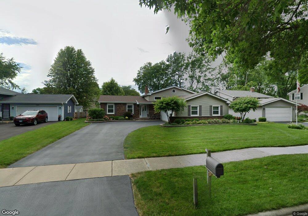
1805 Clyde Dr Naperville, IL 60565
Maple Brook NeighborhoodEstimated Value: $374,000 - $586,000
Studio
1
Bath
1,465
Sq Ft
$336/Sq Ft
Est. Value
About This Home
This home is located at 1805 Clyde Dr, Naperville, IL 60565 and is currently estimated at $492,809, approximately $336 per square foot. 1805 Clyde Dr is a home located in DuPage County with nearby schools including Maplebrook Elementary School, Lincoln Jr. High School, and Naperville Central High School.
Ownership History
Date
Name
Owned For
Owner Type
Purchase Details
Closed on
Aug 3, 2001
Sold by
Rabel Melissa L
Bought by
Rabel Timothy R
Current Estimated Value
Purchase Details
Closed on
Mar 26, 1996
Sold by
Ring Arthur A and Ring Carole L
Bought by
Rabel Timothy R and Rabel Melissa L
Home Financials for this Owner
Home Financials are based on the most recent Mortgage that was taken out on this home.
Original Mortgage
$143,200
Outstanding Balance
$2,927
Interest Rate
7.36%
Estimated Equity
$489,882
Create a Home Valuation Report for This Property
The Home Valuation Report is an in-depth analysis detailing your home's value as well as a comparison with similar homes in the area
Home Values in the Area
Average Home Value in this Area
Purchase History
We collect this data history from publicly available records. To have your information removed, we recommend requesting removal directly through your county’s website.
| Date | Buyer | Sale Price | Title Company |
|---|---|---|---|
| Rabel Timothy R | -- | -- | |
| Rabel Timothy R | $168,500 | -- |
Source: Public Records
Mortgage History
We collect this data history from publicly available records. To have your information removed, we recommend requesting removal directly through your county’s website.
| Date | Status | Borrower | Loan Amount |
|---|---|---|---|
| Open | Rabel Timothy R | $143,200 |
Source: Public Records
Tax History
| Year | Tax Paid | Tax Assessment Tax Assessment Total Assessment is a certain percentage of the fair market value that is determined by local assessors to be the total taxable value of land and additions on the property. | Land | Improvement |
|---|---|---|---|---|
| 2024 | $8,108 | $140,359 | $74,343 | $66,016 |
| 2023 | $7,804 | $128,100 | $67,850 | $60,250 |
| 2022 | $7,507 | $122,000 | $64,620 | $57,380 |
| 2021 | $7,230 | $117,390 | $62,180 | $55,210 |
| 2020 | $7,075 | $115,280 | $61,060 | $54,220 |
| 2019 | $6,864 | $110,290 | $58,420 | $51,870 |
| 2018 | $6,689 | $107,590 | $56,990 | $50,600 |
| 2017 | $6,551 | $103,960 | $55,070 | $48,890 |
| 2016 | $6,416 | $100,200 | $53,080 | $47,120 |
| 2015 | $6,369 | $94,360 | $49,990 | $44,370 |
| 2014 | $6,243 | $89,870 | $47,610 | $42,260 |
| 2013 | $6,149 | $90,080 | $47,720 | $42,360 |
Source: Public Records
Map
Nearby Homes
- 1813 Clyde Dr
- 381 Prairie Knoll Dr
- 1508 Terrance Dr
- 106 Foxcroft Rd
- 43 Foxcroft Rd Unit G135
- 35 Foxcroft Rd Unit 123
- 1908 Wisteria Ct Unit 2
- 314 Westbury Ct
- 1942 Town Dr
- 54 Plymouth Ct Unit 102D
- 50 Plymouth Ct Unit 202B
- 2153 Lancaster Cir Unit 102B
- 2115 Lancaster Cir Unit 202D
- 241 Briarheath Ln Unit 3B
- 1751 S Washington St Unit 1
- 2056 Garth Ct
- 27 Exeter Ct Unit 202A
- 1432 Terrance Dr Unit 3
- 1431 Terrance Dr
- 209 Briarheath Ln
- 1757 Clyde Dr
- 1809 Clyde Dr
- 1753 Clyde Dr
- 348 Prairie Knoll Dr
- 352 Prairie Knoll Dr
- 344 Prairie Knoll Dr
- 356 Prairie Knoll Dr
- 1749 Clyde Dr
- 1817 Clyde Dr
- 88 Drendel Ln
- 340 Prairie Knoll Dr
- 89 Drendel Ln
- 1812 Clyde Dr
- 360 Prairie Knoll Dr
- 1745 Clyde Dr
- 1821 Clyde Dr
- 1748 Clyde Dr
- 1816 Clyde Dr
- 336 Prairie Knoll Dr
- 1744 Clyde Dr
Your Personal Tour Guide
Ask me questions while you tour the home.