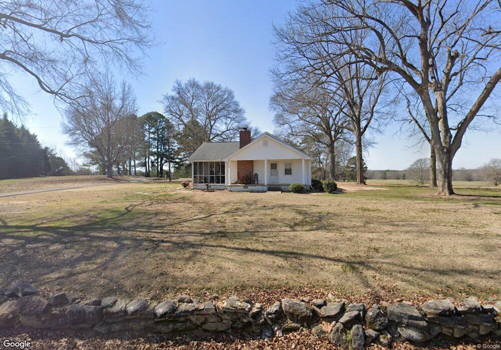
1805 Davis Rd Woodruff, SC 29388
Estimated Value: $240,936 - $345,000
3
Beds
1
Bath
1,410
Sq Ft
$205/Sq Ft
Est. Value
About This Home
This home is located at 1805 Davis Rd, Woodruff, SC 29388 and is currently estimated at $288,984, approximately $204 per square foot. 1805 Davis Rd is a home located in Spartanburg County with nearby schools including Woodruff Primary School, Woodruff Elementary School, and Woodruff Middle School.
Ownership History
Date
Name
Owned For
Owner Type
Purchase Details
Closed on
Feb 8, 2022
Sold by
Coleman Ernest R
Bought by
Parsons Austin Tyler
Current Estimated Value
Purchase Details
Closed on
Oct 23, 2021
Sold by
Parsons Patrick C and Stack Marie
Bought by
Parsons Austin Tyler
Purchase Details
Closed on
Jun 4, 2018
Sold by
Parsons Patrick C
Bought by
Parsons Patrick C and Stack Marie
Purchase Details
Closed on
Feb 13, 2007
Sold by
Parsons Mary Beth
Bought by
Parsons Patrick C
Home Financials for this Owner
Home Financials are based on the most recent Mortgage that was taken out on this home.
Original Mortgage
$20,000
Interest Rate
6.3%
Mortgage Type
Unknown
Create a Home Valuation Report for This Property
The Home Valuation Report is an in-depth analysis detailing your home's value as well as a comparison with similar homes in the area
Home Values in the Area
Average Home Value in this Area
Purchase History
| Date | Buyer | Sale Price | Title Company |
|---|---|---|---|
| Parsons Austin Tyler | -- | None Listed On Document | |
| Parsons Austin Tyler | -- | None Listed On Document | |
| Parsons Austin Tyler | -- | None Available | |
| Parsons Patrick C | -- | None Available | |
| Parsons Patrick C | -- | None Available |
Source: Public Records
Mortgage History
| Date | Status | Borrower | Loan Amount |
|---|---|---|---|
| Previous Owner | Parsons Patrick C | $20,000 |
Source: Public Records
Tax History
| Year | Tax Paid | Tax Assessment Tax Assessment Total Assessment is a certain percentage of the fair market value that is determined by local assessors to be the total taxable value of land and additions on the property. | Land | Improvement |
|---|---|---|---|---|
| 2025 | $870 | $4,944 | $2,429 | $2,515 |
| 2023 | $870 | $4,944 | $2,429 | $2,515 |
Source: Public Records
Map
Nearby Homes
- 111 Hortizone Dr
- 565 Fenwick Dr
- 1510 Talley Ridge Dr
- 569 Fenwick Dr
- 488 Fenwick Dr
- 1771 Odessa Ln
- 726 Bill Pearson Rd
- 299 Pretoria Dr
- 287 Pretoria Dr
- 437 Haddon Trail
- 275 Pretoria Dr
- 442 Haddon Trail
- 445 Haddon Trail
- 453 Haddon Trail
- 461 Haddon Trail
- 247 Pretoria Dr
- 256 Pretoria Dr
- 243 Pretoria Dr
- 236 Pretoria Dr
- 228 Pretoria Dr
- 1811 Davis Rd
- 1781 Davis Rd
- 1770 Davis Rd
- 747 Bill Pearson Rd
- 1945 Davis Rd
- 760 Bill Pearson Rd
- 741 Bill Pearson Rd
- 1708 Davis Rd
- 1701 Davis Rd
- 1712 Davis Rd
- 1716 Davis Rd
- 121 Hortizone Dr
- 1641 Davis Rd
- 140 Hortizone Dr
- 728 Bill Pearson Rd
- 1950 Davis Rd
- 1900 Davis Rd
- 1635 Davis Rd
- 2021 Davis Rd
- 1780 Davis Rd
Your Personal Tour Guide
Ask me questions while you tour the home.