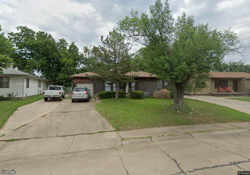
1805 N Osage St Ponca City, OK 74601
Estimated Value: $68,000 - $90,573
2
Beds
1
Bath
925
Sq Ft
$88/Sq Ft
Est. Value
About This Home
This home is located at 1805 N Osage St, Ponca City, OK 74601 and is currently estimated at $81,143, approximately $87 per square foot. 1805 N Osage St is a home located in Kay County with nearby schools including Liberty Elementary School, Ponca City East Middle School, and Ponca City West Middle School.
Ownership History
Date
Name
Owned For
Owner Type
Purchase Details
Closed on
Dec 23, 2020
Sold by
Buck Larry Edward and Buck Susan Carol
Bought by
Buck Ridge Llc
Current Estimated Value
Purchase Details
Closed on
Jun 13, 2019
Sold by
Bank Of The West
Bought by
Buck Larry E and Buck Susan
Purchase Details
Closed on
Jan 15, 2019
Sold by
Mumby Travis T
Bought by
Bank Of The West
Purchase Details
Closed on
Jan 2, 2004
Sold by
Betty Clifton and Betty Wyatt
Bought by
Diamond J Hood
Purchase Details
Closed on
Oct 24, 2003
Sold by
Clifton T Wyatt
Bought by
Wyatt Clifton T and Wyatt Betty E
Purchase Details
Closed on
Jun 3, 2003
Sold by
Leon Robison C
Bought by
Clifton Wyatt
Purchase Details
Closed on
Jul 6, 1992
Sold by
Connie Mark and Connie Nieberlein
Bought by
Robison Leon C and Robison Linda K
Create a Home Valuation Report for This Property
The Home Valuation Report is an in-depth analysis detailing your home's value as well as a comparison with similar homes in the area
Home Values in the Area
Average Home Value in this Area
Purchase History
| Date | Buyer | Sale Price | Title Company |
|---|---|---|---|
| Buck Ridge Llc | -- | None Available | |
| Buck Larry E | $32,500 | None Available | |
| Bank Of The West | $25,727 | None Available | |
| Diamond J Hood | $43,900 | -- | |
| Wyatt Clifton T | -- | -- | |
| Clifton Wyatt | $39,700 | -- | |
| Robison Leon C | $33,000 | -- |
Source: Public Records
Tax History Compared to Growth
Tax History
| Year | Tax Paid | Tax Assessment Tax Assessment Total Assessment is a certain percentage of the fair market value that is determined by local assessors to be the total taxable value of land and additions on the property. | Land | Improvement |
|---|---|---|---|---|
| 2024 | $534 | $5,635 | $764 | $4,871 |
| 2023 | $534 | $5,367 | $764 | $4,603 |
| 2022 | $486 | $5,111 | $764 | $4,347 |
| 2021 | $489 | $5,111 | $764 | $4,347 |
| 2020 | $484 | $5,111 | $764 | $4,347 |
| 2019 | $472 | $4,938 | $764 | $4,174 |
| 2018 | $481 | $4,963 | $764 | $4,199 |
| 2017 | $490 | $5,003 | $764 | $4,239 |
| 2016 | $399 | $5,030 | $764 | $4,266 |
| 2015 | $398 | $5,002 | $764 | $4,238 |
| 2014 | $386 | $4,952 | $764 | $4,188 |
Source: Public Records
Map
Nearby Homes
- 1801 N Osage St
- 1807 N Osage St
- 1717 N Osage St
- 1712 Riggs Dr
- 1716 Riggs Dr
- 1809 N Osage St
- 1720 Riggs Dr
- 1708 Riggs Dr
- 1800 Riggs Dr
- 1704 Riggs Dr
- 1713 N Osage St
- 1804 N Osage St
- 1800 N Osage St
- 1804 Riggs Dr
- 1813 N Osage St
- 1808 N Osage St
- 1700 Riggs Dr
- 1716 N Osage St
- 1808 Riggs Dr
- 1709 N Osage St