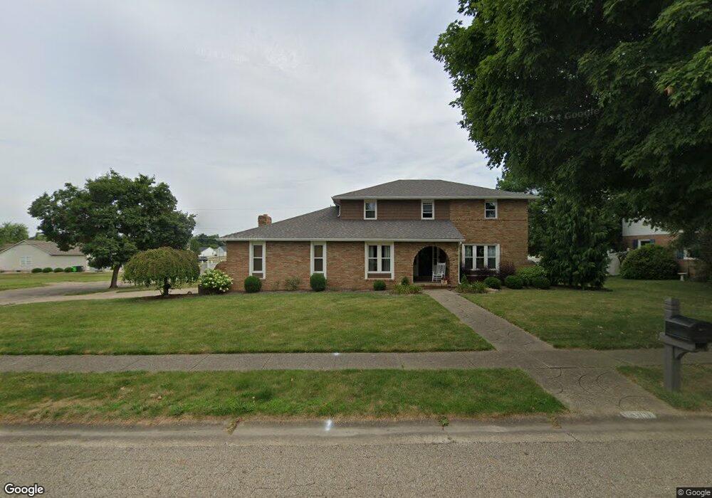
1805 Opal St Louisville, OH 44641
Estimated Value: $338,000 - $403,000
4
Beds
4
Baths
2,540
Sq Ft
$147/Sq Ft
Est. Value
About This Home
This home is located at 1805 Opal St, Louisville, OH 44641 and is currently estimated at $373,889, approximately $147 per square foot. 1805 Opal St is a home located in Stark County with nearby schools including Louisville High School and St. Thomas Aquinas High School & Middle School.
Ownership History
Date
Name
Owned For
Owner Type
Purchase Details
Closed on
Oct 3, 2024
Sold by
Burick Robert M and Burick Angela M
Bought by
Wilson Daniel E and Elmerick Karlee A
Current Estimated Value
Home Financials for this Owner
Home Financials are based on the most recent Mortgage that was taken out on this home.
Original Mortgage
$328,000
Outstanding Balance
$324,623
Interest Rate
6.46%
Mortgage Type
New Conventional
Estimated Equity
$49,266
Purchase Details
Closed on
May 9, 2008
Sold by
Smith Regina B
Bought by
Burick Robert M and Burick Angela M
Home Financials for this Owner
Home Financials are based on the most recent Mortgage that was taken out on this home.
Original Mortgage
$163,821
Interest Rate
5.88%
Mortgage Type
FHA
Purchase Details
Closed on
Mar 18, 2008
Sold by
Smith Thomas J
Bought by
Smith Regina B
Home Financials for this Owner
Home Financials are based on the most recent Mortgage that was taken out on this home.
Original Mortgage
$163,821
Interest Rate
5.88%
Mortgage Type
FHA
Purchase Details
Closed on
Apr 23, 1998
Sold by
Amigo Raymond J
Bought by
Smith Thomas J and Smith Regina B
Home Financials for this Owner
Home Financials are based on the most recent Mortgage that was taken out on this home.
Original Mortgage
$148,750
Interest Rate
7.26%
Mortgage Type
New Conventional
Purchase Details
Closed on
Oct 30, 1992
Purchase Details
Closed on
Aug 26, 1992
Create a Home Valuation Report for This Property
The Home Valuation Report is an in-depth analysis detailing your home's value as well as a comparison with similar homes in the area
Home Values in the Area
Average Home Value in this Area
Purchase History
| Date | Buyer | Sale Price | Title Company |
|---|---|---|---|
| Wilson Daniel E | $390,000 | None Listed On Document | |
| Burick Robert M | $166,400 | None Available | |
| Smith Regina B | -- | Attorney | |
| Smith Thomas J | $175,000 | -- | |
| -- | $105,000 | -- | |
| -- | $104,000 | -- |
Source: Public Records
Mortgage History
| Date | Status | Borrower | Loan Amount |
|---|---|---|---|
| Open | Wilson Daniel E | $328,000 | |
| Previous Owner | Burick Robert M | $163,821 | |
| Previous Owner | Smith Thomas J | $148,750 |
Source: Public Records
Tax History Compared to Growth
Tax History
| Year | Tax Paid | Tax Assessment Tax Assessment Total Assessment is a certain percentage of the fair market value that is determined by local assessors to be the total taxable value of land and additions on the property. | Land | Improvement |
|---|---|---|---|---|
| 2025 | -- | $131,460 | $19,250 | $112,210 |
| 2024 | -- | $131,460 | $19,250 | $112,210 |
| 2023 | $3,450 | $80,300 | $18,170 | $62,130 |
| 2022 | $3,386 | $78,650 | $18,170 | $60,480 |
| 2021 | $3,395 | $78,650 | $18,170 | $60,480 |
| 2020 | $2,806 | $70,600 | $16,380 | $54,220 |
| 2019 | $2,799 | $70,280 | $16,380 | $53,900 |
| 2018 | $2,794 | $70,280 | $16,380 | $53,900 |
| 2017 | $2,586 | $62,760 | $14,390 | $48,370 |
| 2016 | $2,639 | $62,760 | $14,390 | $48,370 |
| 2015 | $2,647 | $62,760 | $14,390 | $48,370 |
| 2014 | $460 | $54,220 | $12,430 | $41,790 |
| 2013 | $1,234 | $54,220 | $12,430 | $41,790 |
Source: Public Records
Map
Nearby Homes
- 1715 High St
- 2110 Edmar St
- 1812 E Broad St
- 641 S Nickelplate St
- 308 Superior St
- 520 S Silver St
- 728 E Broad St
- 908 Sand Lot Cir
- 2015 E Main St
- 3390 Meese Rd NE
- 0 Michigan Blvd
- 510 S Bauman Ct
- 204 E Broad St
- 107 E Broad St
- 325 Lincoln Ave
- 8225 Georgetown St
- 1702 View Pointe Ave
- 1170 Winding Ridge Ave
- 1639 Horizon Dr
- 910 Crosswyck Cir