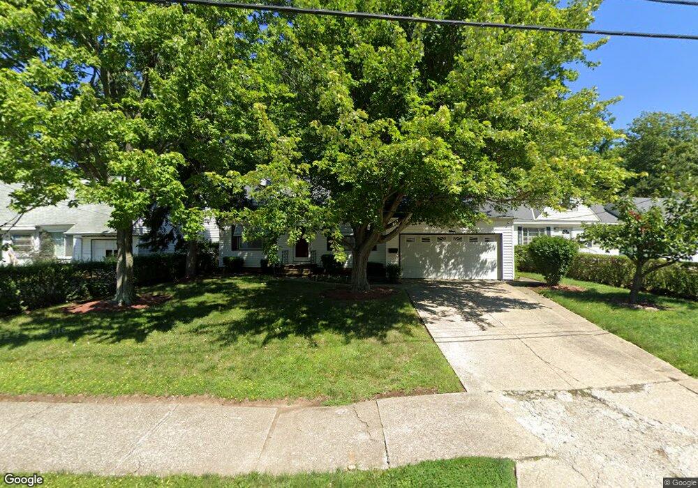
1805 Pontiac Dr Euclid, OH 44117
Estimated Value: $130,000 - $185,962
3
Beds
2
Baths
1,642
Sq Ft
$98/Sq Ft
Est. Value
About This Home
This home is located at 1805 Pontiac Dr, Euclid, OH 44117 and is currently estimated at $161,491, approximately $98 per square foot. 1805 Pontiac Dr is a home located in Cuyahoga County with nearby schools including Bluestone Elementary School, Euclid Middle School, and Euclid High School.
Ownership History
Date
Name
Owned For
Owner Type
Purchase Details
Closed on
Oct 8, 2009
Sold by
Prasek Jack Dennis and Prasek Danielle
Bought by
Heath Roscoe J
Current Estimated Value
Home Financials for this Owner
Home Financials are based on the most recent Mortgage that was taken out on this home.
Original Mortgage
$108,007
Outstanding Balance
$70,922
Interest Rate
5.19%
Mortgage Type
FHA
Estimated Equity
$90,569
Purchase Details
Closed on
Aug 18, 1978
Sold by
Bradac Albert A and Bradac Margt D
Bought by
Prasek Jack D
Purchase Details
Closed on
Jan 1, 1975
Bought by
Bradac Albert A and Bradac Margt D
Create a Home Valuation Report for This Property
The Home Valuation Report is an in-depth analysis detailing your home's value as well as a comparison with similar homes in the area
Home Values in the Area
Average Home Value in this Area
Purchase History
| Date | Buyer | Sale Price | Title Company |
|---|---|---|---|
| Heath Roscoe J | $110,000 | Attorney | |
| Prasek Jack D | $51,000 | -- | |
| Bradac Albert A | -- | -- |
Source: Public Records
Mortgage History
| Date | Status | Borrower | Loan Amount |
|---|---|---|---|
| Open | Heath Roscoe J | $108,007 |
Source: Public Records
Tax History Compared to Growth
Tax History
| Year | Tax Paid | Tax Assessment Tax Assessment Total Assessment is a certain percentage of the fair market value that is determined by local assessors to be the total taxable value of land and additions on the property. | Land | Improvement |
|---|---|---|---|---|
| 2024 | $3,316 | $48,090 | $9,660 | $38,430 |
| 2023 | $3,475 | $40,500 | $8,540 | $31,960 |
| 2022 | $3,396 | $40,500 | $8,540 | $31,960 |
| 2021 | $3,786 | $40,500 | $8,540 | $31,960 |
| 2020 | $3,587 | $34,900 | $7,350 | $27,550 |
| 2019 | $3,228 | $99,700 | $21,000 | $78,700 |
| 2018 | $3,259 | $34,900 | $7,350 | $27,550 |
| 2017 | $3,458 | $30,940 | $5,320 | $25,620 |
| 2016 | $3,466 | $30,940 | $5,320 | $25,620 |
| 2015 | $3,152 | $30,940 | $5,320 | $25,620 |
| 2014 | $3,152 | $30,940 | $5,320 | $25,620 |
Source: Public Records
Map
Nearby Homes
- 19871 Upper Valley Dr
- 1721 Grand Blvd
- 1860 Glenridge Rd
- 19201 Shawnee Rd
- 2150 Glenridge Rd
- 19201 Genesee Rd
- 24 Washington Square
- 1477 E 195th St
- 1524 E 204th St
- 209 Greenbriar Ct
- 1777 Catalpa Rd
- 237 Greenbriar Ct Unit F237
- 2010 E 221st St
- 1707 Catalpa Rd
- 1563 Clermont Rd
- 2441 Malden Rd
- 22601 Harms Rd
- 2337 Greenvale Rd
- 1517 Larchmont Rd
- 2075 E 226th St
- 1799 Pontiac Dr
- 1809 Pontiac Dr
- 1795 Pontiac Dr
- 1815 Pontiac Dr
- 1850 Buena Vista Dr
- 1797 Pinehurst Dr
- 1790 Pinehurst Dr
- 1854 Buena Vista Dr
- 1789 Pontiac Dr
- 1830 Buena Vista Dr
- 1796 Karen Dr
- 1819 Pontiac Dr
- 1799 Pinehurst Dr
- 1792 Pinehurst Dr
- 1798 Karen Dr
- 1864 Buena Vista Dr
- 1785 Pontiac Dr
- 1820 Buena Vista Dr
- 1825 Pontiac Dr
- 1788 Pontiac Dr