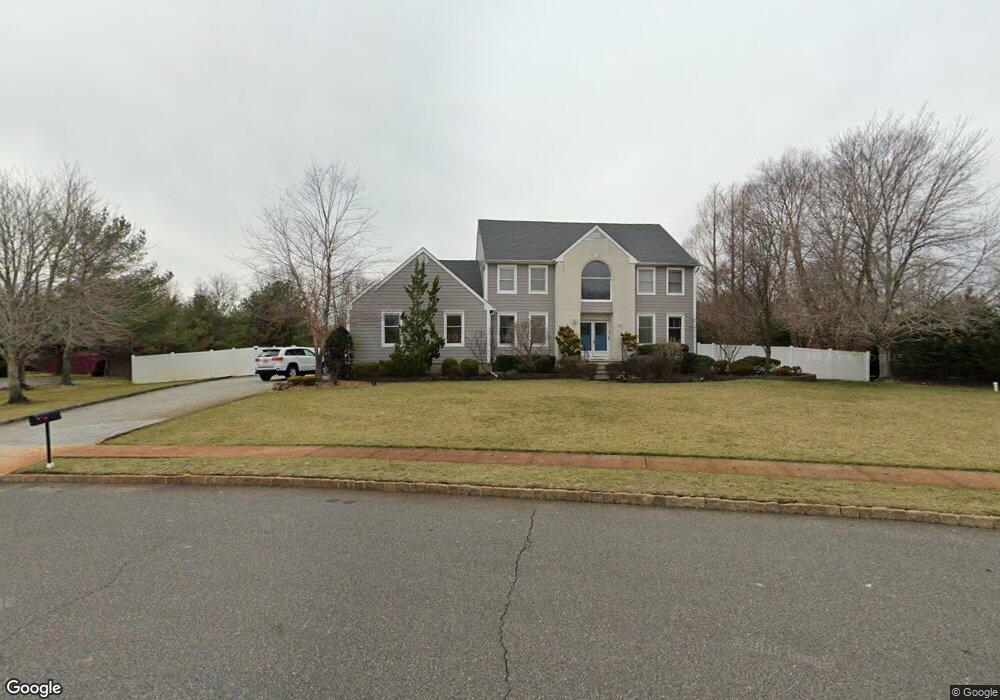
1805 Rue de La Port Wall Township, NJ 07719
Estimated Value: $1,218,000 - $1,552,000
5
Beds
3
Baths
3,420
Sq Ft
$412/Sq Ft
Est. Value
About This Home
This home is located at 1805 Rue de La Port, Wall Township, NJ 07719 and is currently estimated at $1,407,467, approximately $411 per square foot. 1805 Rue de La Port is a home located in Monmouth County with nearby schools including Wall High School and The Brookside School.
Ownership History
Date
Name
Owned For
Owner Type
Purchase Details
Closed on
Dec 14, 2017
Sold by
Canning James and Canning Patricia
Bought by
Canning James
Current Estimated Value
Purchase Details
Closed on
Aug 17, 1999
Sold by
Cicconetti Victor
Bought by
Canning James and Canning Patricia
Home Financials for this Owner
Home Financials are based on the most recent Mortgage that was taken out on this home.
Original Mortgage
$359,600
Outstanding Balance
$104,791
Interest Rate
7.83%
Mortgage Type
Purchase Money Mortgage
Estimated Equity
$1,302,676
Purchase Details
Closed on
Aug 5, 1994
Sold by
Friendship Manor
Bought by
Cicconetti Victor and Cicconetti Yvonne
Home Financials for this Owner
Home Financials are based on the most recent Mortgage that was taken out on this home.
Original Mortgage
$298,000
Interest Rate
8.52%
Mortgage Type
Purchase Money Mortgage
Create a Home Valuation Report for This Property
The Home Valuation Report is an in-depth analysis detailing your home's value as well as a comparison with similar homes in the area
Home Values in the Area
Average Home Value in this Area
Purchase History
| Date | Buyer | Sale Price | Title Company |
|---|---|---|---|
| Canning James | -- | None Available | |
| Canning James | $400,000 | -- | |
| Cicconetti Victor | $331,000 | -- |
Source: Public Records
Mortgage History
| Date | Status | Borrower | Loan Amount |
|---|---|---|---|
| Open | Canning James | $359,600 | |
| Previous Owner | Cicconetti Victor | $298,000 |
Source: Public Records
Tax History Compared to Growth
Tax History
| Year | Tax Paid | Tax Assessment Tax Assessment Total Assessment is a certain percentage of the fair market value that is determined by local assessors to be the total taxable value of land and additions on the property. | Land | Improvement |
|---|---|---|---|---|
| 2025 | $16,268 | $759,500 | $273,000 | $486,500 |
| 2024 | $15,866 | $759,500 | $273,000 | $486,500 |
| 2023 | $15,866 | $759,500 | $273,000 | $486,500 |
| 2022 | $15,372 | $759,500 | $273,000 | $486,500 |
| 2021 | $15,372 | $759,500 | $273,000 | $486,500 |
| 2020 | $15,175 | $759,500 | $273,000 | $486,500 |
| 2019 | $15,000 | $759,500 | $273,000 | $486,500 |
| 2018 | $16,167 | $827,800 | $341,300 | $486,500 |
| 2017 | $15,844 | $827,800 | $341,300 | $486,500 |
| 2016 | $16,347 | $827,800 | $341,300 | $486,500 |
| 2015 | $14,572 | $489,500 | $133,400 | $356,100 |
| 2014 | $15,671 | $538,900 | $125,200 | $413,700 |
Source: Public Records
Map
Nearby Homes
- 1826 New Bedford Rd
- 2628 E Hurley Pond Rd
- 2641 E Hurley Pond Rd
- 2123 Dumont Terrace
- 1624 Dumont Terrace
- 1820 New Jersey 35 Unit 34
- 1820 New Jersey 35 Unit Home Site 26
- 2501 Bedford Corners Ln Unit 11
- 1727 Elizabeth Ct
- 1838 State Route 35 Unit 80
- 2217 Old Mill Rd
- 1335 State Route 138
- 451 Deuce Dr
- 1331 New Jersey 138
- 1890 Cleveland Ave
- 2705 Buchanan St
- 384 Deuce Dr
- 2608 Garfield St
- 1425 Adrienne Rd
- 2005 Nassau Dr
- 1807 Rue de La Port
- 1803 Rue de La Port
- 1806 Rue de La Port
- 1617 18th Ave
- 1809 Rue de La Port
- 1804 Rue de La Port
- 1623 18th Ave
- 1801 Rue de La Port
- 1808 Rue de La Port
- 1802 Rue de La Port
- 1627 18th Ave
- 1813 Rue de La Port
- 1800 Rue de La Port
- 1810 Rue de La Port
- 1810 New Bedford Rd
- 1625 1/2 18th Ave
- 1625 18th Ave
- 1812 Rue de La Port
- 1609 18th Ave
- 1631 18th Ave