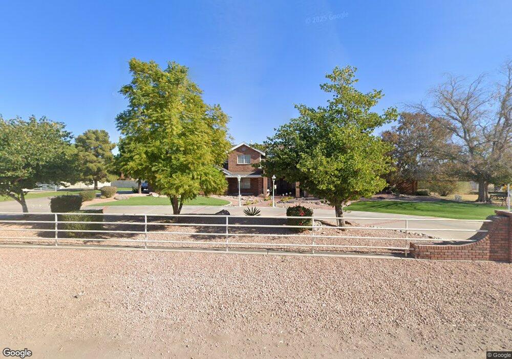
1805 S 131st St Gilbert, AZ 85233
Southwest Gilbert NeighborhoodEstimated Value: $1,364,000 - $2,189,000
Studio
6
Baths
4,798
Sq Ft
$331/Sq Ft
Est. Value
About This Home
This home is located at 1805 S 131st St, Gilbert, AZ 85233 and is currently estimated at $1,590,311, approximately $331 per square foot. 1805 S 131st St is a home located in Maricopa County with nearby schools including Chandler Traditional Academy - Liberty Campus, Willis Junior High School, and Imagine West Gilbert Elementary School.
Ownership History
Date
Name
Owned For
Owner Type
Purchase Details
Closed on
Dec 28, 2012
Sold by
Perkins Wanda I
Bought by
The Catherine Fenn Dynasty Trust and Perkins Ronald Keith
Current Estimated Value
Purchase Details
Closed on
Oct 28, 2011
Sold by
The Qualified Election Trust
Bought by
The Catherine Fenn Dynasty Trust and Perkins Ronald Keith
Purchase Details
Closed on
Apr 14, 2004
Sold by
Perkins Wanda I
Bought by
Perkins Wanda I and Ronald R Perkins Family Trust
Create a Home Valuation Report for This Property
The Home Valuation Report is an in-depth analysis detailing your home's value as well as a comparison with similar homes in the area
Home Values in the Area
Average Home Value in this Area
Purchase History
| Date | Buyer | Sale Price | Title Company |
|---|---|---|---|
| The Catherine Fenn Dynasty Trust | -- | None Available | |
| The Catherine Fenn Dynasty Trust | -- | None Available | |
| Perkins Wanda I | -- | Lawyers Title Insurance Corp |
Source: Public Records
Tax History
| Year | Tax Paid | Tax Assessment Tax Assessment Total Assessment is a certain percentage of the fair market value that is determined by local assessors to be the total taxable value of land and additions on the property. | Land | Improvement |
|---|---|---|---|---|
| 2025 | $6,099 | $65,942 | -- | -- |
| 2024 | $5,884 | $62,802 | -- | -- |
| 2023 | $5,884 | $83,380 | $16,670 | $66,710 |
| 2022 | $5,699 | $63,030 | $12,600 | $50,430 |
| 2021 | $5,857 | $61,200 | $12,240 | $48,960 |
| 2020 | $5,823 | $59,660 | $11,930 | $47,730 |
| 2019 | $5,616 | $57,930 | $11,580 | $46,350 |
| 2018 | $5,452 | $59,320 | $11,860 | $47,460 |
| 2017 | $5,138 | $57,450 | $11,490 | $45,960 |
| 2016 | $4,969 | $56,010 | $11,200 | $44,810 |
| 2015 | $4,755 | $56,280 | $11,250 | $45,030 |
Source: Public Records
Map
Nearby Homes
- 1774 S 131st St
- 1900 S Oak St
- 2124 E Oakland St
- 562 N Kimberlee Way
- 741 N Soho Place
- 2123 E Carla Vista Place
- 2833 E Cobalt St
- 2480 E Stephens Place
- 2720 E Carla Vista Dr
- 286 W Gail Dr
- 1863 S Spartan St
- 1940 E Oakland St
- 1948 E Carla Vista Dr
- 2691 E Hulet Dr
- 13613 E Shannon St
- 1126 N Melody Cir
- 750 W Golden St
- 1695 E Monterey St
- 1813 E Gail Dr
- 1691 E Gary Dr
- 14209 S 131st St
- 14209 S 131st St
- 14209 S 131st St
- 14209 S 131st St
- 14505 S 131st St
- 476 W Patrick Ct
- 463 W Patrick Ct Unit 5
- 463 W Patrick Ct
- 463 E Patrick St Unit 5
- 14211 S 131st St
- 14509 S 131st St
- 14317 S 131st St
- 1775 S 131st St
- 1814 S 131st St
- 14248 S 131st St
- 14420 S 131st St
- 433 W Patrick Ct
- 436 W Patrick Ct Unit 3
- 1745 S 131st St
- 14425 S 131st St
Your Personal Tour Guide
Ask me questions while you tour the home.