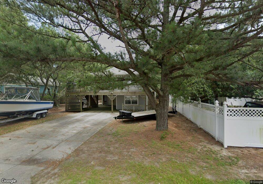
1805 Upper Dune Rd Kill Devil Hills, NC 27948
Estimated Value: $440,000 - $450,000
3
Beds
2
Baths
1,176
Sq Ft
$379/Sq Ft
Est. Value
About This Home
This home is located at 1805 Upper Dune Rd, Kill Devil Hills, NC 27948 and is currently estimated at $445,370, approximately $378 per square foot. 1805 Upper Dune Rd is a home located in Dare County with nearby schools including Nags Head Elementary School, First Flight Middle School, and First Flight High School.
Ownership History
Date
Name
Owned For
Owner Type
Purchase Details
Closed on
Dec 11, 2024
Sold by
Winslow Ronald Ray and Winslow Jean P
Bought by
Winslow Edward Ray
Current Estimated Value
Purchase Details
Closed on
Dec 1, 2011
Sold by
Winslow Christopher Dale and Winslow Anna R
Bought by
Winslow Ronald Ay and Winslow Jean P
Home Financials for this Owner
Home Financials are based on the most recent Mortgage that was taken out on this home.
Original Mortgage
$130,000
Interest Rate
4.17%
Mortgage Type
New Conventional
Purchase Details
Closed on
Jan 4, 2006
Sold by
Parr Ronald G and Parr Jane P
Bought by
Winslow Christopher Dale and Winslow Anna R
Home Financials for this Owner
Home Financials are based on the most recent Mortgage that was taken out on this home.
Original Mortgage
$176,000
Interest Rate
6.22%
Mortgage Type
New Conventional
Create a Home Valuation Report for This Property
The Home Valuation Report is an in-depth analysis detailing your home's value as well as a comparison with similar homes in the area
Home Values in the Area
Average Home Value in this Area
Purchase History
| Date | Buyer | Sale Price | Title Company |
|---|---|---|---|
| Winslow Edward Ray | -- | None Listed On Document | |
| Winslow Edward Ray | -- | None Listed On Document | |
| Winslow Ronald Ay | $189,000 | None Available | |
| Winslow Christopher Dale | $220,000 | None Available |
Source: Public Records
Mortgage History
| Date | Status | Borrower | Loan Amount |
|---|---|---|---|
| Previous Owner | Winslow Ronald Ay | $130,000 | |
| Previous Owner | Winslow Christopher Dale | $176,000 |
Source: Public Records
Tax History
| Year | Tax Paid | Tax Assessment Tax Assessment Total Assessment is a certain percentage of the fair market value that is determined by local assessors to be the total taxable value of land and additions on the property. | Land | Improvement |
|---|---|---|---|---|
| 2025 | $2,174 | $400,200 | $155,800 | $244,400 |
| 2024 | $1,863 | $246,600 | $84,000 | $162,600 |
| 2023 | $1,863 | $246,600 | $84,000 | $162,600 |
| 2022 | $1,777 | $246,600 | $84,000 | $162,600 |
| 2021 | $1,777 | $246,600 | $84,000 | $162,600 |
| 2020 | $1,777 | $246,600 | $84,000 | $162,600 |
| 2019 | $1,354 | $155,600 | $65,500 | $90,100 |
| 2018 | $1,324 | $155,600 | $65,500 | $90,100 |
| 2017 | $1,324 | $155,600 | $65,500 | $90,100 |
| 2016 | $1,262 | $155,600 | $65,500 | $90,100 |
| 2014 | $1,215 | $155,600 | $65,500 | $90,100 |
Source: Public Records
Map
Nearby Homes
- 705 W 4th St Unit Lot 23
- 1817 Sioux St Unit Lot 7
- 1806 Creek St Unit Lot 13
- 1204 Indian Dr Unit Lot 29
- 1208 W 4th St Unit 4
- 1207 W 4th St Unit Lot 45
- 1106 Indian Dr Unit Lot 27
- 1317 Devonshire Rd Unit 36
- 1100 W Durham St Unit lot 697
- 1208 W 5th St Unit 5
- 700 Skipjack Ln Unit G7
- 700 W First St Unit J-11
- 700 W First St Unit E7
- 1515 Dogwood Ln Unit Lot 58
- 1005 W Avalon Dr Unit Lot 272
- 102 Greensboro St Unit Lot 504
- 105 Charlotte St Unit Lot 459
- 1711 Bobby Lee Trail
- 1002 W Avalon Dr Unit Lot 251
- 702 W Avalon Dr Unit 206
- 1807 Upper Dune Rd Unit 2
- 1807 Upper Dune Rd
- 806 W 3rd St Unit 4
- 806 W 3rd St
- 804 W 3rd St Unit 3
- 804 W 3rd St
- 1809 Upper Dune Rd
- 1804 Apache St Unit 14
- 1804 Apache St
- 802 W 3rd St
- 1806 Apache St
- 1804 Upper Dune Rd
- 900 W 3rd St
- 0 Upper Dune Rd Unit 73612
- 0 Upper Dune Rd Unit 73611
- 0 Upper Dune Rd Unit 73795
- 0 Upper Dune Rd Unit 73794
- 0 Upper Dune Rd Unit 73854
- 0 Upper Dune Rd Unit 74595
- 1806 Upper Dune Rd
Your Personal Tour Guide
Ask me questions while you tour the home.