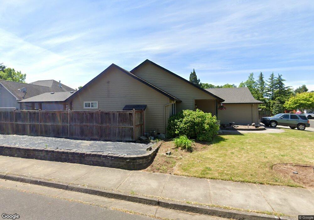
1805 W 11th Ave Junction City, OR 97448
Estimated Value: $446,000 - $479,000
3
Beds
2
Baths
1,458
Sq Ft
$315/Sq Ft
Est. Value
About This Home
This home is located at 1805 W 11th Ave, Junction City, OR 97448 and is currently estimated at $458,833, approximately $314 per square foot. 1805 W 11th Ave is a home located in Lane County with nearby schools including Junction City High School.
Ownership History
Date
Name
Owned For
Owner Type
Purchase Details
Closed on
Nov 8, 2013
Sold by
Hunter Nicole Lynn and Hunter Patrick Wayne
Bought by
Hunter Nicole Lynn
Current Estimated Value
Purchase Details
Closed on
Feb 26, 2002
Sold by
Bruce Wiechert Custom Homes Inc
Bought by
Hunter Nicole Lynn and Hunter Patrick Wayne
Home Financials for this Owner
Home Financials are based on the most recent Mortgage that was taken out on this home.
Original Mortgage
$143,260
Outstanding Balance
$58,748
Interest Rate
6.8%
Estimated Equity
$400,085
Purchase Details
Closed on
Nov 30, 2001
Sold by
Lee & Robin Babb Llc
Bought by
Bruce Wiechert Custom Homes Inc
Create a Home Valuation Report for This Property
The Home Valuation Report is an in-depth analysis detailing your home's value as well as a comparison with similar homes in the area
Home Values in the Area
Average Home Value in this Area
Purchase History
| Date | Buyer | Sale Price | Title Company |
|---|---|---|---|
| Hunter Nicole Lynn | -- | First American Title | |
| Hunter Nicole Lynn | $150,800 | Cascade Title Co | |
| Bruce Wiechert Custom Homes Inc | $35,500 | Western Title & Escrow Compa |
Source: Public Records
Mortgage History
| Date | Status | Borrower | Loan Amount |
|---|---|---|---|
| Open | Hunter Nicole Lynn | $143,260 |
Source: Public Records
Tax History Compared to Growth
Tax History
| Year | Tax Paid | Tax Assessment Tax Assessment Total Assessment is a certain percentage of the fair market value that is determined by local assessors to be the total taxable value of land and additions on the property. | Land | Improvement |
|---|---|---|---|---|
| 2024 | $4,044 | $240,891 | -- | -- |
| 2023 | $4,044 | $233,875 | $0 | $0 |
| 2022 | $3,773 | $227,064 | $0 | $0 |
| 2021 | $3,697 | $220,451 | $0 | $0 |
| 2020 | $3,579 | $214,031 | $0 | $0 |
| 2019 | $3,453 | $207,798 | $0 | $0 |
| 2018 | $3,354 | $195,870 | $0 | $0 |
| 2017 | $3,236 | $195,870 | $0 | $0 |
| 2016 | $3,146 | $190,165 | $0 | $0 |
| 2015 | $2,781 | $184,626 | $0 | $0 |
| 2014 | $2,792 | $179,249 | $0 | $0 |
Source: Public Records
Map
Nearby Homes
- 94403 Oaklea Dr
- 847 Unity Dr
- 1011 Rose St
- 850 Spruce St
- 2347 10th Ave
- 2363 10th Ave
- 2347 W 10th Ave
- 2363 W 10th Ave
- 2379 W 10th Ave
- 2373 W 10th Ave
- 2379 10th Ave
- 2384 W 9th Ave
- 2447 W 13th Ave
- 2401 W 9th Ave Unit Lot 27
- 887 Darlington Dr
- 1346 Echo Valley Dr
- The 1783 Plan at Rolling Meadows
- The 2096 Plan at Rolling Meadows
- The 2539 Plan at Rolling Meadows
- 2383 W 7th Ave