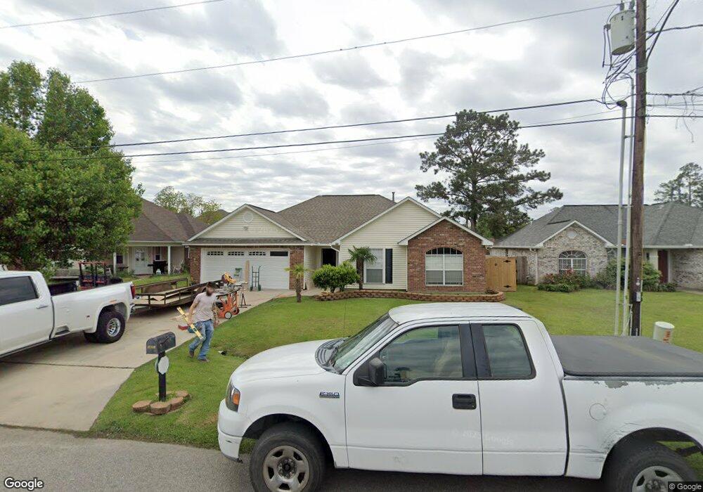
18054 Brandon Dr E Hammond, LA 70403
Estimated Value: $204,996 - $272,000
--
Bed
--
Bath
2,004
Sq Ft
$113/Sq Ft
Est. Value
About This Home
This home is located at 18054 Brandon Dr E, Hammond, LA 70403 and is currently estimated at $226,499, approximately $113 per square foot. 18054 Brandon Dr E is a home located in Tangipahoa Parish with nearby schools including Hammond Eastside Magnet, Hammond High Magnet School, and Tangi Academy.
Ownership History
Date
Name
Owned For
Owner Type
Purchase Details
Closed on
Sep 22, 2006
Sold by
Depaula Vincent S
Bought by
Singer Scott P and Singer Paula L
Current Estimated Value
Home Financials for this Owner
Home Financials are based on the most recent Mortgage that was taken out on this home.
Original Mortgage
$33,500
Interest Rate
6.16%
Mortgage Type
Stand Alone Second
Create a Home Valuation Report for This Property
The Home Valuation Report is an in-depth analysis detailing your home's value as well as a comparison with similar homes in the area
Home Values in the Area
Average Home Value in this Area
Purchase History
| Date | Buyer | Sale Price | Title Company |
|---|---|---|---|
| Singer Scott P | $167,500 | None Available |
Source: Public Records
Mortgage History
| Date | Status | Borrower | Loan Amount |
|---|---|---|---|
| Closed | Singer Scott P | $33,500 | |
| Open | Singer Scott P | $134,000 |
Source: Public Records
Tax History Compared to Growth
Tax History
| Year | Tax Paid | Tax Assessment Tax Assessment Total Assessment is a certain percentage of the fair market value that is determined by local assessors to be the total taxable value of land and additions on the property. | Land | Improvement |
|---|---|---|---|---|
| 2024 | $1,469 | $12,213 | $1,350 | $10,863 |
| 2023 | $1,467 | $12,112 | $1,250 | $10,862 |
| 2022 | $1,467 | $12,112 | $1,250 | $10,862 |
| 2021 | $564 | $12,112 | $1,250 | $10,862 |
| 2020 | $1,467 | $12,112 | $1,250 | $10,862 |
| 2019 | $1,451 | $12,112 | $1,250 | $10,862 |
| 2018 | $1,455 | $12,112 | $1,250 | $10,862 |
| 2017 | $1,467 | $12,112 | $1,250 | $10,862 |
| 2016 | $1,455 | $12,112 | $1,250 | $10,862 |
| 2015 | $612 | $12,585 | $1,250 | $11,335 |
| 2014 | $591 | $12,585 | $1,250 | $11,335 |
Source: Public Records
Map
Nearby Homes
- 44153 Wedgewood Ct
- 18067 Wedgewood Dr
- 44258 Nicholas Cir
- 0 W Pleasant Ridge Rd Unit 2457528
- 00000 Old Covington Hwy
- Lot 5-C Robinson Rd
- 43485 Mclain Ln
- 3.63 Acres Old Covington Hwy
- 43480 N Little Italy Rd
- 0 Old Covington Hwy Unit 2491492
- 0 Old Covington Hwy Unit 2461817
- Tract 3 Old Covington Hwy
- 18203 Holly Ridge Dr
- 17351 Old Covington Hwy
- 0 S Airport Rd Unit 2484510
- 44154 Simpson Place
- 44084 W Pleasant Ridge Rd
- 18058 Brandon Dr E
- 18060 Brandon Dr E
- 18053 Brandon Dr E
- 18049 Brandon Dr E
- 18057 Brandon Dr E
- 44163 Audubon Circle None
- 18066 Brandon Dr E
- 18042 Brandon Dr E
- 44163 Audubon Cir
- 18045 Brandon Dr E
- 44163 Audubon Cir
- 44135 Audubon Cir
- 18041 Brandon Dr E
- 18065 Brandon Dr E
- 18038 Brandon Dr E
- 18069 Brandon Dr
- 18056 E Gate Dr Unit 18B
- 18056 E Gate Dr Unit 18-A