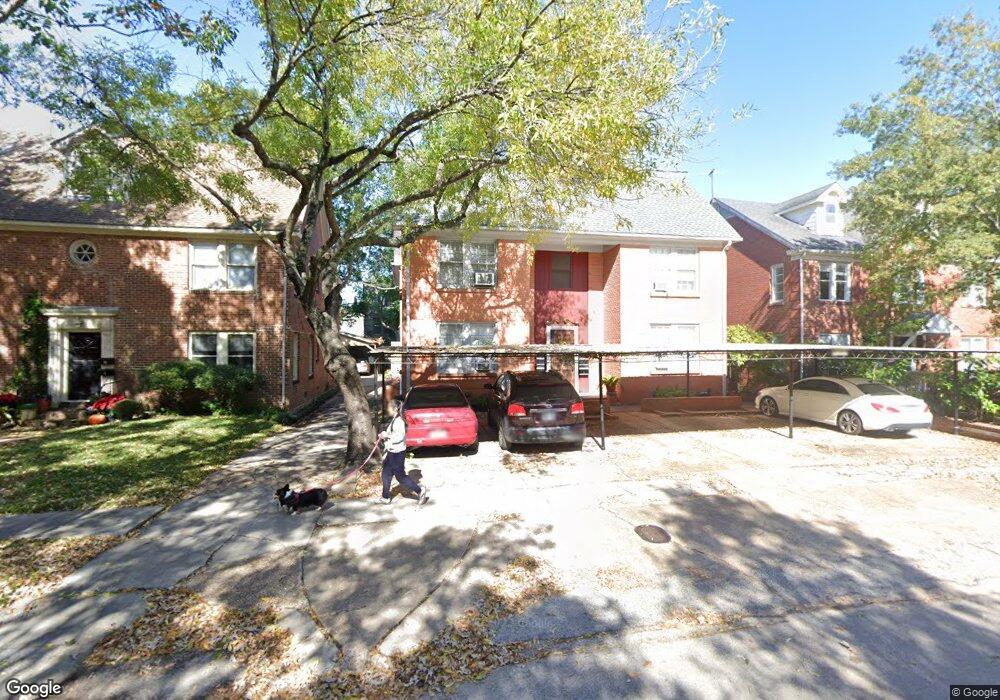
1806 Banks St Unit 3 Houston, TX 77098
University Place NeighborhoodEstimated Value: $762,000 - $951,000
4
Beds
1
Bath
5,132
Sq Ft
$167/Sq Ft
Est. Value
About This Home
This home is located at 1806 Banks St Unit 3, Houston, TX 77098 and is currently estimated at $856,500, approximately $166 per square foot. 1806 Banks St Unit 3 is a home located in Harris County with nearby schools including Poe Elementary School, Lanier Middle School, and Lamar High School.
Ownership History
Date
Name
Owned For
Owner Type
Purchase Details
Closed on
Jun 28, 2002
Sold by
Guerguin Carlos L
Bought by
Trellue J Richard
Current Estimated Value
Home Financials for this Owner
Home Financials are based on the most recent Mortgage that was taken out on this home.
Original Mortgage
$360,000
Outstanding Balance
$154,557
Interest Rate
6.89%
Mortgage Type
Seller Take Back
Estimated Equity
$701,943
Create a Home Valuation Report for This Property
The Home Valuation Report is an in-depth analysis detailing your home's value as well as a comparison with similar homes in the area
Home Values in the Area
Average Home Value in this Area
Purchase History
| Date | Buyer | Sale Price | Title Company |
|---|---|---|---|
| Trellue J Richard | -- | Stewart Title |
Source: Public Records
Mortgage History
| Date | Status | Borrower | Loan Amount |
|---|---|---|---|
| Open | Trellue J Richard | $360,000 |
Source: Public Records
Tax History Compared to Growth
Tax History
| Year | Tax Paid | Tax Assessment Tax Assessment Total Assessment is a certain percentage of the fair market value that is determined by local assessors to be the total taxable value of land and additions on the property. | Land | Improvement |
|---|---|---|---|---|
| 2025 | $9,159 | $420,082 | $396,060 | $24,022 |
| 2024 | $9,159 | $437,715 | $413,693 | $24,022 |
| 2023 | $9,159 | $500,678 | $378,840 | $121,838 |
| 2022 | $8,081 | $367,000 | $292,740 | $74,260 |
| 2021 | $8,875 | $380,775 | $292,740 | $88,035 |
| 2020 | $9,023 | $372,601 | $292,740 | $79,861 |
| 2019 | $9,365 | $370,109 | $292,740 | $77,369 |
| 2018 | $8,770 | $347,126 | $292,740 | $54,386 |
| 2017 | $8,556 | $345,367 | $292,740 | $52,627 |
| 2016 | $6,994 | $276,606 | $223,860 | $52,746 |
| 2015 | $8,754 | $276,659 | $223,860 | $52,799 |
Source: Public Records
Map
Nearby Homes
- 1819 Banks St
- 1741 Banks St
- 1723 Milford St
- 1656 Banks St
- 2016 Milford St
- 1655 Castle Ct
- 4509 Hazard St
- 1925 Lexington St
- 1637 Castle Ct
- 1635 Castle Ct
- 1624 Vassar St
- 1849 Portsmouth St
- 1933 Lexington St
- 1658 Norfolk St
- 1656 Norfolk St
- 1652 Norfolk St
- 1802 Portsmouth St
- 1826 Portsmouth St
- 2102 Banks St
- 1955 Lexington St
- 1812 Banks St
- 1812 Banks St Unit 2
- 1812 Banks St Unit 1
- 1802 Banks St
- 1802 Banks St Unit 2
- 1802 Banks St Unit 1
- 4808 Woodhead St
- 4808 Woodhead St Unit D
- 4808 Woodhead St Unit 6
- 4808 Woodhead St Unit A
- 4808 Woodhead St Unit B
- 4808 Woodhead St Unit C
- 1807 Vassar St
- 1816 Banks St
- 1803 Vassar St
- 1811 Vassar St
- 1820 Banks St
- 1820 Banks St Unit 1
- 1820 Banks St Unit 2
- 1820 Banks St Unit 3